Enable Location

We need your location to show you interesting places around you

Discover nearby places

Find interesting locations and hidden gems around you

Precise directions

Get accurate directions and distances to places

Your location is never shared with other users. It's only used when you tap the location button.

Delaware and Raritan Canal

Log in to your account

Start exploring — it's free

Trusted by 62,372 travelers worldwide

Continue with Google
Continue with Apple
or

We will send you a code to connect

By continuing, you accept our Terms and Conditions and our Privacy Policy

Check your inbox

We've sent a pincode in your inbox. Please enter the code below.

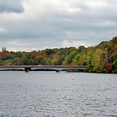
Delaware and Raritan Canal, Historic waterway system in central New Jersey, United States.

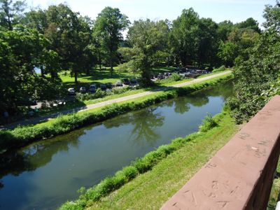
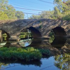
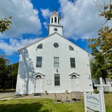
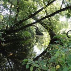
The Delaware and Raritan Canal is a historic waterway in New Jersey that links the Delaware River near Bordentown to the Raritan River close to New Brunswick across 70 miles (113 kilometers). Visitors see locks, stone bridges, and maintained banks lined with trees along the route.

Construction started in 1830 and workers dug the entire waterway by hand, many of them Irish immigrants. The project ended in 1834 and linked both rivers for freight transport between Philadelphia and New York.

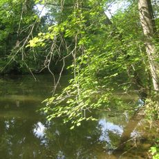
A former towpath now runs the entire length and locals use it for running or cycling beside the quiet water. Anglers try their luck at many spots while paddlers drift slowly through the natural surroundings.

The waterway is now a state park and visitors can enter at many points along the route for walking or biking. The water is shallow and calm, so it is easy to access for beginners in kayaking or fishing.

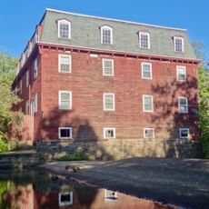
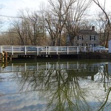
The waterway still supplies drinking water to several communities in the region and fulfills an important role beyond recreation. Old weirs and lock gates control the water level and visitors can see the mechanisms up close at some locations.

The community of curious travelers

AroundUs brings together thousands of curated places, local tips, and hidden gems, enriched daily by 60,000 contributors worldwide.

Start exploring
Location
Location
Location
Location
Elevation above the sea
19 m
GPS coordinates
40.40578,-74.63350
Latest update
December 5, 2025 22:28
Around this place
Lake Carnegie
United States of America

Lake Carnegie

4.1 km
Herrontown Woods Arboretum
United States of America

Herrontown Woods Arboretum

3.3 km
Delaware and Raritan Canal State Park
United States of America

Delaware and Raritan Canal State Park

4.4 km
United States of America

Princeton Community Japanese Language School

6.3 km
Tusculum
United States of America

Tusculum

5.5 km
Kingston Mill Historic District
United States of America

Kingston Mill Historic District

3.7 km
Maybury Hill
United States of America

Maybury Hill

4.3 km
Jugtown Historic District
United States of America

Jugtown Historic District

5.9 km
Donald Grant Herring Estate
United States of America

Donald Grant Herring Estate

3.8 km
Mountain Avenue Historic District
United States of America

Mountain Avenue Historic District

6.3 km
Princeton Nurseries
United States of America

Princeton Nurseries

4.4 km
Red Maple Farm
United States of America

Red Maple Farm

4.6 km
Rocky Hill Historic District
United States of America

Rocky Hill Historic District

700 m
Kingston Bridge
United States of America

Kingston Bridge

3.7 km
Withington Estate
United States of America

Withington Estate

4.1 km
Reformed Dutch Church of Blawenburg
United States of America

Reformed Dutch Church of Blawenburg

5.6 km
River Road Historic Rural District
United States of America

River Road Historic Rural District

3.8 km
Harrys Brook
United States of America

Harrys Brook

4.5 km
Bridgepoint Historic District
United States of America

Bridgepoint Historic District

2.9 km
Maplewood
United States of America

Maplewood

4.4 km
Community Park Pool
United States of America

Community Park Pool

5.9 km
Jedediah Higgins House
United States of America

Jedediah Higgins House

3.8 km
Kingston Presbyterian Church
United States of America

Kingston Presbyterian Church

3.8 km
Kingston Mill
United States of America

Kingston Mill

3.7 km
Blawenburg Historic District
United States of America

Blawenburg Historic District

5.9 km
Laurel Avenue School
United States of America

Laurel Avenue School

3.5 km
Kingston Village Historic District
United States of America

Kingston Village Historic District

3.7 km
Griggstown Historic District
United States of America

Griggstown Historic District

3.1 km
Show the full map
« Delaware and Raritan Canal - Historic waterway system in central New Jersey, United States » is provided by Around Us (aroundus.com). Images and texts are derived from Wikimedia project under a Creative Commons license. You are allowed to copy, distribute, and modify copies of this page, under the conditions set by the license, as long as this note is clearly visible.

Discover hidden gems everywhere you go!

From secret cafés to breathtaking viewpoints, skip the crowded tourist spots and find places that match your style. Our app makes it easy with voice search, smart filtering, route optimization, and insider tips from travelers worldwide. Download now for the complete mobile experience.

Around Us App Screenshot

A unique approach to discovering new places

Le Figaro

All the places worth exploring

France Info

A tailor-made excursion in just a few clicks

20 Minutes

Around Us
Travel Guide & Maps
Download

Send to your phone

QR Code
1

Open the camera app on your mobile.

2

Point at the QR code with your camera. A notification will appear.

3

Tap the notification to open the link.