Wendell State Forest

Log in to your account

AroundUs is a community-driven map of interesting places, built by curious explorers like you. It grows with every review, story, and photo you share.
Connect to save your favorite spots, contribute locations, and create personalized routes.
Continue with Google
Continue with Apple
Continue with X
Continue with Facebook
Continue with email
By continuing, you accept our Terms and Conditions and our Privacy Policy
Create an account

Wendell State Forest

Add to collection
Map
Suggest a change
Share

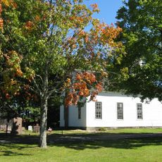
Wendell State Forest, State forest in Millers Falls, Massachusetts, US
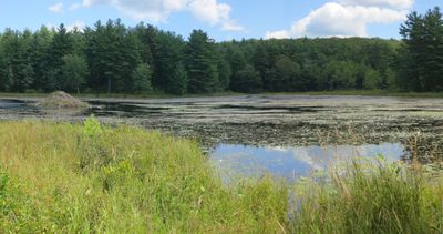
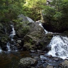
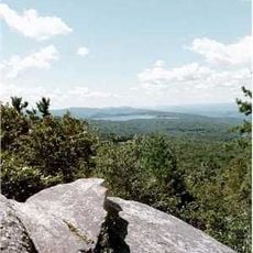
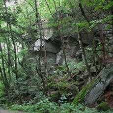
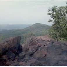
Wendell State Forest is a state forest near Millers Falls covering over 7500 acres of land with rolling terrain, multiple streams, ponds, and an extensive trail network for outdoor recreation. The forest is structured with multiple access points and facilities that support year-round activities for different skill levels.

This forest began as logged territory but was gradually transformed into protected land through conservation efforts over many decades. Today the Massachusetts Department of Conservation and Recreation maintains it as a managed natural area for public use.

The forest serves as a gathering place where visitors can experience how local people connect with nature through hiking and outdoor recreation year-round. Walking through the trails, you notice how the forest is woven into the daily life of the surrounding community.

The forest opens from sunrise to sunset every day of the year, with parking available at Wendell Road for easy access to the trail system. Visitors should wear sturdy footwear and dress for changing weather since conditions vary greatly with the seasons.

A rustic lean-to shelter along the New England Trail accommodates 8 people and features a fire pit and water access, providing weary hikers with a safe resting point. This simple overnight facility connects long-distance walkers passing through with the local trail community.

Location: Wendell

GPS coordinates: 42.55000,-72.45310

Latest update: December 12, 2025 12:01

Photos
Around this place
Metacomet-Monadnock Trail
United States of America

Metacomet-Monadnock Trail

254 m
French King Bridge
United States of America

French King Bridge

6.4 km
Mount Toby
United States of America

Mount Toby

9.8 km
Bear's Den
United States of America

Bear's Den

10.5 km
Northfield Mountain
United States of America

Northfield Mountain

7.5 km
United States of America

New England Peace Pagoda

6.5 km
Lake Wyola State Park
United States of America

Lake Wyola State Park

5.5 km
Connecticut River Greenway State Park
United States of America

Connecticut River Greenway State Park

9.7 km
Canalside Rail Trail Bridge
United States of America

Canalside Rail Trail Bridge

10.5 km
United States of America

Crag Mountain

10.8 km
General Pierce Bridge
United States of America

General Pierce Bridge

10.9 km
Turners Falls Road Bridge
United States of America

Turners Falls Road Bridge

11.1 km
Rattlesnake Gutter
United States of America

Rattlesnake Gutter

9.2 km
Whitaker-Clary House
United States of America

Whitaker-Clary House

11.3 km
Turners Falls–Gill Bridge
United States of America

Turners Falls–Gill Bridge

10.6 km
Springfield Terminal railroad bridge, Deerfield
United States of America

Springfield Terminal railroad bridge, Deerfield

8.6 km
Moore's Corner Historic District
United States of America

Moore's Corner Historic District

6.3 km
Simeon Alexander, Jr., House
United States of America

Simeon Alexander, Jr., House

9.9 km
North Leverett, Massachusetts
United States of America

North Leverett, Massachusetts

5.7 km
Turners Falls Historic District
United States of America

Turners Falls Historic District

10.7 km
Wendell Town Common Historic District
United States of America

Wendell Town Common Historic District

4.6 km
Gill Center Historic District
United States of America

Gill Center Historic District

10.8 km
Robert Frost Trail
United States of America

Robert Frost Trail

9.8 km
Leverett Center Historic District
United States of America

Leverett Center Historic District

10.5 km
Montague Center Historic District
United States of America

Montague Center Historic District

6.9 km
Mount Toby Fire Tower
United States of America

Mount Toby Fire Tower

9.8 km
Great Falls Discovery Center
United States of America

Great Falls Discovery Center

10.7 km
Montague City Covered Bridge
United States of America

Montague City Covered Bridge

10.9 km
Show the full map
Reviews

Visited this place? Tap the stars to rate it and share your experience / photos with the community! Try now! You can cancel it anytime.

« Wendell State Forest - State forest in Millers Falls, Massachusetts, US » is provided by Around Us (aroundus.com). Images and texts are derived from Wikimedia project under a Creative Commons license. You are allowed to copy, distribute, and modify copies of this page, under the conditions set by the license, as long as this note is clearly visible.

Discover hidden gems everywhere you go!

From secret cafés to breathtaking viewpoints, skip the crowded tourist spots and find places that match your style. Our app makes it easy with voice search, smart filtering, route optimization, and insider tips from travelers worldwide. Download now for the complete mobile experience.

Around Us App Screenshot

A unique approach to discovering new places

Le Figaro

All the places worth exploring

France Info

A tailor-made excursion in just a few clicks

20 Minutes