Saville Dam

Log in to your account

AroundUs is a community-driven map of interesting places, built by curious explorers like you. It grows with every review, story, and photo you share.
Connect to save your favorite spots, contribute locations, and create personalized routes.
Continue with Google
Continue with Apple
Continue with X
Continue with Facebook
Continue with email
By continuing, you accept our Terms and Conditions and our Privacy Policy
Create an account
Add to collection
Map
Suggest a change
Share

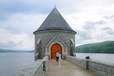
Saville Dam, Embankment dam in Litchfield County, Connecticut.

Saville Dam is an earthen and masonry structure that crosses the eastern branch of the Farmington River, creating a large reservoir. The dam stretches across the valley floor and holds back significant water volume for supply purposes.

Construction started in 1936 after the Metropolitan District Commission acquired property for the project. The reservoir gradually filled over more than a decade, transforming the landscape as water rose.

The submerged village beneath the reservoir tells the story of early settlement along this river valley. Local residents and visitors recognize this underwater community as part of Connecticut's past.

The dam is accessible via Connecticut Route 318, which provides direct access to the site. Most visitors can reach it easily by car, though local conditions may vary depending on the season.

The western side features an uncontrolled spillway that releases water during high water periods. This section shows how engineers manage excess water flow without additional controls.

Location: Litchfield County

Address: Saville Dam, Barkhamsted, CT 06063, USA

GPS coordinates: 41.91000,-72.95470

Latest update: December 8, 2025 10:20

Photos
Nature sites and historic places in Connecticut

Connecticut combines different landscapes from the coast to the mountains with a range of historic sites. The region includes state parks with waterfalls like Kent Falls and Wadsworth Falls, extensive forested areas, and conservation lands. Visitors can hike through White Memorial Conservation...

Around this place
Satan's Kingdom State Recreation Area
United States of America

Satan's Kingdom State Recreation Area

6.1 km
Gilbert Clock Factory
United States of America

Gilbert Clock Factory

8.9 km
Riverton Historic District
United States of America

Riverton Historic District

7.7 km
Peoples State Forest
United States of America

Peoples State Forest

4 km
Pine Meadow Historic District
United States of America

Pine Meadow Historic District

4 km
Nepaug State Forest
United States of America

Nepaug State Forest

8 km
Stratton Brook State Park
United States of America

Stratton Brook State Park

11.2 km
Town Bridge
United States of America

Town Bridge

9.8 km
Canton Center Historic District
United States of America

Canton Center Historic District

6.6 km
American Legion State Forest
United States of America

American Legion State Forest

5.5 km
American Legion State Forest Trails
United States of America

American Legion State Forest Trails

5.3 km
Sun Terrace
United States of America

Sun Terrace

7.9 km
Barkhamsted Center Historic District
United States of America

Barkhamsted Center Historic District

2.4 km
Philip Chapin House
United States of America

Philip Chapin House

4.1 km
Peoples State Forest Nature Museum
United States of America

Peoples State Forest Nature Museum

3.9 km
Gillette's Grist Mill
United States of America

Gillette's Grist Mill

9.9 km
Tunxis Forest Ski Cabin
United States of America

Tunxis Forest Ski Cabin

11.2 km
William Moore Jr. House
United States of America

William Moore Jr. House

7.8 km
Massaco Forest Pavilion
United States of America

Massaco Forest Pavilion

11.1 km
Esperanza
United States of America

Esperanza

7.1 km
Union Church/St. Paul's Church
United States of America

Union Church/St. Paul's Church

8 km
Winsted Green Historic District
United States of America

Winsted Green Historic District

8.9 km
Samuel Hayes II House
United States of America

Samuel Hayes II House

11.9 km
Solomon Rockwell House
United States of America

Solomon Rockwell House

10.4 km
Winsted Hosiery Mill
United States of America

Winsted Hosiery Mill

8.8 km
West End Commercial District
United States of America

West End Commercial District

9.8 km
Moses Camp House
United States of America

Moses Camp House

10.2 km
Collinsville Historic District
United States of America

Collinsville Historic District

11.2 km
Show the full map
Reviews

Visited this place? Tap the stars to rate it and share your experience / photos with the community! Try now! You can cancel it anytime.

« Saville Dam - Embankment dam in Litchfield County, Connecticut » is provided by Around Us (aroundus.com). Images and texts are derived from Wikimedia project under a Creative Commons license. You are allowed to copy, distribute, and modify copies of this page, under the conditions set by the license, as long as this note is clearly visible.

Discover hidden gems everywhere you go!

From secret cafés to breathtaking viewpoints, skip the crowded tourist spots and find places that match your style. Our app makes it easy with voice search, smart filtering, route optimization, and insider tips from travelers worldwide. Download now for the complete mobile experience.

Around Us App Screenshot

A unique approach to discovering new places

Le Figaro

All the places worth exploring

France Info

A tailor-made excursion in just a few clicks

20 Minutes