Enable Location

We need your location to show you interesting places around you

Discover nearby places

Find interesting locations and hidden gems around you

Precise directions

Get accurate directions and distances to places

Your location is never shared with other users. It's only used when you tap the location button.

Ransom Place Historic District

Log in to your account

Start exploring — it's free

Trusted by 62,773 travelers worldwide

Continue with Google
Continue with Apple
or

We will send you a code to connect

By continuing, you accept our Terms and Conditions and our Privacy Policy

Check your inbox

We've sent a pincode in your inbox. Please enter the code below.

Ransom Place Historic District, Historic district in Indianapolis, United States.

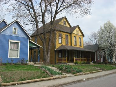
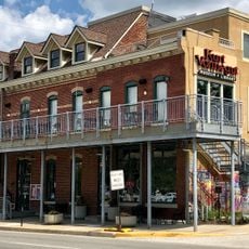
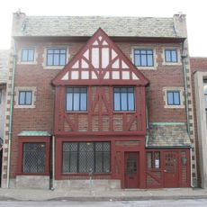
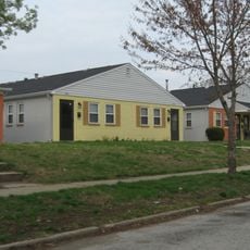
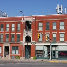
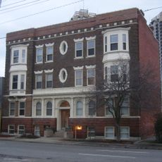
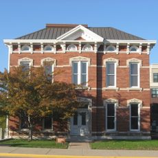
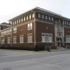
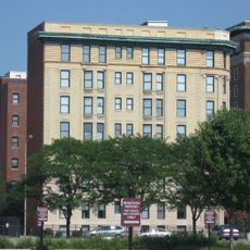
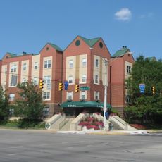
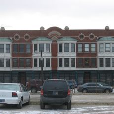
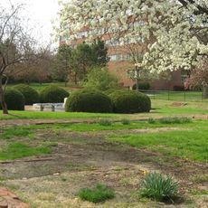
Ransom Place is a residential neighborhood in Indianapolis with more than 50 years of building history from the late 1800s to early 1900s. The homes and buildings display Queen Anne and Colonial Revival architectural styles across a six-block area.

This neighborhood started in 1865 as one of Indianapolis's first African American communities. The district gained official recognition as a historic place in 1992.

The neighborhood is named after Freeman B. Ransom, an attorney who lived here and shaped the area through his work with prominent businesses. Residents built a stable and prosperous community together, creating a neighborhood that reflected their economic progress and social standing.

The neighborhood sits just one block from Indiana Avenue, making it easy to find and explore. You can walk through the area freely and see the buildings from the public streets.

This area holds the most complete collection of original structures from Indianapolis's early African American residential area. These buildings together form a rare surviving example from that period.

The community of curious travelers

AroundUs brings together thousands of curated places, local tips, and hidden gems, enriched daily by 60,000 contributors worldwide.

Start exploring
Location
GPS coordinates
39.77889,-86.16972
Latest update
December 14, 2025 11:41
Around this place
Madam Walker Legacy Center
United States of America

Madam Walker Legacy Center

391 m
Scottish Rite Cathedral
United States of America

Scottish Rite Cathedral

1 km
Indiana Central Canal
United States of America

Indiana Central Canal

970 m
Indiana State Museum
United States of America

Indiana State Museum

1.1 km
Kurt Vonnegut Museum and Library
United States of America

Kurt Vonnegut Museum and Library

472 m
Indianapolis Masonic Temple
United States of America

Indianapolis Masonic Temple

922 m
Military Park
United States of America

Military Park

950 m
Eve
United States of America

Eve

1.1 km
Medal of Honor Memorial
United States of America

Medal of Honor Memorial

1.1 km
Project 9/11 Indianapolis
United States of America

Project 9/11 Indianapolis

1 km
Eiteljorg Museum
United States of America

Eiteljorg Museum

1.2 km
Manchester Apartments
United States of America

Manchester Apartments

1.2 km
Flanner House Homes
United States of America

Flanner House Homes

630 m
The Emelie
United States of America

The Emelie

897 m
Apartments and Flats of Downtown Indianapolis TR
United States of America

Apartments and Flats of Downtown Indianapolis TR

908 m
Charles Kuhn House
United States of America

Charles Kuhn House

693 m
The Alameda
United States of America

The Alameda

908 m
The Savoy
United States of America

The Savoy

1.2 km
Independent Turnverein
United States of America

Independent Turnverein

1 km
The Rink
United States of America

The Rink

1.1 km
Indianapolis Chair Manufacturing Company
United States of America

Indianapolis Chair Manufacturing Company

922 m
Indiana Historical Society
United States of America

Indiana Historical Society

994 m
The Martens
United States of America

The Martens

936 m
Nurses' Sunken Garden and Convalescent Park
United States of America

Nurses' Sunken Garden and Convalescent Park

1.1 km
Spiritkeeper
United States of America

Spiritkeeper

429 m
Indiana Avenue Historic District
United States of America

Indiana Avenue Historic District

571 m
Indianapolis Cultural Trail: A Legacy of Gene & Marilyn Glick
United States of America

Indianapolis Cultural Trail: A Legacy of Gene & Marilyn Glick

784 m
Central Library
United States of America

Central Library

1.1 km
Show the full map
« Ransom Place Historic District - Historic district in Indianapolis, United States » is provided by Around Us (aroundus.com). Images and texts are derived from Wikimedia project under a Creative Commons license. You are allowed to copy, distribute, and modify copies of this page, under the conditions set by the license, as long as this note is clearly visible.

Discover hidden gems everywhere you go!

From secret cafés to breathtaking viewpoints, skip the crowded tourist spots and find places that match your style. Our app makes it easy with voice search, smart filtering, route optimization, and insider tips from travelers worldwide. Download now for the complete mobile experience.

Around Us App Screenshot

A unique approach to discovering new places

Le Figaro

All the places worth exploring

France Info

A tailor-made excursion in just a few clicks

20 Minutes

Around Us
Travel Guide & Maps
Download

Send to your phone

QR Code
1

Open the camera app on your mobile.

2

Point at the QR code with your camera. A notification will appear.

3

Tap the notification to open the link.