Watson Park Historic District

Log in to your account

AroundUs is a community-driven map of interesting places, built by curious explorers like you. It grows with every review, story, and photo you share.
Connect to save your favorite spots, contribute locations, and create personalized routes.
Continue with Google
Continue with Apple
Continue with X
Continue with Facebook
Continue with email
By continuing, you accept our Terms and Conditions and our Privacy Policy
Create an account
Add to collection
Map
Suggest a change
Share

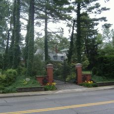
Watson Park Historic District, Residential historic district in northeast Indianapolis, United States.

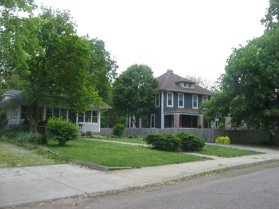
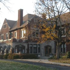
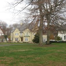
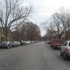
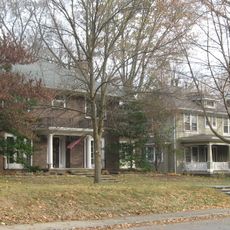
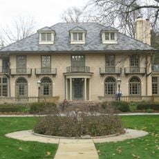
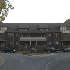
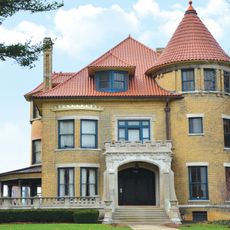
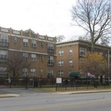
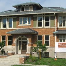
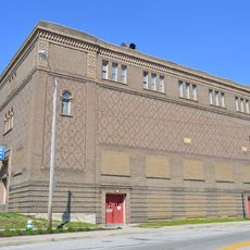
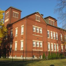
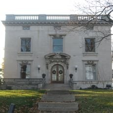
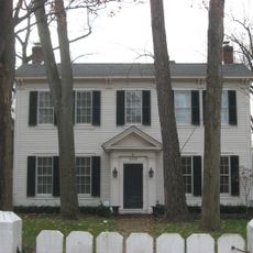
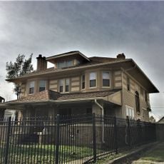
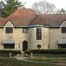
Watson Park Historic District is a residential area in northeast Indianapolis with more than 400 buildings including single-family homes, multi-family dwellings, and garages spread across a large area. The architecture features mainly Colonial Revival, Tudor Revival, and Bungalow styles typical of suburban developments from that period.

The area developed between 1910 and 1960 as a planned suburban residential community for the growing middle class. The architecture was shaped by building companies like Emerson Chaille & Company and local lumber businesses that offered standardized house designs.

The district shows how suburban residents lived in the early 20th century through its homes in various architectural styles that define the neighborhood's character. The buildings reflect the tastes of that era and create a sense of continuity throughout the streets.

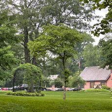
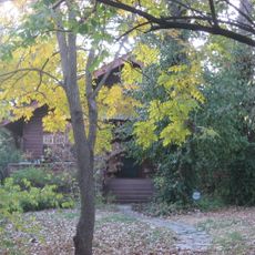
The district stretches along several streets and avenues in the northeast and is walkable, with a bird sanctuary also available for visitors to explore. The best time to explore is during pleasant weather when the architecture and landscaping are most visible.

The architecture was partly influenced by the Architect's Small House Service Bureau, an organization that promoted affordable house designs for average families. This makes the area an example of a democratic approach to housing in the early modern era.

Location: Indianapolis

GPS coordinates: 39.82222,-86.14444

Latest update: December 14, 2025 17:03

Photos
Around this place
The Children's Museum of Indianapolis
United States of America

The Children's Museum of Indianapolis

1.7 km
Indiana Governor's Residence
United States of America

Indiana Governor's Residence

2.4 km
Broad Ripple Park Carousel
United States of America

Broad Ripple Park Carousel

1.7 km
Clowes Memorial Hall
United States of America

Clowes Memorial Hall

3 km
Crown Hill National Cemetery
United States of America

Crown Hill National Cemetery

2.5 km
Glossbrenner Mansion
United States of America

Glossbrenner Mansion

1.4 km
North Meridian Street Historic District
United States of America

North Meridian Street Historic District

2.5 km
Marcy Village Apartments
United States of America

Marcy Village Apartments

2 km
Oliver Johnson's Woods Historic District
United States of America

Oliver Johnson's Woods Historic District

2 km
William N. Thompson House
United States of America

William N. Thompson House

1.8 km
Esplanade Apartments
United States of America

Esplanade Apartments

1.5 km
Schnull-Rauch House
United States of America

Schnull-Rauch House

1.6 km
Central Court Historic District
United States of America

Central Court Historic District

309 m
Tee Pee Restaurant
United States of America

Tee Pee Restaurant

1.2 km
Washington Park Historic District
United States of America

Washington Park Historic District

1.2 km
The Buckingham
United States of America

The Buckingham

1.5 km
Beth-El Zedeck Temple
United States of America

Beth-El Zedeck Temple

635 m
Henry P. Coburn Public School No. 66
United States of America

Henry P. Coburn Public School No. 66

379 m
Shortridge-Meridian Street Apartments Historic District
United States of America

Shortridge-Meridian Street Apartments Historic District

1.1 km
The Gramse
United States of America

The Gramse

2.7 km
Oriental Lodge No. 500
United States of America

Oriental Lodge No. 500

2.8 km
Benjamin Franklin Public School Number 36
United States of America

Benjamin Franklin Public School Number 36

2 km
Louis Levey Mansion
United States of America

Louis Levey Mansion

1.9 km
Johnson-Denny House
United States of America

Johnson-Denny House

1.7 km
George Philip Meier House
United States of America

George Philip Meier House

1.4 km
Lovel D. Millikan House
United States of America

Lovel D. Millikan House

2.1 km
Joseph J. Cole, Jr., House and 1925 Cole Brouette No. 70611
United States of America

Joseph J. Cole, Jr., House and 1925 Cole Brouette No. 70611

2.5 km
Joseph W. Summers Memorial Bridge
United States of America

Joseph W. Summers Memorial Bridge

2.4 km
Show the full map
Reviews

Visited this place? Tap the stars to rate it and share your experience / photos with the community! Try now! You can cancel it anytime.

« Watson Park Historic District - Residential historic district in northeast Indianapolis, United States » is provided by Around Us (aroundus.com). Images and texts are derived from Wikimedia project under a Creative Commons license. You are allowed to copy, distribute, and modify copies of this page, under the conditions set by the license, as long as this note is clearly visible.

Discover hidden gems everywhere you go!

From secret cafés to breathtaking viewpoints, skip the crowded tourist spots and find places that match your style. Our app makes it easy with voice search, smart filtering, route optimization, and insider tips from travelers worldwide. Download now for the complete mobile experience.

Around Us App Screenshot

A unique approach to discovering new places

Le Figaro

All the places worth exploring

France Info

A tailor-made excursion in just a few clicks

20 Minutes