Central Court Historic District

Log in to your account

AroundUs is a community-driven map of interesting places, built by curious explorers like you. It grows with every review, story, and photo you share.
Connect to save your favorite spots, contribute locations, and create personalized routes.
Continue with Google
Continue with Apple
Continue with X
Continue with Facebook
Continue with email
By continuing, you accept our Terms and Conditions and our Privacy Policy
Create an account
Add to collection
Map
Suggest a change
Share

Central Court Historic District, Historic residential district in Indianapolis, United States.

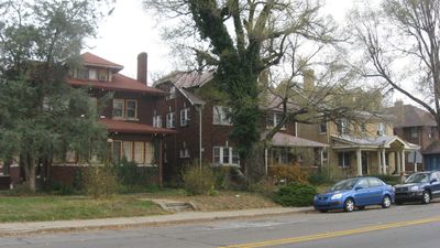
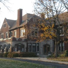
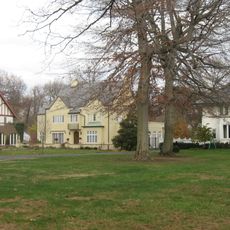
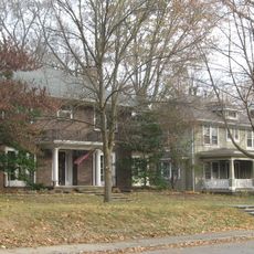
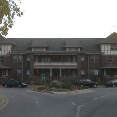
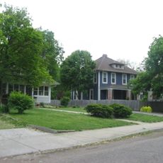
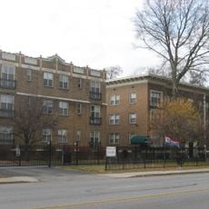
Central Court Historic District is a residential neighborhood in Indianapolis containing around 75 buildings arranged in a U-shaped pattern around a central courtyard. The homes face toward 36th Street, Central Avenue, or inward toward the central space, creating different views from different parts of the area.

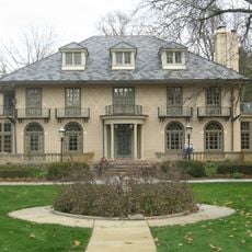
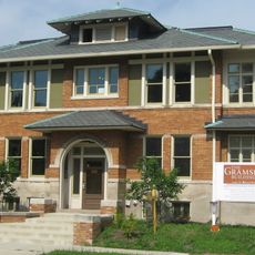
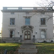
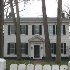
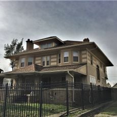
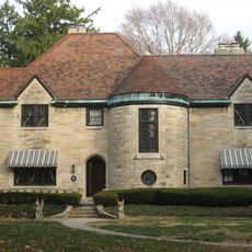
Developers Oscar A. Jose and Peter J. Balz founded the neighborhood in 1916 as a planned residential community featuring Prairie School and Colonial Revival architecture. The project reflected how developers were building new neighborhoods during Indianapolis's period of urban growth.

The neighborhood displays residential buildings from the early 1900s that were arranged to create a shared community center where neighbors naturally gathered. This layout reflects the desire to build connected, walkable streets rather than isolated suburban plots.

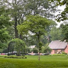
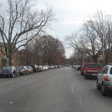
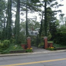
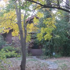
The neighborhood is located near the intersection of 36th Street and Central Avenue and is easy to explore on foot since the houses sit close together. There are multiple open pathways and passages through the grounds, allowing visitors to view the different building facades from various angles.

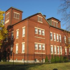
The neighborhood was designed as a contained system where roughly half the homes face inward toward the central court while others turn toward the surrounding streets. This intentional layout created a pocket of residential space that remains visually distinct from the broader neighborhood around it.

Location: Indiana

GPS coordinates: 39.82222,-86.14806

Latest update: December 14, 2025 12:27

Photos
Around this place
The Children's Museum of Indianapolis
United States of America

The Children's Museum of Indianapolis

1.5 km
Indiana Governor's Residence
United States of America

Indiana Governor's Residence

2.2 km
Broad Ripple Park Carousel
United States of America

Broad Ripple Park Carousel

1.5 km
Clowes Memorial Hall
United States of America

Clowes Memorial Hall

2.7 km
Crown Hill National Cemetery
United States of America

Crown Hill National Cemetery

2.2 km
Glossbrenner Mansion
United States of America

Glossbrenner Mansion

1.2 km
North Meridian Street Historic District
United States of America

North Meridian Street Historic District

2.4 km
Marcy Village Apartments
United States of America

Marcy Village Apartments

2.2 km
Oliver Johnson's Woods Historic District
United States of America

Oliver Johnson's Woods Historic District

1.9 km
William N. Thompson House
United States of America

William N. Thompson House

1.6 km
Esplanade Apartments
United States of America

Esplanade Apartments

1.4 km
Schnull-Rauch House
United States of America

Schnull-Rauch House

1.4 km
Tee Pee Restaurant
United States of America

Tee Pee Restaurant

1.5 km
Washington Park Historic District
United States of America

Washington Park Historic District

1 km
Watson Park Historic District
United States of America

Watson Park Historic District

309 m
The Buckingham
United States of America

The Buckingham

1.3 km
Beth-El Zedeck Temple
United States of America

Beth-El Zedeck Temple

528 m
Henry P. Coburn Public School No. 66
United States of America

Henry P. Coburn Public School No. 66

369 m
Shortridge-Meridian Street Apartments Historic District
United States of America

Shortridge-Meridian Street Apartments Historic District

747 m
The Gramse
United States of America

The Gramse

2.7 km
Oriental Lodge No. 500
United States of America

Oriental Lodge No. 500

2.7 km
Benjamin Franklin Public School Number 36
United States of America

Benjamin Franklin Public School Number 36

1.8 km
Louis Levey Mansion
United States of America

Louis Levey Mansion

1.7 km
Johnson-Denny House
United States of America

Johnson-Denny House

1.7 km
George Philip Meier House
United States of America

George Philip Meier House

1.2 km
Lovel D. Millikan House
United States of America

Lovel D. Millikan House

2.1 km
Joseph J. Cole, Jr., House and 1925 Cole Brouette No. 70611
United States of America

Joseph J. Cole, Jr., House and 1925 Cole Brouette No. 70611

2.4 km
Joseph W. Summers Memorial Bridge
United States of America

Joseph W. Summers Memorial Bridge

2.3 km
Show the full map
Reviews

Visited this place? Tap the stars to rate it and share your experience / photos with the community! Try now! You can cancel it anytime.

« Central Court Historic District - Historic residential district in Indianapolis, United States » is provided by Around Us (aroundus.com). Images and texts are derived from Wikimedia project under a Creative Commons license. You are allowed to copy, distribute, and modify copies of this page, under the conditions set by the license, as long as this note is clearly visible.

Discover hidden gems everywhere you go!

From secret cafés to breathtaking viewpoints, skip the crowded tourist spots and find places that match your style. Our app makes it easy with voice search, smart filtering, route optimization, and insider tips from travelers worldwide. Download now for the complete mobile experience.

Around Us App Screenshot

A unique approach to discovering new places

Le Figaro

All the places worth exploring

France Info

A tailor-made excursion in just a few clicks

20 Minutes