Log in to your account

AroundUs is a community-driven map of interesting places, built by curious explorers like you. It grows with every review, story, and photo you share.
Connect to save your favorite spots, contribute locations, and create personalized routes.
Continue with Google
Continue with Apple
Continue with X
Continue with Facebook
Continue with email
By continuing, you accept our Terms and Conditions and our Privacy Policy
Create an account
Add to collection
Map
Suggest a change
Share

State Game Lands Number 118, Public hunting grounds in Blair County, Pennsylvania

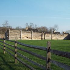
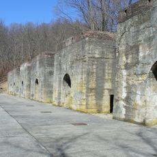
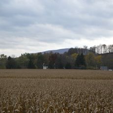
State Game Lands Number 118 is a game area covering roughly 6,133 acres with forests, wetlands, and open fields along the Tussey Mountain ridge. The grounds include multiple access points and parking areas connected to trail networks throughout the property.

The Pennsylvania Game Commission established this protected area in the late 20th century to preserve wildlife and habitats in the region. Its formal registration in 1979 marked the beginning of official management as a state game area.

Local hunters use the grounds during regulated seasons for deer, wild turkey, and small game, shaping how the surrounding community connects with the land. This activity remains central to how people in the area spend their time outdoors.

The area sits directly along U.S. Route 22, making it easy to reach by car. Visitors should check ahead about current hunting seasons since access may be restricted during active periods.

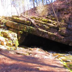
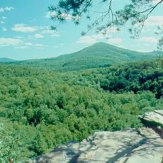
The land spans elevations that create distinct habitats within a relatively small area, with both the Frankstown and Raystown branches of the Juniata River originating on or near the grounds. This concentration of water sources and varied terrain is an often-overlooked feature that shapes much of the area's ecology.

Location: Blair County

Location: Pennsylvania

GPS coordinates: 40.47028,-78.14944

Latest update: December 14, 2025 18:14

Photos
Around this place
Raystown Lake
United States of America

Raystown Lake

12.8 km
Fort Roberdeau
United States of America

Fort Roberdeau

16.3 km
Canoe Creek State Park
United States of America

Canoe Creek State Park

10.3 km
Tytoona Cave
United States of America

Tytoona Cave

15.8 km
Trough Creek State Park
United States of America

Trough Creek State Park

15.8 km
Pulpit Rocks
United States of America

Pulpit Rocks

10.4 km
Baker Bridge
United States of America

Baker Bridge

20.6 km
Warrior Ridge Dam and Hydroelectric Plant
United States of America

Warrior Ridge Dam and Hydroelectric Plant

12.4 km
Pennsylvania Railroad Old Bridge over Standing Stone Creek
United States of America

Pennsylvania Railroad Old Bridge over Standing Stone Creek

12.3 km
Huntingdon Borough Historic District
United States of America

Huntingdon Borough Historic District

11.8 km
Etna Furnace
United States of America

Etna Furnace

7 km
Williamsburg Historic District
United States of America

Williamsburg Historic District

4.7 km
Brumbaugh Homestead
United States of America

Brumbaugh Homestead

8.6 km
St. John's Evangelical Lutheran Church
United States of America

St. John's Evangelical Lutheran Church

16.2 km
Birmingham Bridge
United States of America

Birmingham Bridge

20.3 km
Corbin Bridge
United States of America

Corbin Bridge

14.2 km
Paradise Furnace
United States of America

Paradise Furnace

17.9 km
Huntingdon Armory
United States of America

Huntingdon Armory

13.3 km
Barree Forge and Furnace
United States of America

Barree Forge and Furnace

9.7 km
Mount Union Historic District
United States of America

Mount Union Historic District

10 km
Marklesburg Historic District
United States of America

Marklesburg Historic District

10 km
Pennsylvania Railroad District
United States of America

Pennsylvania Railroad District

15.9 km
Juniata Iron Works
United States of America

Juniata Iron Works

9.7 km
Daniel Royer House
United States of America

Daniel Royer House

11.5 km
Jacob Isett House and Store
United States of America

Jacob Isett House and Store

15.7 km
Robb Farm
United States of America

Robb Farm

5 km
Pennsylvania Railroad Bridge over Shavers Creek
United States of America

Pennsylvania Railroad Bridge over Shavers Creek

13.7 km
Colerain Forges Mansion
United States of America

Colerain Forges Mansion

19.2 km
Show the full map
Reviews

Visited this place? Tap the stars to rate it and share your experience / photos with the community! Try now! You can cancel it anytime.

« State Game Lands Number 118 - Public hunting grounds in Blair County, Pennsylvania » is provided by Around Us (aroundus.com). Images and texts are derived from Wikimedia project under a Creative Commons license. You are allowed to copy, distribute, and modify copies of this page, under the conditions set by the license, as long as this note is clearly visible.

Discover hidden gems everywhere you go!

From secret cafés to breathtaking viewpoints, skip the crowded tourist spots and find places that match your style. Our app makes it easy with voice search, smart filtering, route optimization, and insider tips from travelers worldwide. Download now for the complete mobile experience.

Around Us App Screenshot

A unique approach to discovering new places

Le Figaro

All the places worth exploring

France Info

A tailor-made excursion in just a few clicks

20 Minutes