Enable Location

We need your location to show you interesting places around you

Discover nearby places

Find interesting locations and hidden gems around you

Precise directions

Get accurate directions and distances to places

Your location is never shared with other users. It's only used when you tap the location button.

Devil's Dyke, Sussex

Log in to your account

Start exploring — it's free

Trusted by 61,444 travelers worldwide

Continue with Google
Continue with Apple
or

We will send you a code to connect

By continuing, you accept our Terms and Conditions and our Privacy Policy

Check your inbox

We've sent a pincode in your inbox. Please enter the code below.

Devil's Dyke, Sussex, Iron Age valley in South Downs, England

Description

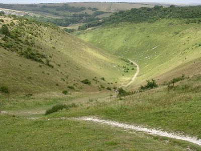
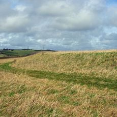
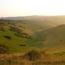
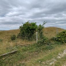
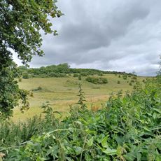
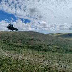
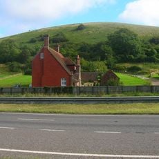
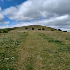
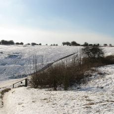
Devil's Dyke is a valley cutting through the chalk hills of the South Downs, extending about one mile and forming the deepest and widest dry valley in the United Kingdom. The landscape features steep sides and a flat floor that draws walkers and hikers to explore its distinctive terrain.

History

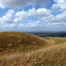
The site contains remnants of an Iron Age hillfort built between 450 and 350 BCE, serving both defensive and settlement functions for its inhabitants. This fortified settlement was a significant stronghold during that ancient period.

Culture

The site became a major tourist destination during the Victorian era, drawing visitors eager to explore its dramatic landscape. Today, it remains an important place for walkers and outdoor enthusiasts to experience the South Downs region.

Practical

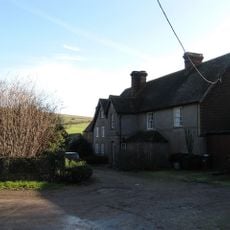
The National Trust maintains marked walking routes, information panels, and parking facilities throughout the site. Sturdy footwear is recommended for exploring the terrain, and visitors should bring water and sun protection for their time here.

Did you know?

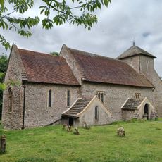
Local folklore claims the Devil himself dug this valley to create a channel to the sea and flood churches in the Weald region. This tale reveals how people attributed extraordinary origins to the dramatic landforms around them.

Location
GPS coordinates
50.88397,-0.21138
Latest update
December 20, 2025 11:34

AroundUs brings together thousands of curated places, local tips, and hidden gems, enriched daily by 60,000 contributors worldwide. Discover all places nearby (Mid Sussex).

Sussex: coasts, castles and villages in the south of England

Sussex extends along the south coast of England, between London and the Channel. This area has different types of scenery: white chalk cliffs that rise above the sea, gentle hills of the South Downs, old forests, and valleys with quiet rivers. There are seaside towns such as Brighton and Eastbourne,...

Around this place
Show the full map
« Devil's Dyke, Sussex - Iron Age valley in South Downs, England » is provided by Around Us (aroundus.com). Images and texts are derived from Wikimedia project under a Creative Commons license. You are allowed to copy, distribute, and modify copies of this page, under the conditions set by the license, as long as this note is clearly visible.

Discover hidden gems everywhere you go!

From secret cafés to breathtaking viewpoints, skip the crowded tourist spots and find places that match your style. Our app makes it easy with voice search, smart filtering, route optimization, and insider tips from travelers worldwide. Download now for the complete mobile experience.

Around Us App Screenshot

A unique approach to discovering new places

Le Figaro

All the places worth exploring

France Info

A tailor-made excursion in just a few clicks

20 Minutes

Around Us
Travel Guide & Maps
Download

Send to your phone

QR Code
1

Open the camera app on your mobile.

2

Point at the QR code with your camera. A notification will appear.

3

Tap the notification to open the link.