Enable Location

We need your location to show you interesting places around you

Discover nearby places

Find interesting locations and hidden gems around you

Precise directions

Get accurate directions and distances to places

Your location is never shared with other users. It's only used when you tap the location button.

Beeding Hill to Newtimber Hill

Log in to your account

Start exploring — it's free

Trusted by 63,087 travelers worldwide

Continue with Google
Continue with Apple
or

We will send you a code to connect

By continuing, you accept our Terms and Conditions and our Privacy Policy

Check your inbox

We've sent a pincode in your inbox. Please enter the code below.

Discussion Reviews 1 Photos
1.1k Popularity

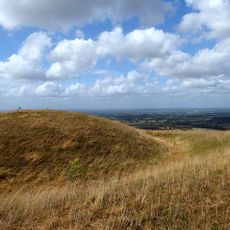
Beeding Hill to Newtimber Hill, An escarpment of special scientific interest for its biodiversity

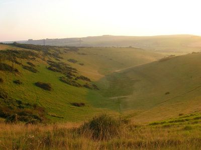
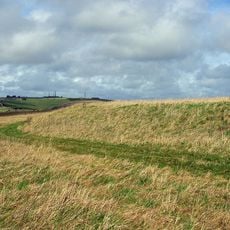
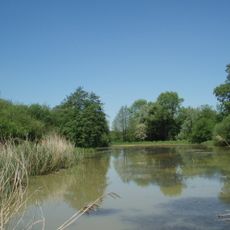
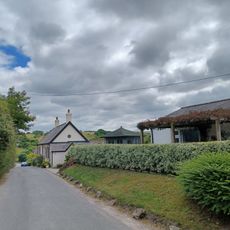
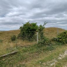
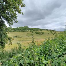
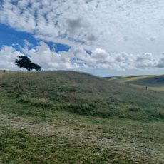
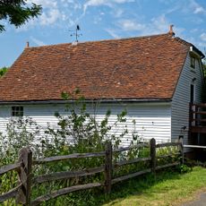
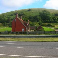
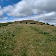
Beeding Hill to Newtimber Hill is a protected area in West Sussex, part of the South Downs, known for its chalk grasslands and rolling hills. The site spans hundreds of hectares and features open fields, ancient terraces carved into the hillside, and views across the Adur Valley to the surrounding landscape.

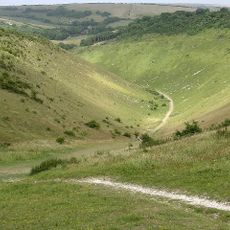
The site was officially designated as a Site of Special Scientific Interest in 1986, protecting its chalk geology and distinctive plant life. The landscape bears traces of ancient farming through old terraces and trackways, while local legends like Devil's Dyke reflect the area's deep cultural history.

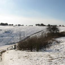
Local people and visitors walk, cycle, and explore the paths throughout the year, making use of the open spaces for outdoor activities. Community groups occasionally gather here for events and nature-watching, reflecting a long tradition of enjoying these South Downs landscapes.

The walking paths are easy to follow and accessible for most people, with parking available near the entrances for a simple start. Wear comfortable shoes and bring water, especially on warm days, as there are no facilities directly on the hill.

Legend tells of the devil digging Devil's Dyke in a single night out of anger at Christianity's spread, only to be tricked by a woman with a candle and a crowing cockerel into thinking dawn had come. The tale explains how the valley remains as a sign of his failed plan, and the story persists as a favorite among visitors today.

The community of curious travelers

AroundUs brings together thousands of curated places, local tips, and hidden gems, enriched daily by 60,000 contributors worldwide.

Start exploring
Location
GPS coordinates
50.88700,-0.22400
Latest update
February 9, 2026 07:43
Around this place
Devil's Dyke, Sussex
United Kingdom

Devil's Dyke, Sussex

949 m
Hangleton Manor Inn
United Kingdom

Hangleton Manor Inn

4.5 km
Patcham Pylon
United Kingdom

Patcham Pylon

4.2 km
Foredown Tower
United Kingdom

Foredown Tower

4.1 km
St Helen's Church, Hangleton
United Kingdom

St Helen's Church, Hangleton

4.3 km
Thundersbarrow Hill
United Kingdom

Thundersbarrow Hill

3.5 km
Church of the Transfiguration, Pyecombe
United Kingdom

Church of the Transfiguration, Pyecombe

4.4 km
Woods Mill
United Kingdom

Woods Mill

4.1 km
Newtimber Place
United Kingdom

Newtimber Place

3.1 km
Edburton Castle Ring
United Kingdom

Edburton Castle Ring

1.3 km
Saddlescombe Preceptory
United Kingdom

Saddlescombe Preceptory

2.2 km
The Parish Church of St Peter
United Kingdom

The Parish Church of St Peter

4.2 km
The Parish Church of St John Evangelist
United Kingdom

The Parish Church of St John Evangelist

3 km
The Church of the Holy Trinity, Poynings
United Kingdom

The Church of the Holy Trinity, Poynings

1.7 km
Church of St Andrew
United Kingdom

Church of St Andrew

1.7 km
The Shepherd And Dog Public House
United Kingdom

The Shepherd And Dog Public House

358 m
Wolstonbury
United Kingdom

Wolstonbury

4.3 km
Pyecombe Manor
United Kingdom

Pyecombe Manor

3.8 km
Star House
United Kingdom

Star House

3.7 km
Wolstonbury Camp: a Ram's Hill type enclosure on Wolstonbury Hill and associated later remains
United Kingdom

Wolstonbury Camp: a Ram's Hill type enclosure on Wolstonbury Hill and associated later remains

4.3 km
The Old School House
United Kingdom

The Old School House

4.5 km
Cross dyke and bowl barrow 310m south east of Wolstonbury Camp
United Kingdom

Cross dyke and bowl barrow 310m south east of Wolstonbury Camp

4.2 km
Roman road and 18th century coaching road N of Pyecombe church
United Kingdom

Roman road and 18th century coaching road N of Pyecombe church

4.7 km
Bowl barrow on Edburton Hill, 380m west of the motte and bailey castle
United Kingdom

Bowl barrow on Edburton Hill, 380m west of the motte and bailey castle

1.7 km
The Mill Building At Woods Mill
United Kingdom

The Mill Building At Woods Mill

4.1 km
Redhouse Farmhouse
United Kingdom

Redhouse Farmhouse

3.4 km
Romano-British farmstead, field system and trackway on Wolstonbury Hill
United Kingdom

Romano-British farmstead, field system and trackway on Wolstonbury Hill

4.5 km
Devil's Dyke hillfort
United Kingdom

Devil's Dyke hillfort

966 m
Show the full map
Reviews
Share your experience

No review yet

Discussions
Start a discussion...

No discussion yet

« Beeding Hill to Newtimber Hill - An escarpment of special scientific interest for its biodiversity » is provided by Around Us (aroundus.com). Images and texts are derived from Wikimedia project under a Creative Commons license. You are allowed to copy, distribute, and modify copies of this page, under the conditions set by the license, as long as this note is clearly visible.

Discover hidden gems everywhere you go!

From secret cafés to breathtaking viewpoints, skip the crowded tourist spots and find places that match your style. Our app makes it easy with voice search, smart filtering, route optimization, and insider tips from travelers worldwide. Download now for the complete mobile experience.

Around Us App Screenshot

A unique approach to discovering new places

Le Figaro

All the places worth exploring

France Info

A tailor-made excursion in just a few clicks

20 Minutes

Around Us
Travel Guide & Maps
Download

Send to your phone

QR Code
1

Open the camera app on your mobile.

2

Point at the QR code with your camera. A notification will appear.

3

Tap the notification to open the link.