Enable Location

We need your location to show you interesting places around you

Discover nearby places

Find interesting locations and hidden gems around you

Precise directions

Get accurate directions and distances to places

Your location is never shared with other users. It's only used when you tap the location button.

Rincon Point

Log in to your account

Start exploring — it's free

Trusted by 61,368 travelers worldwide

Continue with Google
Continue with Apple
or

We will send you a code to connect

By continuing, you accept our Terms and Conditions and our Privacy Policy

Check your inbox

We've sent a pincode in your inbox. Please enter the code below.

Rincon Point

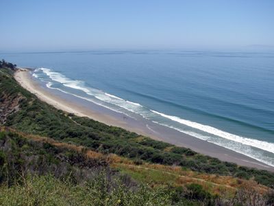
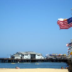
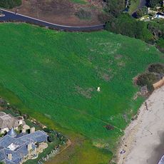
Rincon Point, Coastal cape in Santa Barbara County, United States.

Description

Rincon Point is a coastal cape jutting into the Pacific Ocean at the border between Ventura and Santa Barbara counties. The formation features multiple sections that together create varying wave patterns across the site.

History

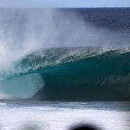
A lifeguard named Gates Foss discovered the wave potential of this location in the late 1930s, bringing it to wider attention. This discovery marked the beginning of its transformation into a recognized destination for riders.

Culture

This coastal location serves as a gathering place for the surfing community, where riders from different backgrounds meet to challenge the waves. It represents more than just a sports venue—it is where local surfing culture takes shape and evolves through shared experience.

Practical

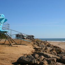
Reaching this location requires navigating local roads through Santa Barbara County and careful planning to experience ideal conditions. Wave strength peaks between late autumn and early spring, making these months the most rewarding for a visit.

Did you know?

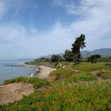
The cape is divided into three connected sections named Indicator, Rivermouth, and The Cove, each producing its own distinct wave pattern. This arrangement makes it a rare spot where multiple wave types can be found in a single location.

GPS coordinates
34.37306,-119.47833
Latest update
December 6, 2025 17:46

AroundUs brings together thousands of curated places, local tips, and hidden gems, enriched daily by 60,000 contributors worldwide. Discover all places nearby (Santa Barbara County).

Surf spots: Banzai Pipeline in Hawaii, Teahupo'o in Polynesia, Jeffreys Bay in South Africa

This collection includes renowned surf spots around the world, located across multiple continents and oceans. From the north coast of Oahu in Hawaii to Australian beaches like Bells Beach and Snapper Rocks, these locations attract surfers from around the world for their consistent waves and...

Around this place
Mission San Buenaventura
United States of America

Mission San Buenaventura

19.5 km
El Fureidis
United States of America

El Fureidis

17.1 km
Moreton Bay Fig Tree
United States of America

Moreton Bay Fig Tree

20.3 km
Lotusland
United States of America

Lotusland

18.2 km
Stearns Wharf
United States of America

Stearns Wharf

19.6 km
Emma Wood State Beach
United States of America

Emma Wood State Beach

17.1 km
Santa Barbara Zoo
United States of America

Santa Barbara Zoo

17.8 km
Carpinteria State Beach
United States of America

Carpinteria State Beach

4.4 km
Casa del Herrero
United States of America

Casa del Herrero

16.2 km
Majestic Ventura Theatre
United States of America

Majestic Ventura Theatre

20.1 km
Ventura County Courthouse
United States of America

Ventura County Courthouse

19.9 km
Santa Barbara Vedanta Temple
United States of America

Santa Barbara Vedanta Temple

12.4 km
Statues of Junípero Serra
United States of America

Statues of Junípero Serra

19.8 km
Santa Barbara Museum of Natural History Sea Center
United States of America

Santa Barbara Museum of Natural History Sea Center

19.5 km
East Beach
United States of America

East Beach

19.3 km
East Beach
United States of America

East Beach

19.2 km
Foster Park Bowl
United States of America

Foster Park Bowl

15.5 km
San Buenaventura Mission Aqueduct
United States of America

San Buenaventura Mission Aqueduct

17.7 km
Big Caliente Hot Springs
United States of America

Big Caliente Hot Springs

20.1 km
Allan Herschell 3-Abreast Carousel
United States of America

Allan Herschell 3-Abreast Carousel

19.5 km
Shalawa Meadow, California
United States of America

Shalawa Meadow, California

15.3 km
Feraud General Merchandise Store
United States of America

Feraud General Merchandise Store

19.3 km
San Miguel Chapel Site
United States of America

San Miguel Chapel Site

19.8 km
Peirano Market
United States of America

Peirano Market

19.5 km
The Wolf Museum of Exploration and Innovation
United States of America

The Wolf Museum of Exploration and Innovation

20.1 km
Acacia Lodge
United States of America

Acacia Lodge

15 km
Emmanuel Franz House
United States of America

Emmanuel Franz House

19.8 km
Santa Barbara Maritime Museum
United States of America

Santa Barbara Maritime Museum

20.1 km
Show the full map
« Rincon Point - Coastal cape in Santa Barbara County, United States » is provided by Around Us (aroundus.com). Images and texts are derived from Wikimedia project under a Creative Commons license. You are allowed to copy, distribute, and modify copies of this page, under the conditions set by the license, as long as this note is clearly visible.

Discover hidden gems everywhere you go!

From secret cafés to breathtaking viewpoints, skip the crowded tourist spots and find places that match your style. Our app makes it easy with voice search, smart filtering, route optimization, and insider tips from travelers worldwide. Download now for the complete mobile experience.

Around Us App Screenshot

A unique approach to discovering new places

Le Figaro

All the places worth exploring

France Info

A tailor-made excursion in just a few clicks

20 Minutes

Around Us
Travel Guide & Maps
Download

Send to your phone

QR Code
1

Open the camera app on your mobile.

2

Point at the QR code with your camera. A notification will appear.

3

Tap the notification to open the link.