Enable Location

We need your location to show you interesting places around you

Discover nearby places

Find interesting locations and hidden gems around you

Precise directions

Get accurate directions and distances to places

Your location is never shared with other users. It's only used when you tap the location button.

Big Caliente Hot Springs

Log in to your account

Start exploring — it's free

Trusted by 62,132 travelers worldwide

Continue with Google
Continue with Apple
or

We will send you a code to connect

By continuing, you accept our Terms and Conditions and our Privacy Policy

Check your inbox

We've sent a pincode in your inbox. Please enter the code below.

Big Caliente Hot Springs

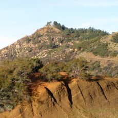
Big Caliente Hot Springs, Natural hot springs in Los Padres National Forest, California, US

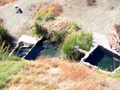
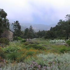
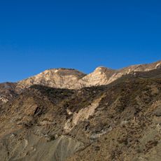
Big Caliente Hot Springs is a system of thermal pools in Los Padres National Forest with several natural and constructed soaking areas that emerge from a hillside. The three main pools reach temperatures around 46 degrees Celsius (115 Fahrenheit) and flow into basins lined with concrete and stone in the mountain landscape.

The springs were used for hundreds of years by Native American tribes who valued the warm waters for healing and ceremonial purposes. Following European settlement, the site lost its original importance but was later rediscovered by hikers and outdoor enthusiasts in modern times.

The springs attract visitors who value the warm water and natural healing properties of the minerals. Many people come here to relax and experience the landscape together.

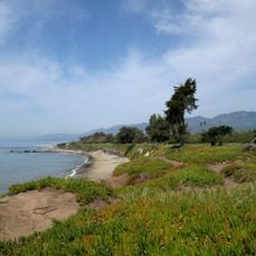
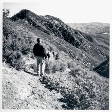
The location is only accessible through a long hike or four-wheel drive vehicle over Romero Canyon, requiring good preparation and planning. The best time to visit is between spring and fall when conditions are most favorable.

The main soaking pool has adjustable valves that allow visitors to control the water temperature themselves and customize their bathing experience. This practical system makes it possible to enjoy the water comfortably during different seasons.

The community of curious travelers

AroundUs brings together thousands of curated places, local tips, and hidden gems, enriched daily by 60,000 contributors worldwide.

Start exploring
GPS coordinates
34.53922,-119.56460
Latest update
December 14, 2025 12:22
Around this place
Mission Santa Barbara
United States of America

Mission Santa Barbara

17.7 km
El Fureidis
United States of America

El Fureidis

13.4 km
Presidio of Santa Barbara
United States of America

Presidio of Santa Barbara

17.8 km
Lotusland
United States of America

Lotusland

13.7 km
Santa Barbara Bowl
United States of America

Santa Barbara Bowl

16.8 km
Santa Barbara County Courthouse
United States of America

Santa Barbara County Courthouse

18 km
Santa Barbara Zoo
United States of America

Santa Barbara Zoo

16.2 km
Carpinteria State Beach
United States of America

Carpinteria State Beach

16.9 km
Santa Barbara Museum of Natural History
United States of America

Santa Barbara Museum of Natural History

17.6 km
Casa del Herrero
United States of America

Casa del Herrero

13.3 km
Santa Barbara Botanic Garden
United States of America

Santa Barbara Botanic Garden

16.3 km
Santa Barbara Vedanta Temple
United States of America

Santa Barbara Vedanta Temple

10.5 km
Gibraltar Dam
United States of America

Gibraltar Dam

11.3 km
Rafael Gonzalez House
United States of America

Rafael Gonzalez House

17.6 km
East Beach
United States of America

East Beach

17.6 km
East Beach
United States of America

East Beach

17.5 km
La Cumbre Peak
United States of America

La Cumbre Peak

14.5 km
United States of America

Covarrubias Adobe

17.8 km
Santa Barbara Historical Museum
United States of America

Santa Barbara Historical Museum

17.9 km
Allan Herschell 3-Abreast Carousel
United States of America

Allan Herschell 3-Abreast Carousel

17.7 km
Shalawa Meadow, California
United States of America

Shalawa Meadow, California

15.1 km
Santa Barbara Mission-Archive Library
United States of America

Santa Barbara Mission-Archive Library

17.7 km
Acacia Lodge
United States of America

Acacia Lodge

14.2 km
Little Pine Mountain
United States of America

Little Pine Mountain

17.4 km
Madulce Peak
United States of America

Madulce Peak

17.1 km
Rocky Nook Park
United States of America

Rocky Nook Park

17.2 km
Rattlesnake Canyon Bridge
United States of America

Rattlesnake Canyon Bridge

14.8 km
A.C. Postel Memorial Rose Garden
United States of America

A.C. Postel Memorial Rose Garden

17.6 km
Show the full map
« Big Caliente Hot Springs - Natural hot springs in Los Padres National Forest, California, US » is provided by Around Us (aroundus.com). Images and texts are derived from Wikimedia project under a Creative Commons license. You are allowed to copy, distribute, and modify copies of this page, under the conditions set by the license, as long as this note is clearly visible.

Discover hidden gems everywhere you go!

From secret cafés to breathtaking viewpoints, skip the crowded tourist spots and find places that match your style. Our app makes it easy with voice search, smart filtering, route optimization, and insider tips from travelers worldwide. Download now for the complete mobile experience.

Around Us App Screenshot

A unique approach to discovering new places

Le Figaro

All the places worth exploring

France Info

A tailor-made excursion in just a few clicks

20 Minutes

Around Us
Travel Guide & Maps
Download

Send to your phone

QR Code
1

Open the camera app on your mobile.

2

Point at the QR code with your camera. A notification will appear.

3

Tap the notification to open the link.