Malgretoute Beach

Log in to your account

AroundUs is a community-driven map of interesting places, built by curious explorers like you. It grows with every review, story, and photo you share.
Connect to save your favorite spots, contribute locations, and create personalized routes.
By continuing, you accept our Terms and Conditions and our Privacy Policy

Malgretoute Beach

Add to collection
Map
Suggest a change
Share

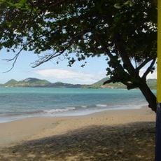
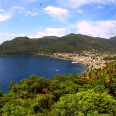
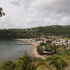
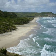
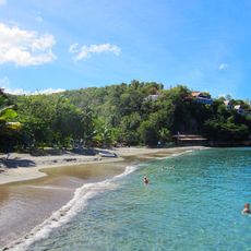
Malgretoute Beach, Beach in Soufrière Quarter, Saint Lucia

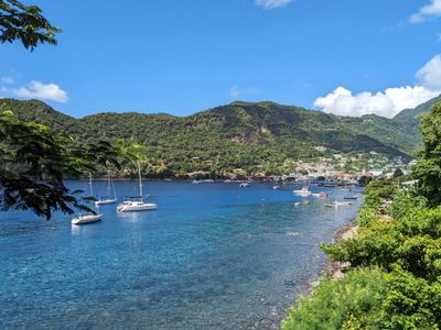
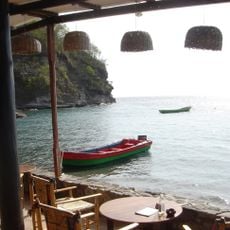
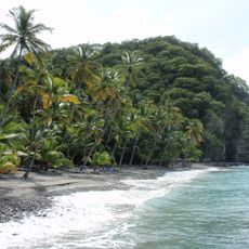
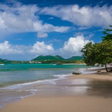
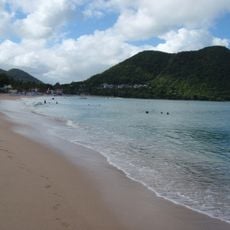
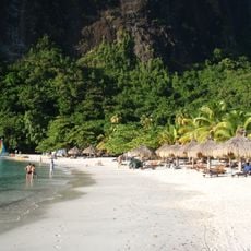
Malgretoute Beach is a stretch of gray sand north of Petit Piton where calm water meets the shore against a backdrop of dense vegetation. The cove has a narrow coastline partly sheltered by rocky formations, which helps protect swimmers from stronger waves.

A large stone with ancient petroglyphs sits on the beach, showing that indigenous peoples lived in this part of Saint Lucia centuries ago. These carved markings are evidence of the earliest inhabitants and their connection to this coastal area.

Local vendors set up small stands along the shore, selling traditional Saint Lucian dishes and fresh coconut water to people who visit. These modest stalls show how the community uses this place as part of their daily routine.

To reach the beach, drive south from Soufrière and turn right onto Sugar Beach road, then follow the unpaved path to the shore. The route is straightforward to find, but wear sturdy shoes as the path can be rough, and proceed carefully in wet conditions.

The waters offshore contain numerous coral formations that create natural homes for tropical fish, and these underwater gardens are visible through the clear water. Snorkeling here lets you see these fish and corals without needing to dive deep, making it appealing for visitors of all swimming abilities.

Location: Soufrière Quarter

GPS coordinates: 13.84158,-61.06306

Latest update: December 6, 2025 19:08

Photo locations in Saint Lucia

Saint Lucia combines volcanic landforms with tropical rainforest and coastal stretches shaped by both Atlantic and Caribbean waters. The island ranges from sea level to peaks reaching nearly 1,000 meters (3,280 feet), creating varied environments for photography. You will find subjects that include steep mountain formations, sheltered bays and historical structures set against natural backdrops. Places like the Pitons near Soufrière show the island's volcanic past, while beaches such as Anse Chastanet and Jalousie Beach offer contrasts between dark and light sand. Marigot Bay and Rodney Bay serve as natural harbors that have anchored vessels for centuries. Historical sites like Pigeon Island National Landmark and La Toc Battery recall colonial conflicts between European powers. Trails such as Tet Paul Nature Trail and routes to Mount Gimie pass through vegetation that shifts with elevation. Waterfalls like Enbas Saut and Sapphire Falls lie inland, where rivers cut through rock formations. Coastal spots like Cas en Bas Beach and Grande Anse Beach show different shoreline patterns, from rocky sections to open sand.

Reviews

Visited this place? Tap the stars to rate it and share your experience / photos with the community! Try now! You can cancel it anytime.

« Malgretoute Beach - Beach in Soufrière Quarter, Saint Lucia » is provided by Around Us (aroundus.com). Images and texts are derived from Wikimedia project under a Creative Commons license. You are allowed to copy, distribute, and modify copies of this page, under the conditions set by the license, as long as this note is clearly visible.

Discover hidden gems everywhere you go!

From secret cafés to breathtaking viewpoints, skip the crowded tourist spots and find places that match your style. Our app makes it easy with voice search, smart filtering, route optimization, and insider tips from travelers worldwide. Download now for the complete mobile experience.

Around Us App Screenshot

A unique approach to discovering new places

Le Figaro

All the places worth exploring

France Info

A tailor-made excursion in just a few clicks

20 Minutes