See the monuments around you in AROpen chests in the app
Around Us is built for your phone — point your camera at the streets and discover the monuments and places around you in augmented reality.Around Us is built for your phone — chests unlock when you walk, explore and capture nearby places.
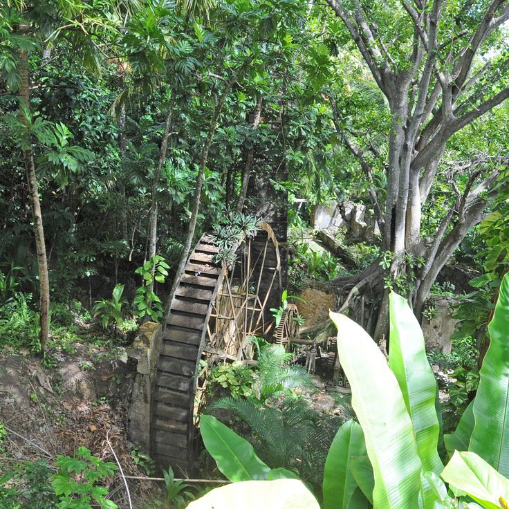
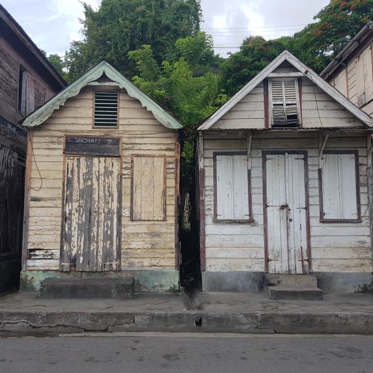
Saint Lucia combines volcanic landforms with tropical rainforest and coastal stretches shaped by both Atlantic and Caribbean waters. The island ranges from sea level to peaks reaching nearly 1,000 meters (3,280 feet), creating varied environments for photography. You will find subjects that include steep mountain formations, sheltered bays and historical structures set against natural backdrops.
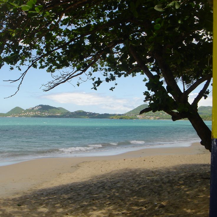
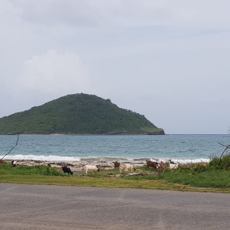
Places like the Pitons near Soufrière show the island's volcanic past, while beaches such as Anse Chastanet and Jalousie Beach offer contrasts between dark and light sand. Marigot Bay and Rodney Bay serve as natural harbors that have anchored vessels for centuries. Historical sites like Pigeon Island National Landmark and La Toc Battery recall colonial conflicts between European powers. Trails such as Tet Paul Nature Trail and routes to Mount Gimie pass through vegetation that shifts with elevation. Waterfalls like Enbas Saut and Sapphire Falls lie inland, where rivers cut through rock formations. Coastal spots like Cas en Bas Beach and Grande Anse Beach show different shoreline patterns, from rocky sections to open sand.
Saint Lucia combines volcanic landforms with tropical rainforest and coastal stretches shaped by both Atlantic and Caribbean waters. The island ranges from sea level to peaks reaching nearly 1,000 meters (3,280 feet), creating varied environments for photography. You will find subjects that include steep mountain formations, sheltered bays and historical structures set against natural backdrops.
Places like the Pitons near Soufrière show the island's volcanic past, while beaches such as Anse Chastanet and Jalousie Beach offer contrasts between dark and light sand. Marigot Bay and Rodney Bay serve as natural harbors that have anchored vessels for centuries. Historical sites like Pigeon Island National Landmark and La Toc Battery recall colonial conflicts between European powers. Trails such as Tet Paul Nature Trail and routes to Mount Gimie pass through vegetation that shifts with elevation. Waterfalls like Enbas Saut and Sapphire Falls lie inland, where rivers cut through rock formations. Coastal spots like Cas en Bas Beach and Grande Anse Beach show different shoreline patterns, from rocky sections to open sand.
This 18th-century fortress sits on a small peninsula on the northern coast. The site holds a museum with military objects from colonial times. Walking paths lead through dry vegetation to the ruins of old barracks and gun positions. From the higher points you see the Caribbean Sea and the coastline. The island once served as a lookout post during battles between France and England. Photographers will find stone walls, arches and viewpoints with ocean views.
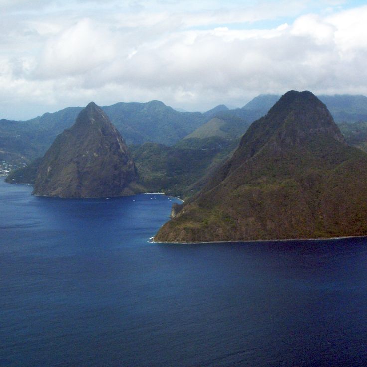
These two volcanic cones rise from the sea along the southwest coast of the island. Petit Piton measures 743 meters (2,438 feet) and Gros Piton 771 meters (2,530 feet). Forests cover the slopes all the way to the summits. The rock formed through volcanic activity several million years ago. Trails lead through the tropical forest at the base of the mountains. From the sea or from surrounding hills, the cones appear like two sentinels of the coastline. Fishermen have used the Pitons as a landmark for centuries.
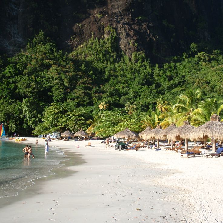
This beach shows black sand of volcanic origin and sits near the coast of Soufrière. Anse Chastanet draws snorkelers who want to swim among coral reefs without traveling far from shore. The water stays shallow enough for easy access, and the reefs begin just a few yards from the sand. Photographers find contrasts here between the dark beach, green rainforest behind, and turquoise sea. The bay sits in a protected spot and offers calm conditions on most days. This location is among the photo subjects in Saint Lucia that combine natural elements and underwater scenery.
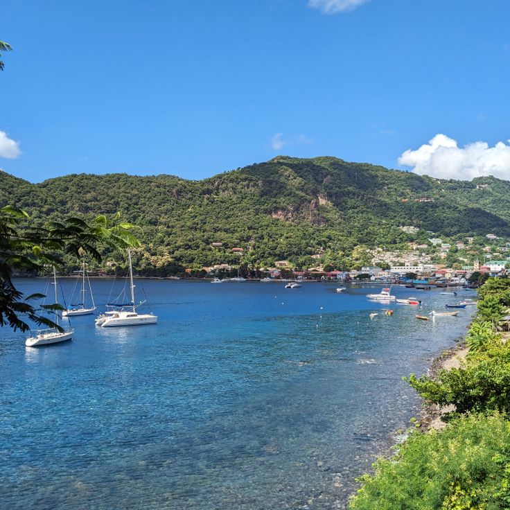
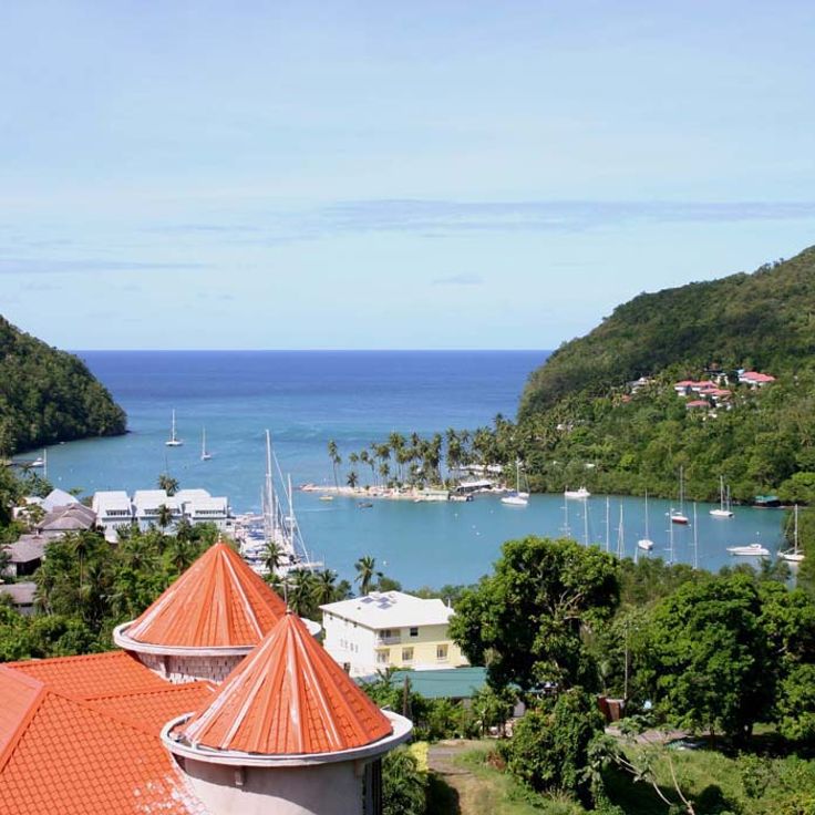
This bay is a natural harbor where yachts and sailboats drop anchor. Palm trees line the shores and green hills frame the calm water. Fishermen and boat owners come here to secure their vessels and use the sheltered location. The bay attracts sailors looking for a safe anchorage and offers views of the Caribbean Sea. Visitors can experience the tropical surroundings and the relaxed mood by the water.
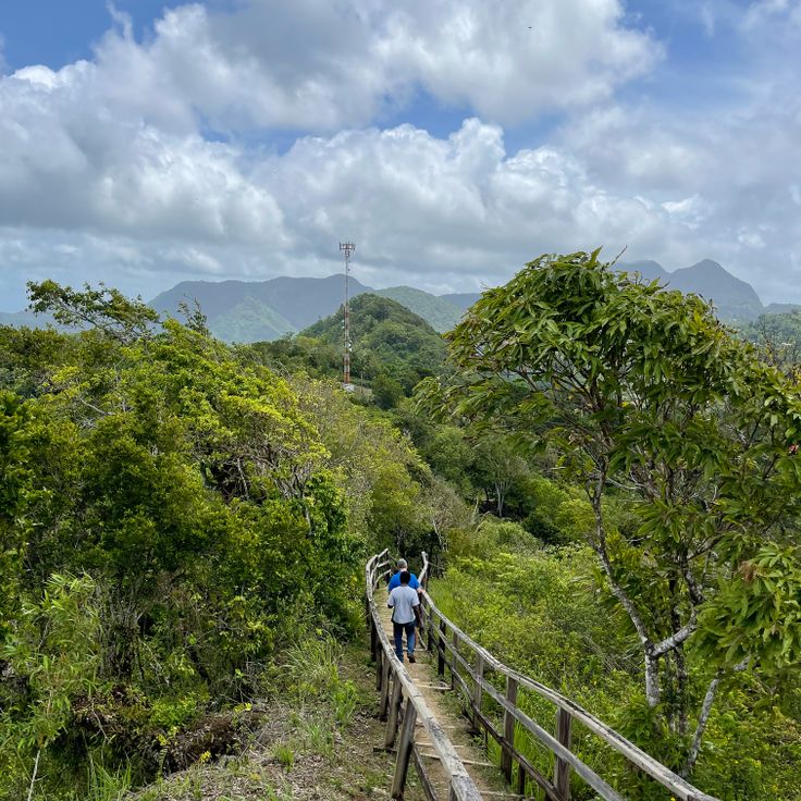
The trail runs through tropical vegetation and reaches viewpoints overlooking the two volcanic peaks of the Pitons and the Caribbean Sea. The route follows a marked path with moderate slopes. Along the way grow trees, cacti and crops such as cassava and bananas. From several spots you can see across to the neighboring island of Martinique, down to the Soufrière coast and out over open water. The trail is about a kilometer long and shows different vegetation zones of the island.
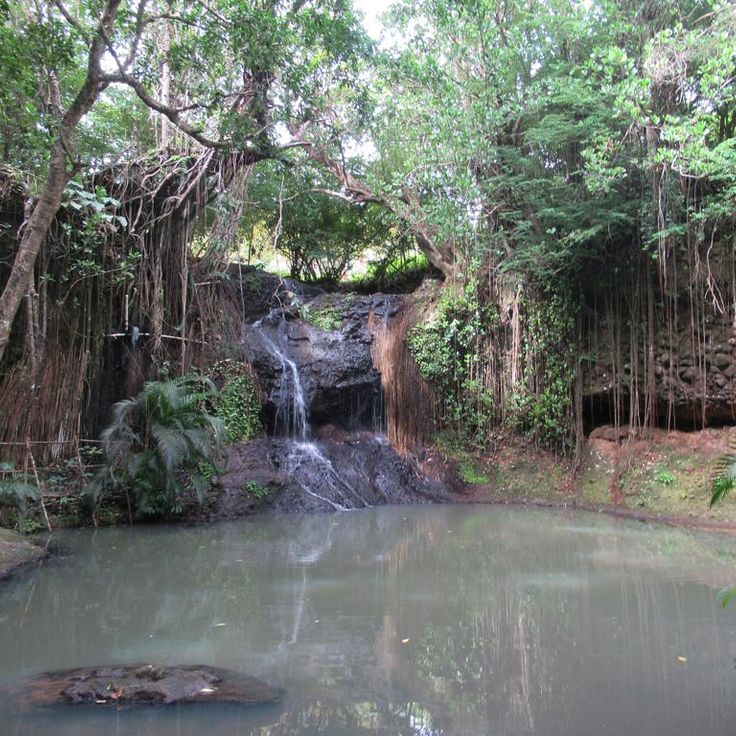
This botanical garden in the mountains offers photographers a mix of tropical plants, mineral springs and a waterfall that drops through dense greenery. Paths wind between beds of orchids, ginger and trees that provide shade. The mineral water in the baths stains rocks in shades of red. The waterfall tumbles over 55 feet and forms a small pool at the base. The site sits on a former estate from the 18th century. Photographers will find different subjects here: close-ups of flowers, warm water running over rocks, and the contrast between dark volcanic stone and the bright colors of the plants.
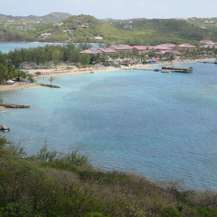
This coastal bay is named after George Rodney, an eighteenth-century British admiral. The marina holds over 250 berths and has become a hub for sailors traveling through the Caribbean. Restaurants, cafés and shops line the waterfront. The sand beach draws visitors who want to swim in the shallow water. In the evening the promenades fill with guests eating or watching the sunset. The bay brings together several activities: boat rentals, water sports and beachfront cafés share the same stretch of coast.
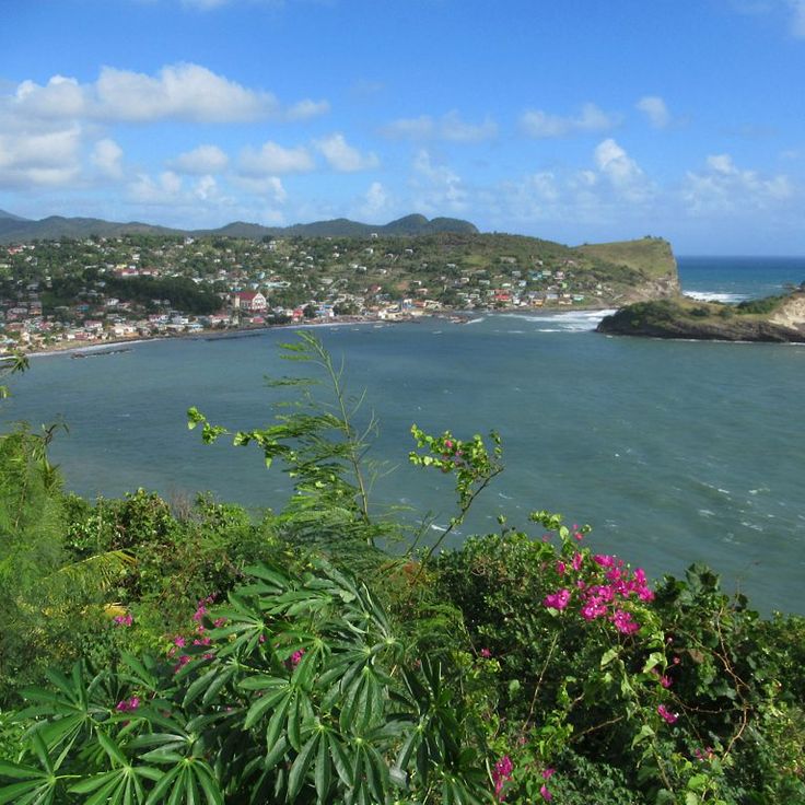
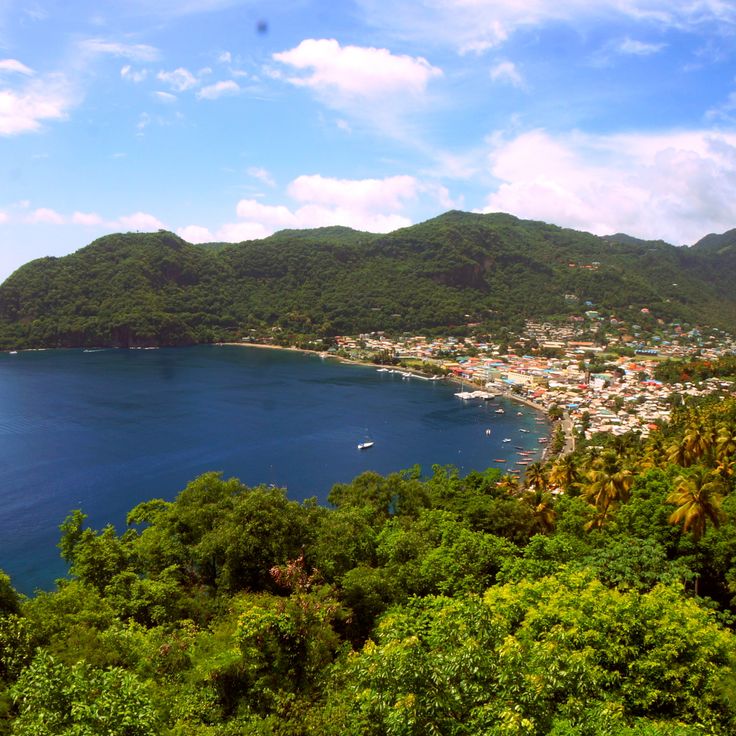
This lookout sits on a rise above the fishing village and offers a view of the Atlantic Ocean and the palm-lined coast. From here you can see the rooftops of the village, small boats on the water and the waves rolling toward the shore. The road climbs through the village to the platform, where photographers can capture the bay, the open sea and the forested hills in the background.
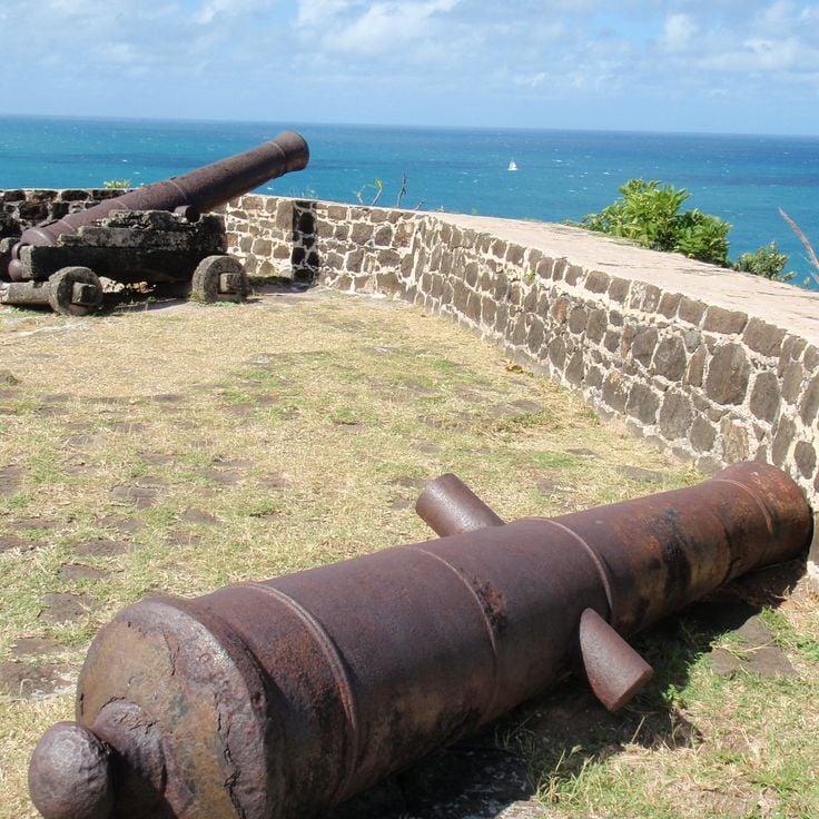
This fort sits on a hill between two seas. British soldiers built the walls and ramparts in the 18th century to watch over shipping routes. From the stone parapets you can see the Caribbean on one side and the Atlantic on the other. Cannons still point toward the water. The structure shows how colonial powers competed for control of the island. Paths lead through the fortifications, past gun ports and lookout towers that remain largely as they were built.
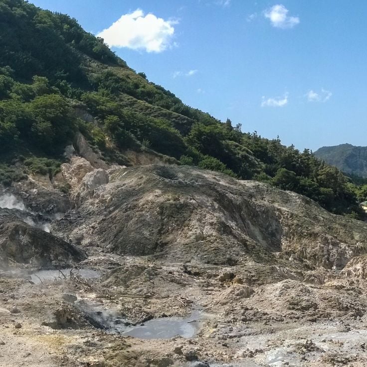
This volcano offers the rare opportunity to drive a vehicle right up to the crater. The site sits near Soufrière and shows the island's active geothermal nature. Visitors can walk among steaming fumaroles and view hot mud pools up close. The volcanic activity can be experienced directly here, with the smell of sulfur in the air and the ground warm underfoot in many places. For photographers, this location provides unusual subjects including steam, mineral deposits and the bare landscape around the crater area.
This beach draws kitesurfers with its steady winds and shallow water. The conditions here offer beginners and experienced riders alike a place to practice and glide. Along the shore you see colorful kites in the air while the waves roll gently toward land. The sand stretches wide and open, with palms in the background and views across the Caribbean Sea. Locals and visitors come here to watch or take to the water themselves, and the feeling is relaxed and shaped by wind and sun.
This hill above Castries preserves old military buildings from the colonial era and provides a wide view of the city, the harbor and the coast. The road leads up through residential neighborhoods to the fortress ruins and barracks. From the top you see the rooftops of the capital, the bay with cruise ships and on clear days the mountains inland. The site takes its name from the French colonial period and served for a long time as a strategic post. Today government buildings and a military academy stand among the old stones. The wind usually blows fresh, and the view reaches across the sea to the horizon.
This beach is known for water sports of many kinds. Along the shore, rental facilities for jet skis, sailboats and snorkeling gear line up one after another. The shallow water near the shore suits beginners, while those with more experience head further out. Local operators also arrange tours along the coast and to nearby bays. The beach is usually busy, especially in the morning when groups arrive. Palms provide shade in some spots, and small bars serve drinks to visitors. The mood is relaxed and activity-focused.
This coastal stretch sits on the Atlantic side and draws windsurfers and kitesurfers who train here regularly. The constant winds make Cas en Bas Beach a place where you can watch athletes on the water. The beach is less crowded than other beaches on the island and has a natural, open feel. The sea here is often active, and the waves roll in directly from the ocean.
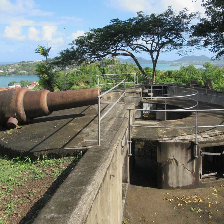
This military site from the 18th century sits on a hill above Castries Bay and offers views of the Caribbean Sea. The battery was part of the defense against attacks from the water and several historic cannons remain at their original positions. Stone walls and gun placements show how important this place was during colonial times. Visitors can walk among the ruins and look across the capital and the harbor.
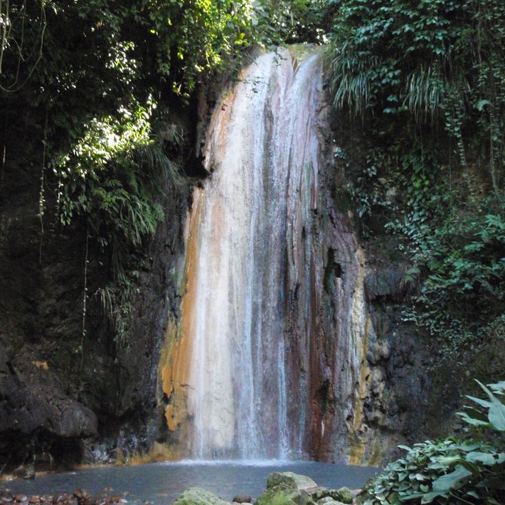
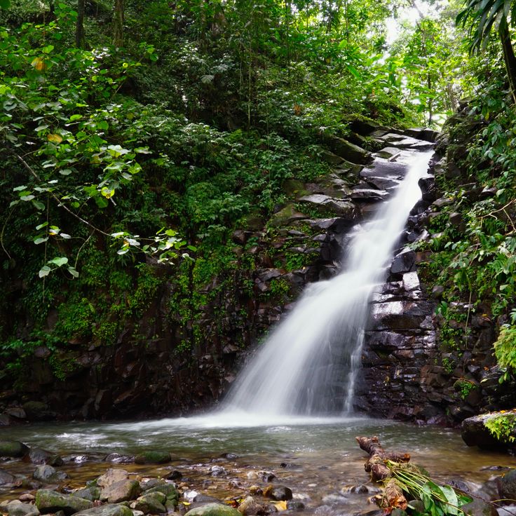
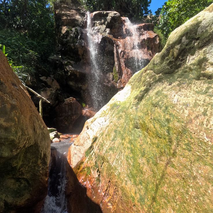
This waterfall sits within the rainforest of the Edmond Forest Reserve and can be reached by a marked hiking trail. The path winds through dense tropical forest where ferns and tree ferns line the way. Water tumbles into a natural pool surrounded by wet rock and green vegetation. Humidity is high, and you often hear bird calls from the canopy above. Photographers find subjects in the forest, water, and natural light filtering through the trees.
This beach sits between the Piton mountains and gives photographers a chance to capture both peaks from the shoreline. The water is good for snorkeling, and the white sand contrasts with the forested slopes. The setting is a popular subject for shots of Saint Lucia's coastline with the distinctive mountains in the background.
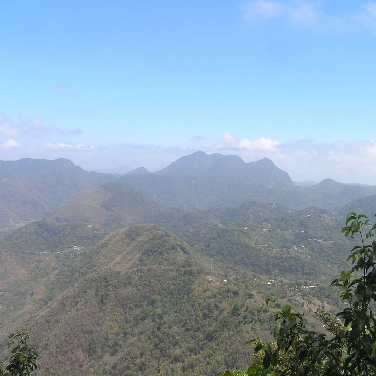
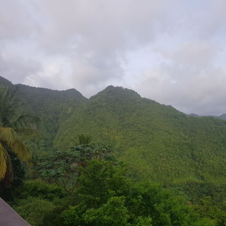
Mount Gimie is the highest mountain in Saint Lucia, reaching 950 meters. Rainforest surrounds the summit, and hiking trails pass through dense vegetation. Photographers will find tropical plants, mist drifting between trees, and views over the forested slopes of the island, particularly effective in early morning light.
The Latille Waterfalls form a natural backdrop in a garden filled with tropical plants. Water falls into a basin where people swim. Narrow paths lead through the vegetation, past palms and flowering plants. You hear the sound of water from a distance. This place invites visitors to discover the plant diversity of the island and refresh themselves in the cool water. Photographers find subjects with waterfalls, greenery and the play of light on water.
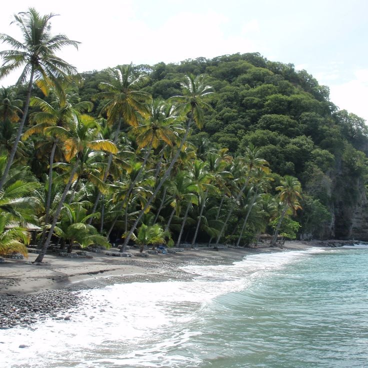
This beach borders Anse Chastanet and receives fewer visitors. Sand and sea show the coastal landscape in its natural form. Anse Mamin Beach offers photographers a quiet subject with palm trees, dark volcanic sand and clear water. The beach sits away from main paths and keeps its original character. Photographers find here the typical vegetation of the west coast and views across the open sea. The surroundings show what the coastline looks like without major changes.
This 18th-century property shows colonial architecture with stone walls and open verandas set in parkland by the sea. The gardens contain cacao trees, palms and tropical plants among old sugar mill ruins. The grounds offer views of the coastline, paths through plantation land and buildings with period furniture and tools from colonial times. For photographers, Balenbouche Estate presents the island's history through architecture and landscape design.
This crafts center brings together local artisans who work in open workshops, shaping pottery, carving wood and weaving baskets. Visitors can watch the craftspeople at their benches and see finished pieces displayed for sale. Most items are made from natural materials found on the island. The village sits in a quiet area away from the main tourist spots and offers a look at traditional techniques passed down through generations.
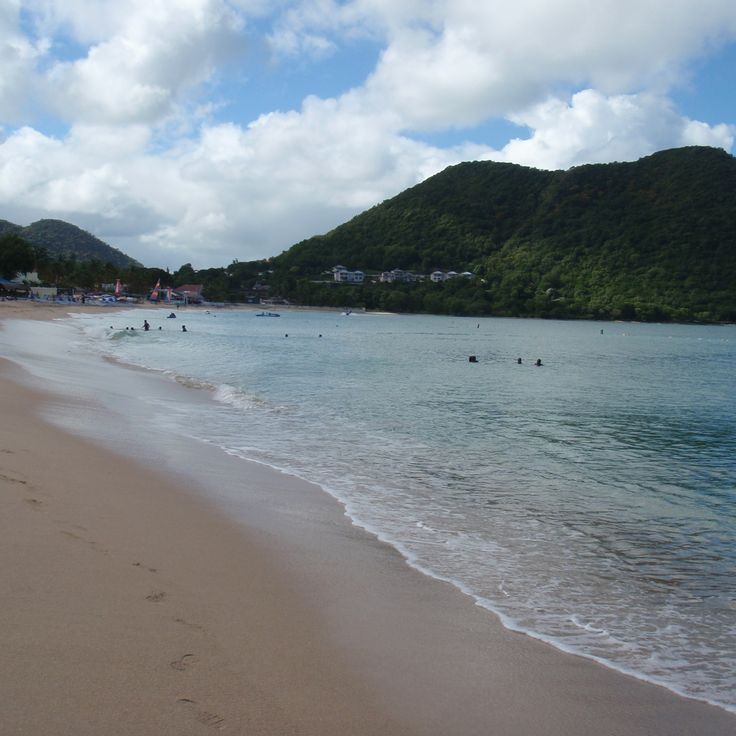
This beach in Castries draws locals and visitors with its fine sand and calm water. Vigie Beach stretches along a long bay where palm trees provide shade and you can often see fishermen at work. The beach offers photographers clear views of boats anchored in the harbor and hills rising in the background against the sky.
This nature reserve consists of two small islands off the southern coast of Saint Lucia and offers photographers a rare opportunity to document endemic animal species and tropical vegetation in their natural setting. The islands are home to around 80 plant species as well as various lizards and snakes found only here. Accessible by boat from Vieux Fort, Maria Islands Nature Reserve is a quiet location for nature photography away from the busier beaches of the island.
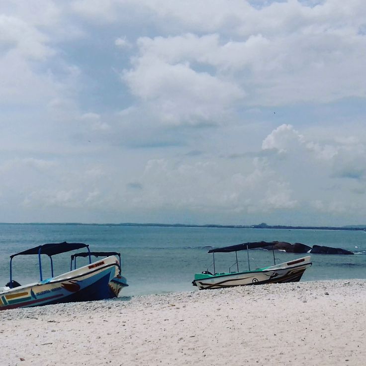
This beach sits in the fishing village and keeps its everyday life with small boats on the sand and local restaurants close by. Laborie Beach shows life on the coast without big development, where local fishermen land their catch and visitors find a quiet place away from the busier parts of Saint Lucia.
This mountain near Choiseul rises through dense tropical forest with palms, ferns and climbing vines. The path ascends steeply and ends at an open spot looking over the coast and Caribbean Sea. You hear birds among the trees and feel the humidity of the surroundings. The trail is narrow and sometimes slippery. At the top, a light breeze comes from the water. On clear days, you can see waves on the beach and the outline of the coastline.
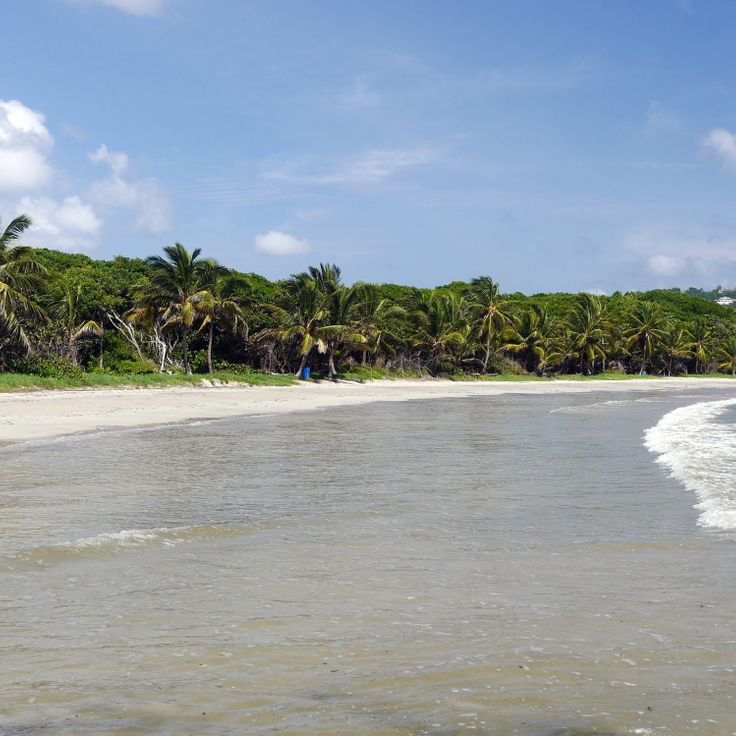
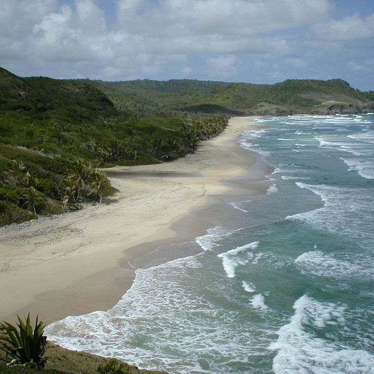
This two-hour walk from the village of Dauphin leads to a quiet beach set between coconut palms and mangroves. The sand is pale and fine, the sea usually clear. From March to August, leatherback turtles come ashore at night to lay their eggs. During the day, you might see fishermen mending their nets or pulling small boats into the water. The beach is long enough to find solitude even when other visitors are present. In the morning, light reflects off the water and the palms cast long shadows across the sand. Those who arrive early can spot turtle tracks in the sand before the tide washes them away.
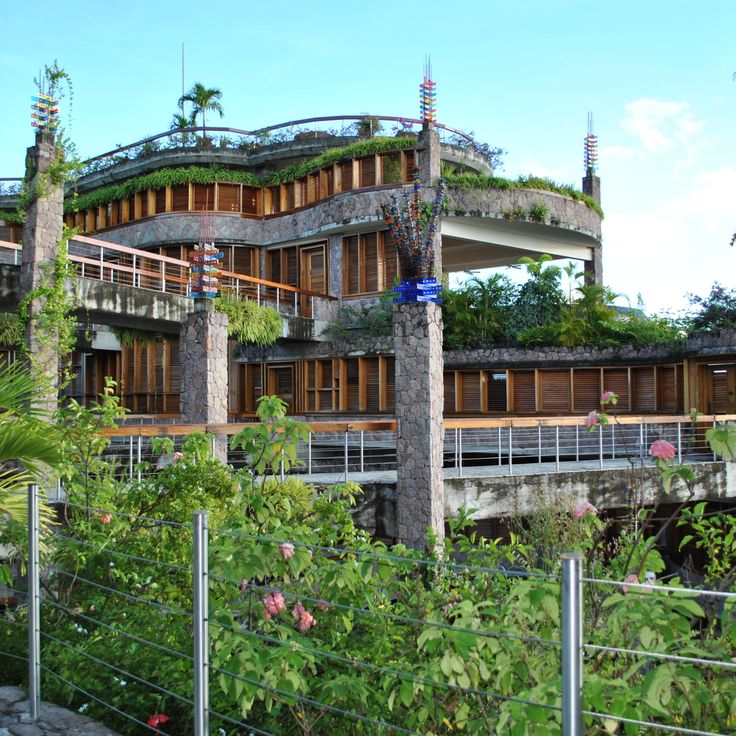
This resort sits in the hills above Soufrière, with open suites arranged across three levels. Each suite includes its own pool and a direct view toward the two Pitons, the volcanic peaks offshore. The rooms have no fourth wall, opening entirely to the landscape. Architecturally, the resort follows a terraced structure that fits into the hillside. Photographers will find a combination of contemporary construction and tropical surroundings. The pools often mirror the sky and mountains. The open design blurs the line between inside and outside, allowing for unusual perspectives.
This waterfall flows from the forest canopy into a clear pool surrounded by moss-covered rocks and thick vegetation. A trail winds through the rainforest to the base, where the sound of falling water fills the air and mist hangs over the surface. The forest opens to a small clearing, and the water runs cool and inviting, with ferns growing along the edges. Photographers who bring their cameras will find light filtering through the canopy, shadows shifting on wet stone, and the motion of water against green foliage.
This beach connects the island to the mainland over 800 meters (half a mile) of sand. On the hill stand ruins of French and British fortresses from the 18th century, testifying to Saint Lucia's military history. The water is calm and invites swimming, while paths wind through the historical grounds.
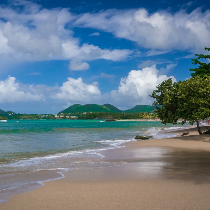
This beach sits in a protected bay just north of Castries and draws locals and travelers who want calm water and shade under the palms. Choc Beach stretches for about a mile of soft sand, where the sea stays shallow and clear. In the mornings, joggers and fishermen pass by, while families play along the shore in the afternoons. The beach lies close to the main road, so small cafés and snack stands are within walking distance. Photographers find soft light here at sunset, when the water turns pastel and boat silhouettes appear against the horizon.
This beach sits between the two Piton mountains, which rise in the background and frame the view from almost every angle. Natural hot springs at the northern end heat the seawater to around 100°F (38°C), so you can swim in the ocean and feel the warmth of the springs at the same time. The dark sand comes from volcanic rock, and on some days small fishing boats pull up to unload their catch right on the shore. Palms grow along the edge, and the water stays calm because the mountains on either side protect the bay. You can see the outline of the Pitons from nearly anywhere on the sand, especially in the morning when the light rises over the water. This spot is a good starting point for photographers looking to capture tropical shorelines with mountains and the contrast between warm springs and cooler ocean water.
This 18th-century fortress sits on a small peninsula on the northern coast. The site holds a museum with military objects from colonial times. Walking paths lead through dry vegetation to the ruins of old barracks and gun positions. From the higher points you see the Caribbean Sea and the coastline. The island once served as a lookout post during battles between France and England. Photographers will find stone walls, arches and viewpoints with ocean views.
These two volcanic cones rise from the sea along the southwest coast of the island. Petit Piton measures 743 meters (2,438 feet) and Gros Piton 771 meters (2,530 feet). Forests cover the slopes all the way to the summits. The rock formed through volcanic activity several million years ago. Trails lead through the tropical forest at the base of the mountains. From the sea or from surrounding hills, the cones appear like two sentinels of the coastline. Fishermen have used the Pitons as a landmark for centuries.
This beach shows black sand of volcanic origin and sits near the coast of Soufrière. Anse Chastanet draws snorkelers who want to swim among coral reefs without traveling far from shore. The water stays shallow enough for easy access, and the reefs begin just a few yards from the sand. Photographers find contrasts here between the dark beach, green rainforest behind, and turquoise sea. The bay sits in a protected spot and offers calm conditions on most days. This location is among the photo subjects in Saint Lucia that combine natural elements and underwater scenery.
This bay is a natural harbor where yachts and sailboats drop anchor. Palm trees line the shores and green hills frame the calm water. Fishermen and boat owners come here to secure their vessels and use the sheltered location. The bay attracts sailors looking for a safe anchorage and offers views of the Caribbean Sea. Visitors can experience the tropical surroundings and the relaxed mood by the water.
The trail runs through tropical vegetation and reaches viewpoints overlooking the two volcanic peaks of the Pitons and the Caribbean Sea. The route follows a marked path with moderate slopes. Along the way grow trees, cacti and crops such as cassava and bananas. From several spots you can see across to the neighboring island of Martinique, down to the Soufrière coast and out over open water. The trail is about a kilometer long and shows different vegetation zones of the island.
This botanical garden in the mountains offers photographers a mix of tropical plants, mineral springs and a waterfall that drops through dense greenery. Paths wind between beds of orchids, ginger and trees that provide shade. The mineral water in the baths stains rocks in shades of red. The waterfall tumbles over 55 feet and forms a small pool at the base. The site sits on a former estate from the 18th century. Photographers will find different subjects here: close-ups of flowers, warm water running over rocks, and the contrast between dark volcanic stone and the bright colors of the plants.
This coastal bay is named after George Rodney, an eighteenth-century British admiral. The marina holds over 250 berths and has become a hub for sailors traveling through the Caribbean. Restaurants, cafés and shops line the waterfront. The sand beach draws visitors who want to swim in the shallow water. In the evening the promenades fill with guests eating or watching the sunset. The bay brings together several activities: boat rentals, water sports and beachfront cafés share the same stretch of coast.
This lookout sits on a rise above the fishing village and offers a view of the Atlantic Ocean and the palm-lined coast. From here you can see the rooftops of the village, small boats on the water and the waves rolling toward the shore. The road climbs through the village to the platform, where photographers can capture the bay, the open sea and the forested hills in the background.
This fort sits on a hill between two seas. British soldiers built the walls and ramparts in the 18th century to watch over shipping routes. From the stone parapets you can see the Caribbean on one side and the Atlantic on the other. Cannons still point toward the water. The structure shows how colonial powers competed for control of the island. Paths lead through the fortifications, past gun ports and lookout towers that remain largely as they were built.
This volcano offers the rare opportunity to drive a vehicle right up to the crater. The site sits near Soufrière and shows the island's active geothermal nature. Visitors can walk among steaming fumaroles and view hot mud pools up close. The volcanic activity can be experienced directly here, with the smell of sulfur in the air and the ground warm underfoot in many places. For photographers, this location provides unusual subjects including steam, mineral deposits and the bare landscape around the crater area.
This beach draws kitesurfers with its steady winds and shallow water. The conditions here offer beginners and experienced riders alike a place to practice and glide. Along the shore you see colorful kites in the air while the waves roll gently toward land. The sand stretches wide and open, with palms in the background and views across the Caribbean Sea. Locals and visitors come here to watch or take to the water themselves, and the feeling is relaxed and shaped by wind and sun.
This hill above Castries preserves old military buildings from the colonial era and provides a wide view of the city, the harbor and the coast. The road leads up through residential neighborhoods to the fortress ruins and barracks. From the top you see the rooftops of the capital, the bay with cruise ships and on clear days the mountains inland. The site takes its name from the French colonial period and served for a long time as a strategic post. Today government buildings and a military academy stand among the old stones. The wind usually blows fresh, and the view reaches across the sea to the horizon.
This beach is known for water sports of many kinds. Along the shore, rental facilities for jet skis, sailboats and snorkeling gear line up one after another. The shallow water near the shore suits beginners, while those with more experience head further out. Local operators also arrange tours along the coast and to nearby bays. The beach is usually busy, especially in the morning when groups arrive. Palms provide shade in some spots, and small bars serve drinks to visitors. The mood is relaxed and activity-focused.
This coastal stretch sits on the Atlantic side and draws windsurfers and kitesurfers who train here regularly. The constant winds make Cas en Bas Beach a place where you can watch athletes on the water. The beach is less crowded than other beaches on the island and has a natural, open feel. The sea here is often active, and the waves roll in directly from the ocean.
This military site from the 18th century sits on a hill above Castries Bay and offers views of the Caribbean Sea. The battery was part of the defense against attacks from the water and several historic cannons remain at their original positions. Stone walls and gun placements show how important this place was during colonial times. Visitors can walk among the ruins and look across the capital and the harbor.
This waterfall sits within the rainforest of the Edmond Forest Reserve and can be reached by a marked hiking trail. The path winds through dense tropical forest where ferns and tree ferns line the way. Water tumbles into a natural pool surrounded by wet rock and green vegetation. Humidity is high, and you often hear bird calls from the canopy above. Photographers find subjects in the forest, water, and natural light filtering through the trees.
This beach sits between the Piton mountains and gives photographers a chance to capture both peaks from the shoreline. The water is good for snorkeling, and the white sand contrasts with the forested slopes. The setting is a popular subject for shots of Saint Lucia's coastline with the distinctive mountains in the background.
Mount Gimie is the highest mountain in Saint Lucia, reaching 950 meters. Rainforest surrounds the summit, and hiking trails pass through dense vegetation. Photographers will find tropical plants, mist drifting between trees, and views over the forested slopes of the island, particularly effective in early morning light.
The Latille Waterfalls form a natural backdrop in a garden filled with tropical plants. Water falls into a basin where people swim. Narrow paths lead through the vegetation, past palms and flowering plants. You hear the sound of water from a distance. This place invites visitors to discover the plant diversity of the island and refresh themselves in the cool water. Photographers find subjects with waterfalls, greenery and the play of light on water.
This beach borders Anse Chastanet and receives fewer visitors. Sand and sea show the coastal landscape in its natural form. Anse Mamin Beach offers photographers a quiet subject with palm trees, dark volcanic sand and clear water. The beach sits away from main paths and keeps its original character. Photographers find here the typical vegetation of the west coast and views across the open sea. The surroundings show what the coastline looks like without major changes.
This 18th-century property shows colonial architecture with stone walls and open verandas set in parkland by the sea. The gardens contain cacao trees, palms and tropical plants among old sugar mill ruins. The grounds offer views of the coastline, paths through plantation land and buildings with period furniture and tools from colonial times. For photographers, Balenbouche Estate presents the island's history through architecture and landscape design.
This crafts center brings together local artisans who work in open workshops, shaping pottery, carving wood and weaving baskets. Visitors can watch the craftspeople at their benches and see finished pieces displayed for sale. Most items are made from natural materials found on the island. The village sits in a quiet area away from the main tourist spots and offers a look at traditional techniques passed down through generations.
This beach in Castries draws locals and visitors with its fine sand and calm water. Vigie Beach stretches along a long bay where palm trees provide shade and you can often see fishermen at work. The beach offers photographers clear views of boats anchored in the harbor and hills rising in the background against the sky.
This nature reserve consists of two small islands off the southern coast of Saint Lucia and offers photographers a rare opportunity to document endemic animal species and tropical vegetation in their natural setting. The islands are home to around 80 plant species as well as various lizards and snakes found only here. Accessible by boat from Vieux Fort, Maria Islands Nature Reserve is a quiet location for nature photography away from the busier beaches of the island.
This beach sits in the fishing village and keeps its everyday life with small boats on the sand and local restaurants close by. Laborie Beach shows life on the coast without big development, where local fishermen land their catch and visitors find a quiet place away from the busier parts of Saint Lucia.
This mountain near Choiseul rises through dense tropical forest with palms, ferns and climbing vines. The path ascends steeply and ends at an open spot looking over the coast and Caribbean Sea. You hear birds among the trees and feel the humidity of the surroundings. The trail is narrow and sometimes slippery. At the top, a light breeze comes from the water. On clear days, you can see waves on the beach and the outline of the coastline.
This two-hour walk from the village of Dauphin leads to a quiet beach set between coconut palms and mangroves. The sand is pale and fine, the sea usually clear. From March to August, leatherback turtles come ashore at night to lay their eggs. During the day, you might see fishermen mending their nets or pulling small boats into the water. The beach is long enough to find solitude even when other visitors are present. In the morning, light reflects off the water and the palms cast long shadows across the sand. Those who arrive early can spot turtle tracks in the sand before the tide washes them away.
This resort sits in the hills above Soufrière, with open suites arranged across three levels. Each suite includes its own pool and a direct view toward the two Pitons, the volcanic peaks offshore. The rooms have no fourth wall, opening entirely to the landscape. Architecturally, the resort follows a terraced structure that fits into the hillside. Photographers will find a combination of contemporary construction and tropical surroundings. The pools often mirror the sky and mountains. The open design blurs the line between inside and outside, allowing for unusual perspectives.
This waterfall flows from the forest canopy into a clear pool surrounded by moss-covered rocks and thick vegetation. A trail winds through the rainforest to the base, where the sound of falling water fills the air and mist hangs over the surface. The forest opens to a small clearing, and the water runs cool and inviting, with ferns growing along the edges. Photographers who bring their cameras will find light filtering through the canopy, shadows shifting on wet stone, and the motion of water against green foliage.
This beach connects the island to the mainland over 800 meters (half a mile) of sand. On the hill stand ruins of French and British fortresses from the 18th century, testifying to Saint Lucia's military history. The water is calm and invites swimming, while paths wind through the historical grounds.
This beach sits in a protected bay just north of Castries and draws locals and travelers who want calm water and shade under the palms. Choc Beach stretches for about a mile of soft sand, where the sea stays shallow and clear. In the mornings, joggers and fishermen pass by, while families play along the shore in the afternoons. The beach lies close to the main road, so small cafés and snack stands are within walking distance. Photographers find soft light here at sunset, when the water turns pastel and boat silhouettes appear against the horizon.
This beach sits between the two Piton mountains, which rise in the background and frame the view from almost every angle. Natural hot springs at the northern end heat the seawater to around 100°F (38°C), so you can swim in the ocean and feel the warmth of the springs at the same time. The dark sand comes from volcanic rock, and on some days small fishing boats pull up to unload their catch right on the shore. Palms grow along the edge, and the water stays calm because the mountains on either side protect the bay. You can see the outline of the Pitons from nearly anywhere on the sand, especially in the morning when the light rises over the water. This spot is a good starting point for photographers looking to capture tropical shorelines with mountains and the contrast between warm springs and cooler ocean water.