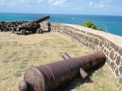
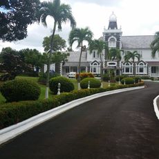
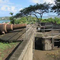
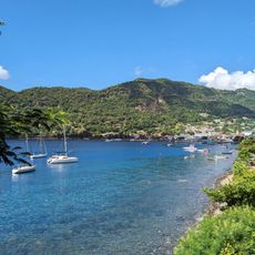
Fort Rodney, Military fort ruins in Gros Islet Quarter, Saint Lucia.
Fort Rodney is a military fortress ruin located on Pigeon Island, featuring stone walls, gun emplacements, and defensive structures spread across elevated terrain. The site includes barracks foundations, storage areas, and remnants of buildings that once housed military personnel.
The fort was built in 1780 by British forces to monitor French naval activity in the Caribbean during colonial conflicts. It served as a military outpost until it was eventually abandoned and fell into decline as colonial rivalries ended.
The fort remains integrate educational panels explaining Caribbean colonial military architecture and defense strategies of the 18th century British forces.
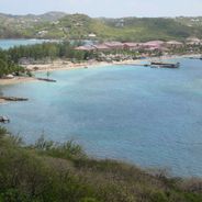
The fort is reached by marked hiking trails that wind through Pigeon Island National Park and lead up to the elevated ruins. Sturdy footwear is advisable due to uneven ground and stone terrain scattered throughout the site.
Underground gunpowder vaults beneath the fort remain intact, revealing how ammunition and explosives were stored during the colonial era. An old officers' dining area has been transformed into an interpretation center where visitors learn about the site's past.
Location: Gros Islet Quarter
GPS coordinates: 14.09129,-60.96660
Latest update: December 6, 2025 19:05
Saint Lucia combines volcanic landforms with tropical rainforest and coastal stretches shaped by both Atlantic and Caribbean waters. The island ranges from sea level to peaks reaching nearly 1,000 meters (3,280 feet), creating varied environments for photography. You will find subjects that include steep mountain formations, sheltered bays and historical structures set against natural backdrops. Places like the Pitons near Soufrière show the island's volcanic past, while beaches such as Anse Chastanet and Jalousie Beach offer contrasts between dark and light sand. Marigot Bay and Rodney Bay serve as natural harbors that have anchored vessels for centuries. Historical sites like Pigeon Island National Landmark and La Toc Battery recall colonial conflicts between European powers. Trails such as Tet Paul Nature Trail and routes to Mount Gimie pass through vegetation that shifts with elevation. Waterfalls like Enbas Saut and Sapphire Falls lie inland, where rivers cut through rock formations. Coastal spots like Cas en Bas Beach and Grande Anse Beach show different shoreline patterns, from rocky sections to open sand.
Pitons
33.1 km
Mount Gimie
25.8 km
Government House, Saint Lucia
10.2 km
Qualibou
29.5 km
St. Lucia Botanical Gardens
28 km
Anse Chastanet
27.9 km
Cathedral Basilica of the Immaculate Conception in Castries
9.5 km
Sulfur Springs
29.5 km
Vigie Beach
7.7 km
Castries Market
9.2 km
Anse Mamin
27.4 km
Dennery Lookout
22.4 km
Sulphur springs
29.4 km
Vigie Lighthouse
8.5 km
Choc Beach
6.6 km
Reduit Beach
2.2 km
Sapphire Waterfall
28.9 km
La Toc Battery
9.8 km
Malgretoute Beach
29.7 km
La Tille Waterfall
29.3 km
Cas-en-Bas Beach
4.1 km
Sugar Beach
31.1 km
En Bas Saut waterfall
27.1 km
Anse-La-Raye
18.7 km
Pigeon Island National Landmark
286 m
Grand Anse Beach
13.2 km
Pigeon Island Beach
764 m
Anse de cochon Beach
20.7 kmReviews
Visited this place? Tap the stars to rate it and share your experience / photos with the community! Try now! You can cancel it anytime.
Discover hidden gems everywhere you go!
From secret cafés to breathtaking viewpoints, skip the crowded tourist spots and find places that match your style. Our app makes it easy with voice search, smart filtering, route optimization, and insider tips from travelers worldwide. Download now for the complete mobile experience.
A unique approach to discovering new places❞
— Le Figaro
All the places worth exploring❞
— France Info
A tailor-made excursion in just a few clicks❞
— 20 Minutes