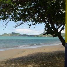
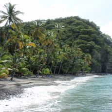
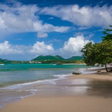
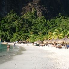
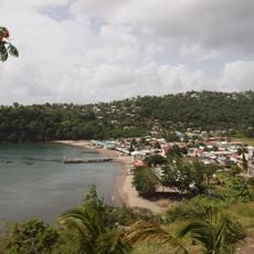
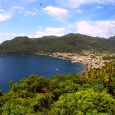
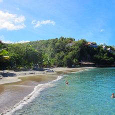
Anse Chastanet, Tropical beach in Soufrière, Saint Lucia
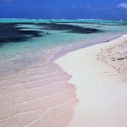
Anse Chastanet is a beach on the Caribbean coast of Soufrière with dark sand and a coral reef close to the shoreline. The reef extends from the land into the water, creating an underwater landscape filled with fish and corals.
The area was once part of a large plantation where cocoa and coffee were grown. In the 1970s, the land was transformed into a marine reserve to protect the coral reefs and sea life.
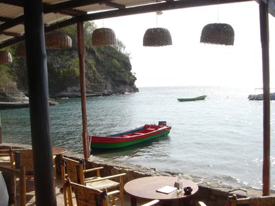
Local fishermen work at the northern end using methods passed down through generations. This practice is woven into daily life and shows how the community has long depended on the sea.
The beach is easy to reach and offers places to relax along with opportunities for snorkeling and water sports. Visitors should know that the best snorkeling happens in calmer months and that you can simply walk into shallow water to see the corals.
More than 150 fish species live under the water here, making the reef one of the richest marine habitats in the Caribbean. This variety is visible to the naked eye when you snorkel or peer into the water.
GPS coordinates: 13.86490,-61.07780
Latest update: December 6, 2025 17:44
The Caribbean holds beaches that have kept their natural shape and offer travelers a different view of the region. Some sit on small islands, others along coasts protected by coral reefs. Eagle Beach in Aruba draws visitors with its white sand, while Flamenco Beach on Culebra in Puerto Rico is known...
Saint Lucia combines volcanic landforms with tropical rainforest and coastal stretches shaped by both Atlantic and Caribbean waters. The island ranges from sea level to peaks reaching nearly 1,000 meters (3,280 feet), creating varied environments for photography. You will find subjects that include...
Pitons
6.2 km
Mount Gimie
7.2 km
Government House, Saint Lucia
17.8 km
Qualibou
4.6 km
St. Lucia Botanical Gardens
3.5 km
Cathedral Basilica of the Immaculate Conception in Castries
18.6 km
Sulfur Springs
4.5 km
Vigie Beach
20.4 km
Castries Market
18.9 km
Anse Mamin
664 m
Dennery Lookout
20.8 km
Sulphur springs
4.5 km
Vigie Lighthouse
19.4 km
Choc Beach
21.7 km
Sandy Beach
21 km
Reduit Beach
26.8 km
La Toc Battery
18.1 km
Sapphire Waterfall
4 km
Sugar Beach
4.5 km
La Tille Waterfall
17.5 km
Malgretoute Beach
3 km
En Bas Saut waterfall
8.4 km
Anse-La-Raye
9.2 km
Rudy John Beach
15.2 km
Grand Anse Beach
25.8 km
Maria Islands Nature Reserve
22.1 km
Anse de cochon Beach
7.3 km
Balenbouche Estate
13.3 kmVisited this place? Tap the stars to rate it and share your experience / photos with the community! Try now! You can cancel it anytime.
Discover hidden gems everywhere you go!
From secret cafés to breathtaking viewpoints, skip the crowded tourist spots and find places that match your style. Our app makes it easy with voice search, smart filtering, route optimization, and insider tips from travelers worldwide. Download now for the complete mobile experience.
A unique approach to discovering new places❞
— Le Figaro
All the places worth exploring❞
— France Info
A tailor-made excursion in just a few clicks❞
— 20 Minutes