Chest opened
+${chestReward.xp} XP
Explorer
NOUVEAU ×${chestReward.collectible.quantity}
tapez pour fermer

See the monuments around you in AR Open chests in the app

Around Us is built for your phone — point your camera at the streets and discover the monuments and places around you in augmented reality. Around Us is built for your phone — chests unlock when you walk, explore and capture nearby places.

•

Enable Location

We need your location to show you interesting places around you

Discover nearby places

Find interesting locations and hidden gems around you

Precise directions

Get accurate directions and distances to places

Your location is never shared with other users. It's only used when you tap the location button.

Praděd

Log in to your account

Start exploring — it's free

Trusted by 92,097 travelers worldwide

Continue with Google
Continue with Apple
or

We will send you a code to connect

By continuing, you accept our Terms and Conditions and our Privacy Policy

Check your inbox

We've sent a pincode in your inbox. Please enter the code below.

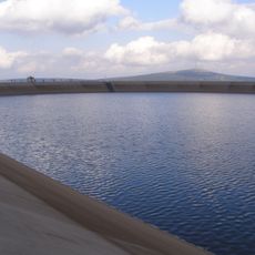
Praděd, Mountain summit in Malá Morávka, Czech Republic.

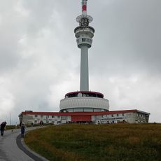
Praděd is a 1491-metre peak in the Hrubý Jeseník range, the highest point of Moravia and Czech Silesia. Its summit carries a 146.5-metre television tower, shortened from 162 metres in 1993, with a public viewing platform at 73 metres. The tower's lower shaft is white, while the upper mast is banded red and white.

The Moravian-Silesian Sudeten Mountain Association built a 32.5 m neo-Gothic stone lookout tower here between 1903 and 1912, designed by Vienna architect Franz Ritter von Neumann. Named Habsburgwarte, then Adolf-Hitler-Turm in 1938, it held 23 rooms over seven floors with a restaurant and a viewing platform. It collapsed on 2 May 1959; a replica stands on the Wetzstein in Thuringia since 2004.

The mountain takes its name from Pradziad, a figure in local mythology regarded as a guardian spirit of the Jeseníky Mountains. This connection to folk tradition shapes how people relate to the landscape today.

The mountain is reachable on foot via marked trails and accessible from nearby villages. In winter, ski slopes of varying difficulty operate on the slopes, while the summit area is navigable thanks to established paths and signage.

The summit lies on the historical land border between Moravia and Silesia, so the highest point of Moravia is about 50 metres from the peak itself. The summit building, a tower with a restaurant, is registered as house number 38 in Malá Morávka.

The community of curious travelers

AroundUs brings together thousands of curated places, local tips, and hidden gems, enriched daily by 92,097 contributors worldwide.

Start exploring
Location
Elevation above the sea
1,491.3 m
GPS coordinates
50.08324,17.23087
Latest update
October 21, 2026 17:41
Reviews
Share your experience

No review yet

Discussions
Start a discussion...

No discussion yet

« Praděd - Mountain summit in Malá Morávka, Czech Republic » is provided by Around Us (aroundus.com). Images and texts are derived from Wikimedia project under a Creative Commons license. You are allowed to copy, distribute, and modify copies of this page, under the conditions set by the license, as long as this note is clearly visible.

Discover hidden gems everywhere you go!

From secret cafés to breathtaking viewpoints, skip the crowded tourist spots and find places that match your style. Our app makes it easy with voice search, smart filtering, route optimization, and insider tips from travelers worldwide. Download now for the complete mobile experience.

Around Us App Screenshot
❝

A unique approach to discovering new places❞

— Le Figaro

❝

All the places worth exploring❞

— France Info

❝

A tailor-made excursion in just a few clicks❞

— 20 Minutes

Around Us
Travel Guide & Maps
Download

Send to your phone

QR Code
1

Open the camera app on your mobile.

2

Point at the QR code with your camera. A notification will appear.

3

Tap the notification to open the link.