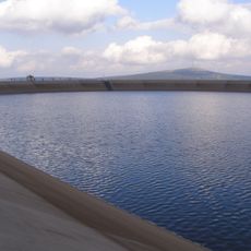
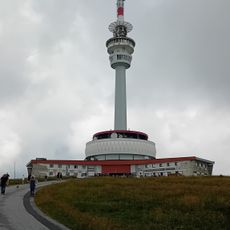
Vysoká hole, Mountain summit in Hrubý Jeseník range, Czech Republic.
Hohe Heide, known in Czech as Vysoká hole, is a broad, flattened summit of the Hrubý Jeseník range at 1,465 m, the second-highest peak of Moravia and Czech Silesia. Its summit plateau covers about 20 ha, with a wooden hut and a Baroque sandstone boundary stone from 1681 standing on top; the northeast spur, called Suť, carries a large stone sea.
A main path across the mountain was known from around 1500, used by hunters and herders and later by soldiers. In July 1866 an Austrian partisan unit under Alfred von Vivenot hid here from the Prussians. From 1919 to 1922 the Czechoslovak army held artillery exercises on the slopes, and in 1943–1944 the Todt Organization built the Nebelhorn radar base for the Luftwaffe.
The main path across the mountain was known from around 1500, used by hunters and herders before soldiers. The sandstone boundary stone near the summit, dated 1681, marked where the feudal estates of the Teutonic Order at Bruntál, Velké Losiny and Janovice met. Until the 19th century the mountain was held to be the highest in Hrubý Jeseník.
Marked hiking trails reach the summit from several starting points, with the town of Ramzová offering one of the most accessible options. Visitors should bring weather-resistant clothing and sturdy footwear since mountain conditions can change rapidly.
Until the 19th century, Vysoká hole was considered the highest peak of the Hrubý Jeseník; only later, more precise measurements showed Praděd to be higher. A sandstone boundary stone from 1681 stands about 430 m southwest of the summit, marking where the borders of three feudal estates met.
The community of curious travelers
AroundUs brings together thousands of curated places, local tips, and hidden gems, enriched daily by 92,416 contributors worldwide.