Chest opened
+${chestReward.xp} XP
Explorer
NOUVEAU ×${chestReward.collectible.quantity}
tapez pour fermer

See the monuments around you in AR Open chests in the app

Around Us is built for your phone — point your camera at the streets and discover the monuments and places around you in augmented reality. Around Us is built for your phone — chests unlock when you walk, explore and capture nearby places.

•

Enable Location

We need your location to show you interesting places around you

Discover nearby places

Find interesting locations and hidden gems around you

Precise directions

Get accurate directions and distances to places

Your location is never shared with other users. It's only used when you tap the location button.

Medvědí hora

Log in to your account

Start exploring — it's free

Trusted by 92,940 travelers worldwide

Continue with Google
Continue with Apple
or

We will send you a code to connect

By continuing, you accept our Terms and Conditions and our Privacy Policy

Check your inbox

We've sent a pincode in your inbox. Please enter the code below.

Medvědí hora

Medvědí hora, Mountain summit in South Bohemia, Czech Republic.

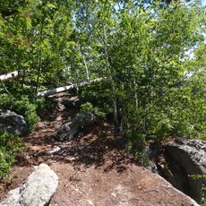
Bärenberg (Medvědí hora) is a flat ridge reaching 1,225 m in the Modravské slatě mires of Šumava National Park, about 1.5 km from the Bavarian border. It has two summits 700 m apart, each with a small summit rock; the northern one (1,224 m) is the official summit and its rocks are called Židovské skály. The southern summit (1,225 m) is unmarked on most maps and carries a small memorial plaque.

After World War II, Medvědí hora lay in an inaccessible border zone, and the first line of the Iron Curtain ran north to south directly over its summit; the cleared strip where the barbed-wire fence stood is no longer visible. The summit and its surroundings now lie in the quiet zone of Šumava National Park and are closed to entry.

The two summit rocks of the northern peak are called Židovské skály (Jewish Rocks), and the spruce forest on the northern slopes is named Židovský les. A small memorial plaque stands on the rock of the southern summit, which most maps leave unmarked.

The summit and its surroundings lie in the quiet zone of Šumava National Park and are not accessible to hikers; the two summit rocks, 700 m apart, can only be viewed from outside this zone. The former north-south wire barrier of the Iron Curtain ran directly over the ridge, but its cleared strip is no longer visible in the terrain.

The summit lies in the quiet zone of Šumava National Park and is not accessible to hikers. A small memorial plaque stands on the summit rock of the unmarked southern peak, about 400 m northwest of Roklanská chata.

The community of curious travelers

AroundUs brings together thousands of curated places, local tips, and hidden gems, enriched daily by 92,940 contributors worldwide.

Start exploring
GPS coordinates
48.61922,14.22571
Latest update
October 21, 2026 20:51
Around this place
Lipno Treetop Walkway
Czech Republic

Lipno Treetop Walkway

2.4 mi
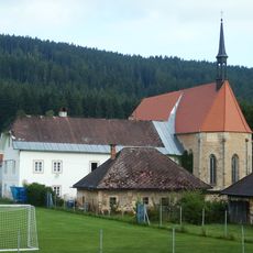
Church of Saint Ulrich
Czech Republic

Church of Saint Ulrich

0.8 mi
Maria Rast am Stein
Czech Republic

Maria Rast am Stein

3.3 mi
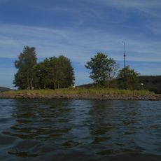
Králičí ostrov
Czech Republic

Králičí ostrov

1.1 mi
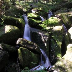
Vodopády svatého Wolfganga
Czech Republic

Vodopády svatého Wolfganga

3 mi
Rašeliniště Kapličky
Czech Republic

Rašeliniště Kapličky

1.3 mi
Church of Saints James and Philip
Czech Republic

Church of Saints James and Philip

2.7 mi
Spáleniště
Czech Republic

Spáleniště

2.7 mi
Medvědí hora
Czech Republic

Medvědí hora

80 ft
Uhlířský vrch
Czech Republic

Uhlířský vrch

1.3 mi
Loučovice
Czech Republic

Loučovice

1.4 mi
Socha Lipenská víla u cyklostezky z Lipna do Frymburka
Czech Republic

Socha Lipenská víla u cyklostezky z Lipna do Frymburka

2.7 mi
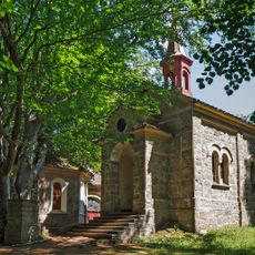
Chapel of Saint Procopius
Czech Republic

Chapel of Saint Procopius

0.9 mi
Chapel shrine in Slupečná
Czech Republic

Chapel shrine in Slupečná

2 mi
Kaplička u silnice v severní části Přední Výtoně
Czech Republic

Kaplička u silnice v severní části Přední Výtoně

3.1 mi
Spirův jez
Czech Republic

Spirův jez

1.9 mi
Bridge no. 100-100 in Lipno nad Vltavou
Czech Republic

Bridge no. 100-100 in Lipno nad Vltavou

1.2 mi
Čertova stěna-Luč
Czech Republic

Čertova stěna-Luč

2.1 mi
Obrázek svatého Wolfganga u vodopádů na Menší Vltavici
Czech Republic

Obrázek svatého Wolfganga u vodopádů na Menší Vltavici

3 mi
Klen Přední Výtoň
Czech Republic

Klen Přední Výtoň

3.2 mi
Rašeliniště Kapličky
Czech Republic

Rašeliniště Kapličky

1.4 mi
Chapel of Our Lady of the Snow
Czech Republic

Chapel of Our Lady of the Snow

3.3 mi
Plastika ryby na molu maríny v Lipně nad Vltavou
Czech Republic

Plastika ryby na molu maríny v Lipně nad Vltavou

1.5 mi
Kříž s kapličkou svatého Pavla u penzionu Modrý jelen v Lipně nad Vltavou
Czech Republic

Kříž s kapličkou svatého Pavla u penzionu Modrý jelen v Lipně nad Vltavou

1.5 mi
Kamenná brána u silnice na Kramolín v Lipně nad Vltavou
Czech Republic

Kamenná brána u silnice na Kramolín v Lipně nad Vltavou

2.1 mi
Column shrines in Slupečná
Czech Republic

Column shrines in Slupečná

2 mi
Kamenné mísy u Opatské stezky ve Vyšším Brodě
Czech Republic

Kamenné mísy u Opatské stezky ve Vyšším Brodě

3.1 mi
Kaple Božího Hrobu na konci křížové cesty z Vyššího Brodu
Czech Republic

Kaple Božího Hrobu na konci křížové cesty z Vyššího Brodu

3.3 mi
Show the full map
Reviews
Share your experience

No review yet

Discussions
Start a discussion...

No discussion yet

« Medvědí hora - Mountain summit in South Bohemia, Czech Republic » is provided by Around Us (aroundus.com). Images and texts are derived from Wikimedia project under a Creative Commons license. You are allowed to copy, distribute, and modify copies of this page, under the conditions set by the license, as long as this note is clearly visible.

Discover hidden gems everywhere you go!

From secret cafés to breathtaking viewpoints, skip the crowded tourist spots and find places that match your style. Our app makes it easy with voice search, smart filtering, route optimization, and insider tips from travelers worldwide. Download now for the complete mobile experience.

Around Us App Screenshot
❝

A unique approach to discovering new places❞

— Le Figaro

❝

All the places worth exploring❞

— France Info

❝

A tailor-made excursion in just a few clicks❞

— 20 Minutes

Around Us
Travel Guide & Maps
Download

Send to your phone

QR Code
1

Open the camera app on your mobile.

2

Point at the QR code with your camera. A notification will appear.

3

Tap the notification to open the link.