Enable Location

We need your location to show you interesting places around you

Discover nearby places

Find interesting locations and hidden gems around you

Precise directions

Get accurate directions and distances to places

Your location is never shared with other users. It's only used when you tap the location button.

Monadnock Mills

Log in to your account

Join the adventure

Create your free account and start exploring (like 60k+ others)

We will send you a code to connect

or
Continue with Google
Continue with Apple
By continuing, you accept our Terms and Conditions and our Privacy Policy

Check your inbox

We've sent a pincode in your inbox. Please enter the code below.

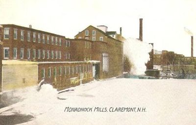
Monadnock Mills, Historic textile district in Claremont, US

Description

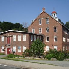
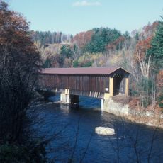
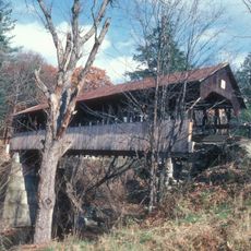
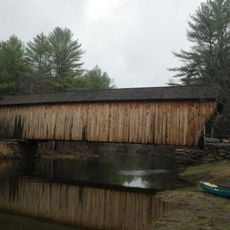
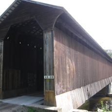
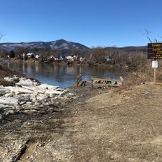
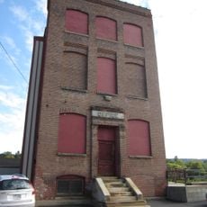
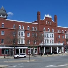
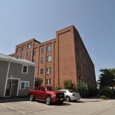
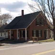
Monadnock Mills is an industrial complex of multiple factory buildings stretching along the Sugar River, constructed during different phases of the 19th century. The site covers about 8.5 acres and includes structures along Broad Street, Water Street, and Mill Road.

History

The mills were founded in 1831 as the Sugar River Manufacturing Company and became one of New England's largest cotton spinning operations for over a century. Production continued without interruption until 1963, reflecting the site's sustained importance to the regional economy.

Culture

The mill buildings show how workers shaped the economic life of the region daily and distributed their products across the nation. These structures remind visitors that people labored and lived here, and their craftsmanship helped build American industry.

Practical

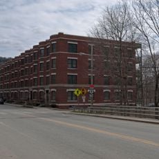
The complex sits along the Sugar River with buildings visible and accessible from surrounding streets. Visitors can explore the exterior of the structures and understand the layout of the industrial site from multiple vantage points.

Did you know?

Mill Number 2 produced America's first dimity fabric in the 1850s, a fine cotton cloth with a distinctive raised pattern. Later, this factory also made Jacquard quilts that won gold medals at the St. Louis World's Fair.

Location
GPS coordinates
43.37389,-72.33806
Latest update
December 14, 2025 16:40

AroundUs brings together thousands of curated places, local tips, and hidden gems, enriched daily by 60,000 contributors worldwide. Discover all places nearby (Claremont).

Around this place
Cornish–Windsor Covered Bridge
United States of America

Cornish–Windsor Covered Bridge

11.7 km
Mount Ascutney
United States of America

Mount Ascutney

12.2 km
American Precision Museum
United States of America

American Precision Museum

12 km
Salmon P. Chase Birthplace
United States of America

Salmon P. Chase Birthplace

9.9 km
Cornish Colony Museum
United States of America

Cornish Colony Museum

12.2 km
Ascutney State Park
United States of America

Ascutney State Park

11.1 km
Claremont City Hall
United States of America

Claremont City Hall

161 m
Union Episcopal Church
United States of America

Union Episcopal Church

2.9 km
Pier Bridge
United States of America

Pier Bridge

7.9 km
Dingleton Hill Covered Bridge
United States of America

Dingleton Hill Covered Bridge

10.4 km
Corbin Covered Bridge
United States of America

Corbin Covered Bridge

11.7 km
David Dexter House
United States of America

David Dexter House

336 m
Wright's Bridge
United States of America

Wright's Bridge

6.6 km
Cornish Wildlife Management Area
United States of America

Cornish Wildlife Management Area

12.1 km
Kenyon Bridge
United States of America

Kenyon Bridge

10.4 km
Lower Village District
United States of America

Lower Village District

213 m
Central Business District
United States of America

Central Business District

206 m
William Rossiter House
United States of America

William Rossiter House

570 m
NAMCO Block
United States of America

NAMCO Block

12.1 km
Farwell School
United States of America

Farwell School

8.2 km
Weathersfield Center Historic District
United States of America

Weathersfield Center Historic District

10.5 km
Unity Town Hall
United States of America

Unity Town Hall

10 km
North Charlestown Historic District
United States of America

North Charlestown Historic District

8.1 km
Spencer Hollow School
United States of America

Spencer Hollow School

11.4 km
Gen. Lewis R. Morris House
United States of America

Gen. Lewis R. Morris House

11 km
Claremont Warehouse No. 34
United States of America

Claremont Warehouse No. 34

592 m
Twing Buckman House
United States of America

Twing Buckman House

11.6 km
BM Claremont & Concord Wiley Bridge
United States of America

BM Claremont & Concord Wiley Bridge

10.3 km
Show the full map
« Monadnock Mills - Historic textile district in Claremont, US » is provided by Around Us (aroundus.com). Images and texts are derived from Wikimedia project under a Creative Commons license. You are allowed to copy, distribute, and modify copies of this page, under the conditions set by the license, as long as this note is clearly visible.

Discover hidden gems everywhere you go!

From secret cafés to breathtaking viewpoints, skip the crowded tourist spots and find places that match your style. Our app makes it easy with voice search, smart filtering, route optimization, and insider tips from travelers worldwide. Download now for the complete mobile experience.

Around Us App Screenshot

A unique approach to discovering new places

Le Figaro

All the places worth exploring

France Info

A tailor-made excursion in just a few clicks

20 Minutes

Around Us
Travel Guide & Maps
Download

Send to your phone

QR Code
1

Open the camera app on your mobile.

2

Point at the QR code with your camera. A notification will appear.

3

Tap the notification to open the link.