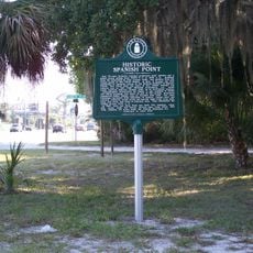
John Nolen Plan of Venice Historic District, Urban planning historic district in Venice, Florida, United States.
The John Nolen Plan of Venice Historic District is an urban neighborhood in Florida shaped by geometric street patterns and Mediterranean-style buildings. The district connects wide avenues with parks and green spaces, arranged according to a comprehensive master plan design.
An American planner designed this neighborhood in the 1920s for a railroad organization during a major real estate boom in Florida. The project emerged during a time when new towns and neighborhoods were rapidly expanding across the state.
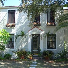
The district shows how residential neighborhoods, shops, and parks were deliberately woven together rather than kept separate. Walking through, you notice how green spaces and buildings balance each other to create a cohesive community.
The area is easy to explore on foot, as the streets are wide and clear with green spaces that invite you to linger. A walk through the different sections gives you a good sense of the overall design approach.
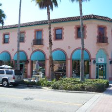
This neighborhood served as a model for later planned communities and influenced how modern planners thought about designing residential areas. Its layout became a reference point that urban designers studied when creating new developments.
The community of curious travelers
AroundUs brings together thousands of curated places, local tips, and hidden gems, enriched daily by 60,000 contributors worldwide.