Enable Location

We need your location to show you interesting places around you

Discover nearby places

Find interesting locations and hidden gems around you

Precise directions

Get accurate directions and distances to places

Your location is never shared with other users. It's only used when you tap the location button.

Lake Leatherwood City Park

Log in to your account

Start exploring — it's free

Trusted by 61,342 travelers worldwide

Continue with Google
Continue with Apple
or

We will send you a code to connect

By continuing, you accept our Terms and Conditions and our Privacy Policy

Check your inbox

We've sent a pincode in your inbox. Please enter the code below.

Lake Leatherwood City Park

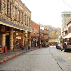
Lake Leatherwood City Park, Municipal recreational area in Eureka Springs, Arkansas.

Description

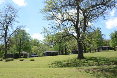
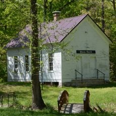
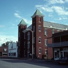
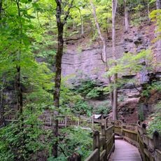
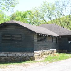
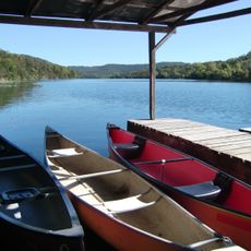
Lake Leatherwood City Park is a large public recreation area in Eureka Springs featuring a spring-fed lake surrounded by dense woodlands and rolling terrain. The park contains a marina, several shelter buildings, camping facilities, and a substantial children's play area spread across its grounds.

History

The park was developed in the early 1940s through a major public works program that employed local workers to construct the dam and buildings. This construction period established the park's current layout and features.

Culture

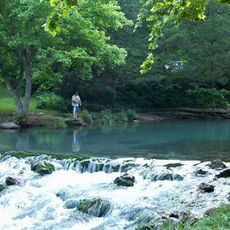
The park maintains its position on the National Register of Historic Places while providing 25 miles of trails for outdoor recreation activities.

Practical

The best time to visit is during warmer months when facilities and water activities are fully available and trail conditions are optimal. Visitors should plan for time to explore the expansive grounds and decide in advance whether to focus on water recreation, hiking, or picnicking.

Did you know?

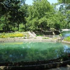
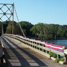
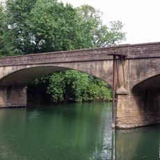
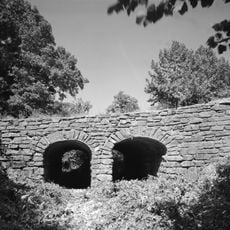
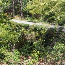
The park's dam was constructed entirely by hand using local limestone and ranks among the largest hand-made dams of its kind in the country. Visitors can observe the craftsmanship in the stone detailing when walking along the structure.

Location
GPS coordinates
36.43528,-93.76028
Latest update
December 12, 2025 09:02

AroundUs brings together thousands of curated places, local tips, and hidden gems, enriched daily by 60,000 contributors worldwide. Discover all places nearby (Eureka Springs).

Around this place
Beaver Lake
United States of America

Beaver Lake

8 km
Christ of the Ozarks
United States of America

Christ of the Ozarks

4.3 km
Roaring River State Park
United States of America

Roaring River State Park

18.2 km
Onyx Cave
United States of America

Onyx Cave

6.8 km
Blue Springs Heritage Center
United States of America

Blue Springs Heritage Center

5.9 km
Beaver Bridge
United States of America

Beaver Bridge

4 km
Eureka Springs and North Arkansas Railway
United States of America

Eureka Springs and North Arkansas Railway

3.4 km
Turpentine Creek Wildlife Refuge
United States of America

Turpentine Creek Wildlife Refuge

13.9 km
Quigley's Castle
United States of America

Quigley's Castle

9.9 km
Eureka Springs Historic District
United States of America

Eureka Springs Historic District

4.2 km
Basin Park Hotel
United States of America

Basin Park Hotel

4.2 km
U.S. 62 White River Bridge
United States of America

U.S. 62 White River Bridge

5.9 km
White River Bridge at Elkins
United States of America

White River Bridge at Elkins

4 km
Winona Church and School
United States of America

Winona Church and School

13.4 km
Carroll County Courthouse, Eastern District
United States of America

Carroll County Courthouse, Eastern District

19 km
Mulladay Hollow Bridge
United States of America

Mulladay Hollow Bridge

478 m
Berryville Agriculture Building
United States of America

Berryville Agriculture Building

18.1 km
Coal Gap School
United States of America

Coal Gap School

16.6 km
Concord School House
United States of America

Concord School House

8.6 km
Sanitarium Lake Bridges Historic District
United States of America

Sanitarium Lake Bridges Historic District

6.6 km
Eureka Springs Historical Museum
United States of America

Eureka Springs Historical Museum

4.4 km
Deer Leap Trail
United States of America

Deer Leap Trail

18.5 km
Holy Land Tour
United States of America

Holy Land Tour

4.9 km
Crescent Spring
United States of America

Crescent Spring

3.8 km
Golden Pioneer Museum
United States of America

Golden Pioneer Museum

12.7 km
Lake Leatherwood Recreational Facilities
United States of America

Lake Leatherwood Recreational Facilities

107 m
Lake Lucerne Bridge
United States of America

Lake Lucerne Bridge

6.6 km
Lake Leatherwood
United States of America

Lake Leatherwood

676 m
Show the full map
« Lake Leatherwood City Park - Municipal recreational area in Eureka Springs, Arkansas » is provided by Around Us (aroundus.com). Images and texts are derived from Wikimedia project under a Creative Commons license. You are allowed to copy, distribute, and modify copies of this page, under the conditions set by the license, as long as this note is clearly visible.

Discover hidden gems everywhere you go!

From secret cafés to breathtaking viewpoints, skip the crowded tourist spots and find places that match your style. Our app makes it easy with voice search, smart filtering, route optimization, and insider tips from travelers worldwide. Download now for the complete mobile experience.

Around Us App Screenshot

A unique approach to discovering new places

Le Figaro

All the places worth exploring

France Info

A tailor-made excursion in just a few clicks

20 Minutes

Around Us
Travel Guide & Maps
Download

Send to your phone

QR Code
1

Open the camera app on your mobile.

2

Point at the QR code with your camera. A notification will appear.

3

Tap the notification to open the link.