Chest opened
+${chestReward.xp} XP
Explorer
NOUVEAU ×${chestReward.collectible.quantity}
tapez pour fermer
Chest locked

Open chests in the app

Around Us is built for your phone — chests unlock when you walk, explore and capture nearby places.

Enable Location

We need your location to show you interesting places around you

Discover nearby places

Find interesting locations and hidden gems around you

Precise directions

Get accurate directions and distances to places

Your location is never shared with other users. It's only used when you tap the location button.

Log in to your account

Start exploring — it's free

Trusted by 72,980 travelers worldwide

Continue with Google
Continue with Apple
or

We will send you a code to connect

By continuing, you accept our Terms and Conditions and our Privacy Policy

Check your inbox

We've sent a pincode in your inbox. Please enter the code below.

Robert G. Wehle State Park
Discussion Reviews Photo
3.9k Popularity

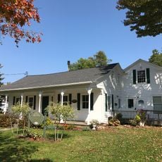
Robert G. Wehle State Park, State park on Lake Ontario shore in Henderson, United States.

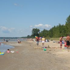
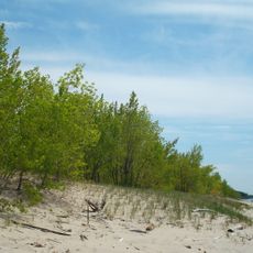
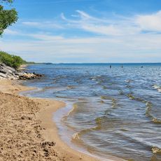
Robert G. Wehle State Park is a large park on the Lake Ontario shoreline in Henderson featuring 17 kilometers (17,000 feet) of waterfront and limestone cliffs up to 24 meters (80 feet) high. The property includes thirteen marked trails that wind through different sections of the terrain.

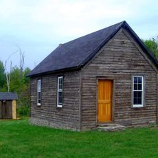
The site served as a military training ground called Stony Point Rifle Range from 1895 to 1947. Afterward it became a cattle ranch before eventually transforming into a public park.

Bronze sculptures of hunting dogs throughout the park commemorate Robert Wehle's renowned English pointer breeding operation. These works reflect how deeply the place was tied to the sporting dog community and its legacy.

The thirteen trails remain accessible year-round and support hiking, mountain biking, cross-country skiing, and snowshoeing depending on the season. Visitors should wear appropriate clothing for weather conditions and be aware of lakeside hazards.

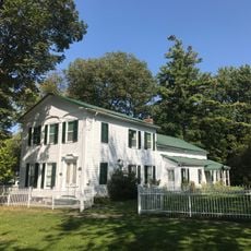
The park contains a dedicated dog cemetery and remnants of the former Elhew Kennels breeding facility that once operated there. This location was the most prestigious breeding center for English pointers in North America.

The community of curious travelers

AroundUs brings together thousands of curated places, local tips, and hidden gems, enriched daily by 60,000 contributors worldwide.

Start exploring
Location
GPS coordinates
43.87330,-76.27080
Latest update
December 11, 2025 18:05
Around this place
Southwick Beach State Park
United States of America

Southwick Beach State Park

12.8 km
Madison Barracks
United States of America

Madison Barracks

15.7 km
Sackets Harbor Battlefield State Historic Site
United States of America

Sackets Harbor Battlefield State Historic Site

13.6 km
Sandy Pond Beach Unique Area
United States of America

Sandy Pond Beach Unique Area

24.5 km
East Charity Shoal Light
United States of America

East Charity Shoal Light

24.8 km
Tibbetts Point Light
United States of America

Tibbetts Point Light

26.5 km
Horse Island Light
United States of America

Horse Island Light

12.8 km
Galloo Island Light
United States of America

Galloo Island Light

14.1 km
Stony Point Light
United States of America

Stony Point Light

4.4 km
Southwick Beach
United States of America

Southwick Beach

13 km
Dr. Samuel Guthrie House
United States of America

Dr. Samuel Guthrie House

16.7 km
Elisha Camp House
United States of America

Elisha Camp House

14.8 km
Dexter Universalist Church
United States of America

Dexter Universalist Church

23.5 km
St. Vincent of Paul Catholic Church
United States of America

St. Vincent of Paul Catholic Church

28.5 km
Gen. Jacob Brown Mansion
United States of America

Gen. Jacob Brown Mansion

27.3 km
Cyrus Bates House
United States of America

Cyrus Bates House

7.7 km
St. John's Episcopal Church
United States of America

St. John's Episcopal Church

28.5 km
Smith-Ripley House
United States of America

Smith-Ripley House

21.2 km
Vincent LeRay House
United States of America

Vincent LeRay House

28.6 km
Bedford Creek Bridge
United States of America

Bedford Creek Bridge

12.7 km
Norton–Burnham House
United States of America

Norton–Burnham House

7.2 km
John Borland House
United States of America

John Borland House

28.7 km
Grenadier Island Schoolhouse
United States of America

Grenadier Island Schoolhouse

20.6 km
William Archer House
United States of America

William Archer House

27.3 km
Otis Starkey House
United States of America

Otis Starkey House

28.7 km
Adams Commercial Historic District
United States of America

Adams Commercial Historic District

21 km
Cape Vincent Light
United States of America

Cape Vincent Light

27.8 km
General Sacket House
United States of America

General Sacket House

28.1 km
Show the full map
Reviews
Share your experience

No review yet

Discussions
Start a discussion...

No discussion yet

« Robert G. Wehle State Park - State park on Lake Ontario shore in Henderson, United States » is provided by Around Us (aroundus.com). Images and texts are derived from Wikimedia project under a Creative Commons license. You are allowed to copy, distribute, and modify copies of this page, under the conditions set by the license, as long as this note is clearly visible.

Discover hidden gems everywhere you go!

From secret cafés to breathtaking viewpoints, skip the crowded tourist spots and find places that match your style. Our app makes it easy with voice search, smart filtering, route optimization, and insider tips from travelers worldwide. Download now for the complete mobile experience.

Around Us App Screenshot

A unique approach to discovering new places

Le Figaro

All the places worth exploring

France Info

A tailor-made excursion in just a few clicks

20 Minutes

Around Us
Travel Guide & Maps
Download

Send to your phone

QR Code
1

Open the camera app on your mobile.

2

Point at the QR code with your camera. A notification will appear.

3

Tap the notification to open the link.