Chest opened
+${chestReward.xp} XP
Explorer
NOUVEAU ×${chestReward.collectible.quantity}
tapez pour fermer

See the monuments around you in AR Open chests in the app

Around Us is built for your phone — point your camera at the streets and discover the monuments and places around you in augmented reality. Around Us is built for your phone — chests unlock when you walk, explore and capture nearby places.

•

Enable Location

We need your location to show you interesting places around you

Discover nearby places

Find interesting locations and hidden gems around you

Precise directions

Get accurate directions and distances to places

Your location is never shared with other users. It's only used when you tap the location button.

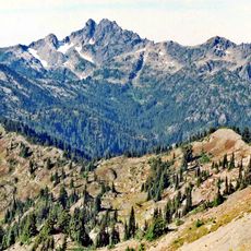
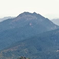
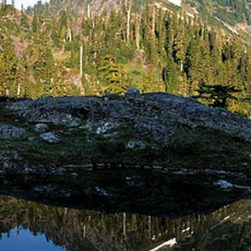
Satsop Hills

Log in to your account

Start exploring — it's free

Trusted by 93,242 travelers worldwide

Continue with Google
Continue with Apple
or

We will send you a code to connect

By continuing, you accept our Terms and Conditions and our Privacy Policy

Check your inbox

We've sent a pincode in your inbox. Please enter the code below.

Satsop Hills, Railroad bridge in Shelton, US

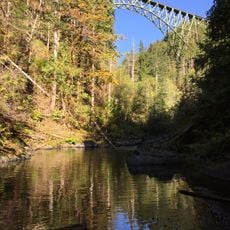
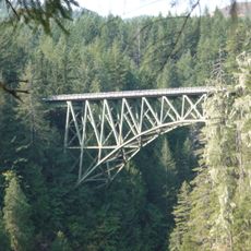
The Vance Creek Bridge is a steel railroad trestle in the Satsop Hills, standing 347 feet (106 m) above Vance Creek at 47°20′04″N 123°19′17″W. It was the highest railroad bridge in the United States and remains among the twenty highest bridges in the country. It sits on closed private land crossed by logging roads and an abandoned Simpson Timber Company logging railroad.

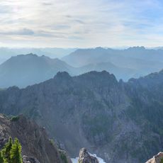
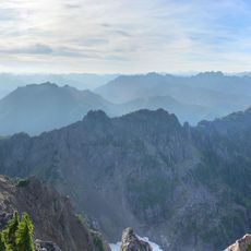
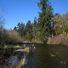
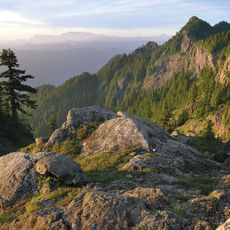
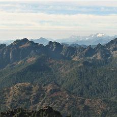
The hills take their name from the Satsop River, which rises in them and drains a 300-square-mile watershed south to the Chehalis River. The Morning Oregonian used the term "Satsop hills" as early as 1885, when it reported forest fires there. In September 1902 catastrophic fires burned from Elma to Summit Lake, destroying a million board feet of lumber at a mill above Elma and darkening Montesano at noon on September 12. Fire lookouts were later built on several peaks.

The hills carry names from the logging era: the abandoned Simpson Timber Company railroad still crosses them, and the Vance Creek Bridge, 347 feet above the creek, was the highest railroad bridge in the United States. The name "Satsop hills" appeared in the Morning Oregonian as early as 1885, in reports of forest fires.

The Vance Creek Bridge stands on closed private land, so it cannot be walked; the hills are reached by extensive logging roads and an abandoned Simpson Timber Company railroad. Truman Glick County Park, 35 acres along that railroad on the southern side, and Schafer State Park on the Satsop River at 125 feet are the established access points. Expect mud and rain: Wynoochee Oxbow, at the west end, records the highest average annual rainfall in the continental United States.

The Vance Creek Bridge stands 347 feet (106 m) above Vance Creek and was the highest railroad bridge in the United States when built. It remains among the twenty highest bridges in the country. Despite being on closed private land, it became one of the more popular destinations on the Olympic Peninsula through millions of social media images.

The community of curious travelers

AroundUs brings together thousands of curated places, local tips, and hidden gems, enriched daily by 93,242 contributors worldwide.

Start exploring
Location
GPS coordinates
47.37000,-123.45000
Latest update
October 24, 2026 16:14
Around this place
High Steel Bridge
United States of America

High Steel Bridge

8 mi
Vance Creek Bridge
United States of America

Vance Creek Bridge

6.5 mi
Mount Ellinor
United States of America

Mount Ellinor

13.7 mi
Mount Washington
United States of America

Mount Washington

14.7 mi
Cushman Dam
United States of America

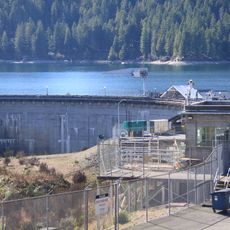
Cushman Dam

11.2 mi
Schafer State Park
United States of America

Schafer State Park

19 mi
Colonel Bob Wilderness
United States of America

Colonel Bob Wilderness

15.6 mi
Lower Cushman Dam
United States of America

Lower Cushman Dam

11.8 mi
Mount Skokomish Wilderness
United States of America

Mount Skokomish Wilderness

14.8 mi
Mount Stone
United States of America

Mount Stone

18.5 mi
United States of America

Colonel Bob

16.1 mi
United States of America

Mount Rose

12 mi
United States of America

Mount Steel

19.4 mi
Graves Creek Ranger Station
United States of America

Graves Creek Ranger Station

15.2 mi
Mount Pershing
United States of America

Mount Pershing

15.5 mi
United States of America

Mount Bretherton

20.6 mi
Mount Cruiser
United States of America

Mount Cruiser

14.8 mi
Copper Mountain
United States of America

Copper Mountain

12.8 mi
Muncaster Mountain
United States of America

Muncaster Mountain

18.8 mi
Mount Skokomish
United States of America

Mount Skokomish

17 mi
Jefferson Peak
United States of America

Jefferson Peak

16.7 mi
Mount Lincoln
United States of America

Mount Lincoln

13.7 mi
Kestner Homestead
United States of America

Kestner Homestead

19.8 mi
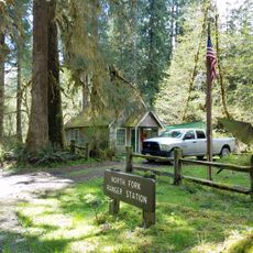
North Fork Quinault Ranger Station
United States of America

North Fork Quinault Ranger Station

16.9 mi
Staircase Rapids Loop
United States of America

Staircase Rapids Loop

11.7 mi
Quinault Rain Forest Ranger Station
United States of America

Quinault Rain Forest Ranger Station

19.7 mi
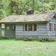
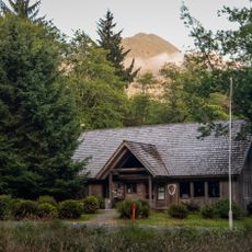
Schafer State Park Day-Use Area Comfort Station
United States of America

Schafer State Park Day-Use Area Comfort Station

18.9 mi
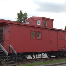
Simpson Logging Company Locomotive No. 7 and Peninsular Railway Caboose No. 700
United States of America

Simpson Logging Company Locomotive No. 7 and Peninsular Railway Caboose No. 700

19.7 mi
Show the full map
Reviews
Share your experience

No review yet

Discussions
Start a discussion...

No discussion yet

« Satsop Hills - Railroad bridge in Shelton, US » is provided by Around Us (aroundus.com). Images and texts are derived from Wikimedia project under a Creative Commons license. You are allowed to copy, distribute, and modify copies of this page, under the conditions set by the license, as long as this note is clearly visible.

Discover hidden gems everywhere you go!

From secret cafés to breathtaking viewpoints, skip the crowded tourist spots and find places that match your style. Our app makes it easy with voice search, smart filtering, route optimization, and insider tips from travelers worldwide. Download now for the complete mobile experience.

Around Us App Screenshot
❝

A unique approach to discovering new places❞

— Le Figaro

❝

All the places worth exploring❞

— France Info

❝

A tailor-made excursion in just a few clicks❞

— 20 Minutes

Around Us
Travel Guide & Maps
Download

Send to your phone

QR Code
1

Open the camera app on your mobile.

2

Point at the QR code with your camera. A notification will appear.

3

Tap the notification to open the link.