Enable Location

We need your location to show you interesting places around you

Discover nearby places

Find interesting locations and hidden gems around you

Precise directions

Get accurate directions and distances to places

Your location is never shared with other users. It's only used when you tap the location button.

Log in to your account

Start exploring — it's free

Trusted by 62,627 travelers worldwide

Continue with Google
Continue with Apple
or

We will send you a code to connect

By continuing, you accept our Terms and Conditions and our Privacy Policy

Check your inbox

We've sent a pincode in your inbox. Please enter the code below.

Fort Santo Angel

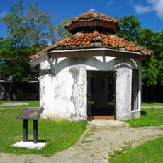
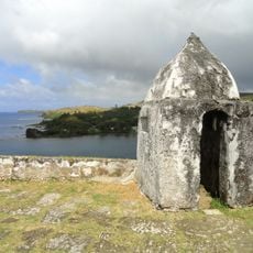
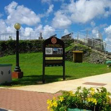
Fort Santo Angel, Spanish fortress on the island of Guam

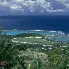
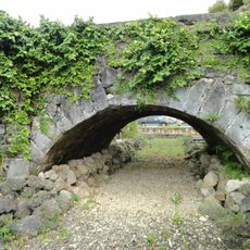
Fort Santo Angel is a fort built on a large rock at the entrance to Humåtak Bay in southern Guam. The structure featured stone walls, a small guard room, and a platform designed to hold three cannons for controlling the bay.

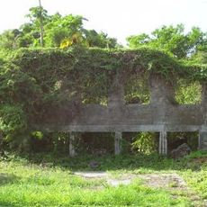
The fort was rebuilt in 1756 by Governor Enrique de Olavide y Michelena after earlier defenses proved inadequate. Around 1800 it was dismantled as wave damage weakened its foundation and officials deemed it no longer secure.

The fort's name reflects Spanish colonial influence on the island. Visitors can observe how this defensive position shaped the relationship between the community and the bay for centuries.

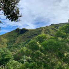
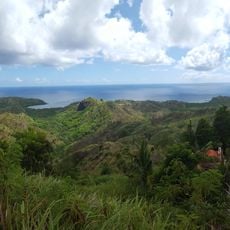
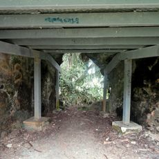
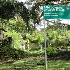
The fort sits on a rocky outcrop accessed by steps cut into the stone and offers open views across the bay and ocean. The ruins are now part of a public park covered with vegetation and can be explored on foot.

Treasure hunters were drawn to the site for years by rumors of buried gold and valuables, leading to unauthorized digging that further damaged the ruins. Such activities reveal how the fort's past continues to captivate people today.

The community of curious travelers

AroundUs brings together thousands of curated places, local tips, and hidden gems, enriched daily by 60,000 contributors worldwide.

Start exploring
Location
GPS coordinates
13.29722,144.65611
Latest update
February 9, 2026 07:40
Around this place
Mount Lamlam
United States of America

Mount Lamlam

4.7 km
War in the Pacific National Historical Park
United States of America

War in the Pacific National Historical Park

1.2 km
Plaza de España
United States of America

Plaza de España

22.2 km
United States of America

Blue Hole

16.4 km
Japanese midget submarine Ha. 62-76
United States of America

Japanese midget submarine Ha. 62-76

14.7 km
United States of America

Piti Bomb Holes Marine Preserve

19.9 km
Orote Field
United States of America

Orote Field

15.6 km
Piti Guns
United States of America

Piti Guns

18.8 km
Aratama Maru
United States of America

Aratama Maru

12.7 km
Fort Nuestra Señora de la Soledad
United States of America

Fort Nuestra Señora de la Soledad

458 m
Fort Santa Agueda
United States of America

Fort Santa Agueda

22 km
Guam Museum
United States of America

Guam Museum

22.4 km
United States of America

Mount Bolanos

3.4 km
Asan Invasion Beach
United States of America

Asan Invasion Beach

20.4 km
Agana Spanish Bridge
United States of America

Agana Spanish Bridge

22.2 km
United States of America

Talofofo Bay

12.9 km
Cetti Bay
United States of America

Cetti Bay

2.1 km
United States of America

Umatac Outdoor Library

541 m
Agat Invasion Beach
United States of America

Agat Invasion Beach

9.8 km
Taleyfac Spanish Bridge
United States of America

Taleyfac Spanish Bridge

7.4 km
Guam Cable Station
United States of America

Guam Cable Station

15.7 km
San Dionisio Church Ruins
United States of America

San Dionisio Church Ruins

512 m
Sumay Cemetery
United States of America

Sumay Cemetery

15.4 km
Mount Jumullong Manglo
United States of America

Mount Jumullong Manglo

4 km
Magellan Monument
United States of America

Magellan Monument

727 m
Korean Air Flight KE801 1997-Crash Memorial
United States of America

Korean Air Flight KE801 1997-Crash Memorial

19.5 km
Nieves M. Flores Memorial Library
United States of America

Nieves M. Flores Memorial Library

22.2 km
Apolinario Mabini historical marker
United States of America

Apolinario Mabini historical marker

20.6 km
Show the full map
« Fort Santo Angel - Spanish fortress on the island of Guam » is provided by Around Us (aroundus.com). Images and texts are derived from Wikimedia project under a Creative Commons license. You are allowed to copy, distribute, and modify copies of this page, under the conditions set by the license, as long as this note is clearly visible.

Discover hidden gems everywhere you go!

From secret cafés to breathtaking viewpoints, skip the crowded tourist spots and find places that match your style. Our app makes it easy with voice search, smart filtering, route optimization, and insider tips from travelers worldwide. Download now for the complete mobile experience.

Around Us App Screenshot

A unique approach to discovering new places

Le Figaro

All the places worth exploring

France Info

A tailor-made excursion in just a few clicks

20 Minutes

Around Us
Travel Guide & Maps
Download

Send to your phone

QR Code
1

Open the camera app on your mobile.

2

Point at the QR code with your camera. A notification will appear.

3

Tap the notification to open the link.