Chili–West Historic District

Log in to your account

AroundUs is a community-driven map of interesting places, built by curious explorers like you. It grows with every review, story, and photo you share.
Connect to save your favorite spots, contribute locations, and create personalized routes.
Continue with Google
Continue with Apple
Continue with X
Continue with Facebook
Continue with email
By continuing, you accept our Terms and Conditions and our Privacy Policy
Create an account
Add to collection
Map
Suggest a change
Share

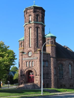
Chili–West Historic District, Historic district in Rochester, United States

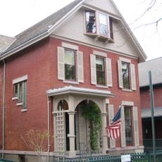
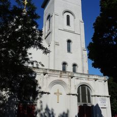
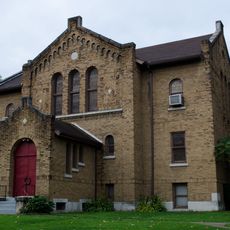
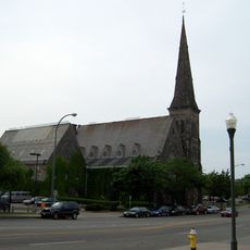
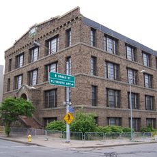
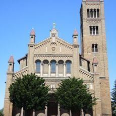
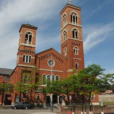
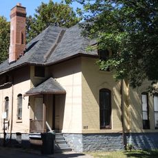
The Chili-West Historic District is a neighborhood in Rochester containing around 500 residential buildings spread across roughly 72 acres, with structures spanning multiple architectural periods. The former St. Augustine Roman Catholic Church complex sits within the district boundaries and serves as a focal point within this residential landscape.

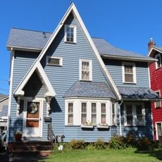
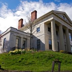
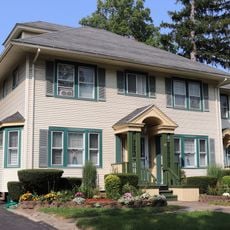
The neighborhood grew between the 1870s and 1935 as Rochester's industrial base expanded rapidly and drew workers seeking employment. Local builders constructed homes in varying styles to accommodate factory workers and middle-class residents seeking housing during this growth period.

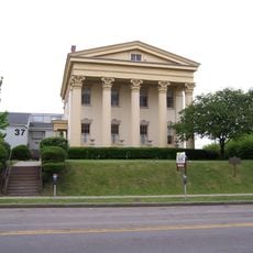
The neighborhood displays a range of building styles from Queen Anne to American Craftsman, reflecting the tastes of different generations who shaped the area. Walking through, you notice how homes and their details tell stories of the people who lived here and how they built their lives.

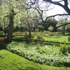
The neighborhood is best explored on foot, allowing you to take in the variety of house types at a leisurely pace throughout the blocks. Taking time to notice the details of individual buildings helps you appreciate the craftsmanship and see the differences between the various architectural styles.

A handful of prolific builders shaped much of this neighborhood, with figures like A.B. Jennings and Otis Dryer leaving their mark on hundreds of homes that define the area. Their work created a sense of connection across the district despite the variety in styles and construction dates.

Location: Rochester

GPS coordinates: 43.14833,-77.64500

Latest update: December 14, 2025 11:23

Photos
Around this place
Kodak Tower
United States of America

Kodak Tower

2.5 km
Marina Auto Stadium
United States of America

Marina Auto Stadium

2 km
Susan B. Anthony House
United States of America

Susan B. Anthony House

1.5 km
Rochester City Hall
United States of America

Rochester City Hall

2.6 km
Rundel Memorial Library
United States of America

Rundel Memorial Library

2.2 km
Brown's Race Historic District
United States of America

Brown's Race Historic District

2.7 km
State Street Historic District
United States of America

State Street Historic District

2.6 km
City Hall Historic District
United States of America

City Hall Historic District

2.6 km
United States of America

University of Rochester Arboretum

2.6 km
Arvine Heights Historic District
United States of America

Arvine Heights Historic District

2.5 km
Ellwanger Garden
United States of America

Ellwanger Garden

2.7 km
Immaculate Conception Church
United States of America

Immaculate Conception Church

2.2 km
Emmanuel Presbyterian Church
United States of America

Emmanuel Presbyterian Church

1.6 km
First Presbyterian Church
United States of America

First Presbyterian Church

2.4 km
United States of America

Third Ward Historic District

2.4 km
Bevier Memorial Building
United States of America

Bevier Memorial Building

2.4 km
Hervey Ely House
United States of America

Hervey Ely House

2.2 km
First National Bank of Rochester-Old Monroe County Savings Bank Building
United States of America

First National Bank of Rochester-Old Monroe County Savings Bank Building

2.7 km
Church of Saints Peter and Paul Complex
United States of America

Church of Saints Peter and Paul Complex

1.1 km
Inglewood and Thurston Historic District
United States of America

Inglewood and Thurston Historic District

1.1 km
Brick Presbyterian Church Complex
United States of America

Brick Presbyterian Church Complex

2.5 km
Jonathan Child House & Brewster–Burke House Historic District
United States of America

Jonathan Child House & Brewster–Burke House Historic District

2.3 km
Ebenezer Watts House
United States of America

Ebenezer Watts House

2.6 km
Campbell-Whittlesey House
United States of America

Campbell-Whittlesey House

2.7 km
Bridge Square Historic District
United States of America

Bridge Square Historic District

2.2 km
Washington Street Rowhouses
United States of America

Washington Street Rowhouses

2.4 km
House at 235–237 Reynolds Street
United States of America

House at 235–237 Reynolds Street

1.6 km
Teoronto Block Historic District
United States of America

Teoronto Block Historic District

2.6 km
Show the full map
Reviews

Visited this place? Tap the stars to rate it and share your experience / photos with the community! Try now! You can cancel it anytime.

« Chili–West Historic District - Historic district in Rochester, United States » is provided by Around Us (aroundus.com). Images and texts are derived from Wikimedia project under a Creative Commons license. You are allowed to copy, distribute, and modify copies of this page, under the conditions set by the license, as long as this note is clearly visible.

Discover hidden gems everywhere you go!

From secret cafés to breathtaking viewpoints, skip the crowded tourist spots and find places that match your style. Our app makes it easy with voice search, smart filtering, route optimization, and insider tips from travelers worldwide. Download now for the complete mobile experience.

Around Us App Screenshot

A unique approach to discovering new places

Le Figaro

All the places worth exploring

France Info

A tailor-made excursion in just a few clicks

20 Minutes