Chest opened
+${chestReward.xp} XP
Explorer
NOUVEAU ×${chestReward.collectible.quantity}
tapez pour fermer
Chest locked

Open chests in the app

Around Us is built for your phone — chests unlock when you walk, explore and capture nearby places.

Enable Location

We need your location to show you interesting places around you

Discover nearby places

Find interesting locations and hidden gems around you

Precise directions

Get accurate directions and distances to places

Your location is never shared with other users. It's only used when you tap the location button.

Log in to your account

Start exploring — it's free

Trusted by 72,887 travelers worldwide

Continue with Google
Continue with Apple
or

We will send you a code to connect

By continuing, you accept our Terms and Conditions and our Privacy Policy

Check your inbox

We've sent a pincode in your inbox. Please enter the code below.

Mattatuck Trail
Discussion Reviews Photo
1.5k Popularity

Mattatuck Trail, Woodland hiking trail in Western Connecticut, United States.

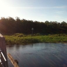
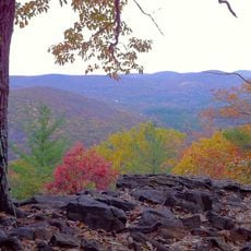
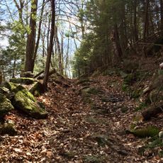
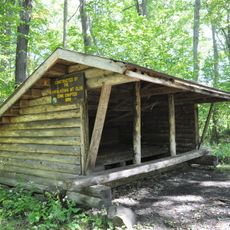
Mattatuck Trail is a hiking route that stretches roughly 42 miles (68 kilometers) through eight towns in Western Connecticut, linking different landscapes together. The path winds through brooks, small ponds, and forest sections that define the region.

The trail was established in the 1970s by the Connecticut Forest & Park Association to connect natural areas across Western Connecticut. This created a walking network that has remained in use ever since.

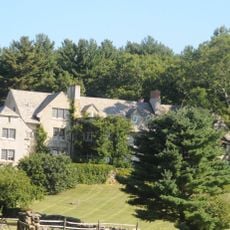
The trail winds through areas long used by local walkers and connects communities that share a love of forest exploration. Over time, the route has become a gathering place where people experience the natural landscape that shapes daily life in the region.

You can join the trail at several points along its route, with the main access at Lane Hill Road in Terryville where parking is available. It is wise to wear comfortable hiking shoes and bring water, especially for longer sections of walking.

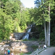
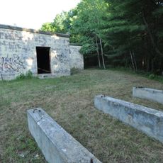
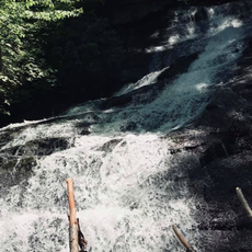
A notable point on the route is a waterfall that drops in three separate tiers and becomes especially dramatic after heavy rain. The path also passes caves that held significance in local history and stories.

The community of curious travelers

AroundUs brings together thousands of curated places, local tips, and hidden gems, enriched daily by 60,000 contributors worldwide.

Start exploring
GPS coordinates
41.82211,-73.29867
Latest update
December 14, 2025 14:42
Around this place
Rye House
United States of America

Rye House

11.3 km
Litchfield Law School
United States of America

Litchfield Law School

12.6 km
House VI
United States of America

House VI

2.2 km
Kent Falls State Park
United States of America

Kent Falls State Park

10.6 km
West Cornwall Covered Bridge
United States of America

West Cornwall Covered Bridge

7.8 km
Stillman House
United States of America

Stillman House

11.9 km
Cathedral Pines
United States of America

Cathedral Pines

2.7 km
Milton Center Historic District
United States of America

Milton Center Historic District

6.4 km
Cornwall Bridge
United States of America

Cornwall Bridge

6.2 km
Above All State Park
United States of America

Above All State Park

11.5 km
Oliver Wolcott House
United States of America

Oliver Wolcott House

12.7 km
White Memorial Foundation
United States of America

White Memorial Foundation

13.3 km
Litchfield Historic District
United States of America

Litchfield Historic District

12.3 km
Housatonic Meadows State Park
United States of America

Housatonic Meadows State Park

7.1 km
First Congregational Church of Litchfield
United States of America

First Congregational Church of Litchfield

12.3 km
Housatonic State Forest
United States of America

Housatonic State Forest

10.5 km
West Goshen Historic District
United States of America

West Goshen Historic District

3.7 km
Trinity Church
United States of America

Trinity Church

6.3 km
Dean's Ravine Falls
United States of America

Dean's Ravine Falls

11.5 km
Amos Baldwin House
United States of America

Amos Baldwin House

13.3 km
Henry B. Bissell House
United States of America

Henry B. Bissell House

10.8 km
Maj. Gen. John Sedgwick House
United States of America

Maj. Gen. John Sedgwick House

8.8 km
Cream Hill Agricultural School
United States of America

Cream Hill Agricultural School

8.1 km
Rumsey Hall
United States of America

Rumsey Hall

3.7 km
Red Mountain Shelter
United States of America

Red Mountain Shelter

2.9 km
Thomas Shepard House
United States of America

Thomas Shepard House

12.4 km
Cream Hill Shelter
United States of America

Cream Hill Shelter

10.1 km
David Welch House
United States of America

David Welch House

6.4 km
Show the full map
Reviews
Share your experience

No review yet

Discussions
Start a discussion...

No discussion yet

« Mattatuck Trail - Woodland hiking trail in Western Connecticut, United States » is provided by Around Us (aroundus.com). Images and texts are derived from Wikimedia project under a Creative Commons license. You are allowed to copy, distribute, and modify copies of this page, under the conditions set by the license, as long as this note is clearly visible.

Discover hidden gems everywhere you go!

From secret cafés to breathtaking viewpoints, skip the crowded tourist spots and find places that match your style. Our app makes it easy with voice search, smart filtering, route optimization, and insider tips from travelers worldwide. Download now for the complete mobile experience.

Around Us App Screenshot

A unique approach to discovering new places

Le Figaro

All the places worth exploring

France Info

A tailor-made excursion in just a few clicks

20 Minutes

Around Us
Travel Guide & Maps
Download

Send to your phone

QR Code
1

Open the camera app on your mobile.

2

Point at the QR code with your camera. A notification will appear.

3

Tap the notification to open the link.