Enable Location

We need your location to show you interesting places around you

Discover nearby places

Find interesting locations and hidden gems around you

Precise directions

Get accurate directions and distances to places

Your location is never shared with other users. It's only used when you tap the location button.

Brandon State School

Log in to your account

Start exploring — it's free

Trusted by 62,374 travelers worldwide

Continue with Google
Continue with Apple
or

We will send you a code to connect

By continuing, you accept our Terms and Conditions and our Privacy Policy

Check your inbox

We've sent a pincode in your inbox. Please enter the code below.

Brandon State School

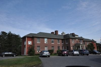
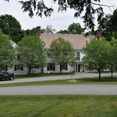
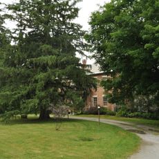
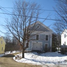
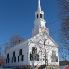
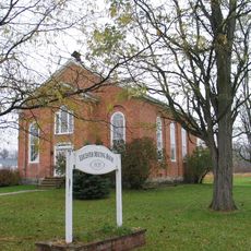
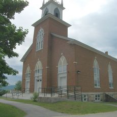
Brandon State School is a historical psychiatric facility in Brandon, Vermont, spanning approximately 18 acres with buildings dating back to the early 20th century. The campus contains solid brick structures with classical architectural features that once served as dormitories, classrooms, and support facilities.

The school opened in 1915 as Vermont's first state-funded facility for children with developmental and mental health needs, providing residential care and education for decades. It closed in 1993 after federal policies and evolving care practices prompted the gradual transition of residents to community living arrangements.

The place carries the stories of residents who often spent their entire lives here, creating a community within the campus grounds. The former dormitories and workshop buildings show how daily life and social bonds formed within this institution.

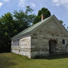
The campus contains about 33 buildings spread across wooded grounds with quiet pathways that are easy to explore on foot. Today many of the original structures have been converted into apartments and businesses, creating a mixed environment for visitors to walk through.

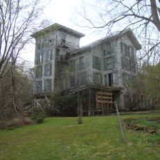
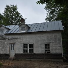
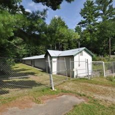
Building J was originally a dormitory for the most severely disabled residents and sat vacant for years before part of it was transformed into a fiber-processing factory. This repurposing shows how the site has found new meaning and economic activity for the local community.

The community of curious travelers

AroundUs brings together thousands of curated places, local tips, and hidden gems, enriched daily by 60,000 contributors worldwide.

Start exploring
Location
Address
US 7
GPS coordinates
43.81167,-73.10833
Latest update
February 9, 2026 08:20
Around this place
Vermont Marble Museum
United States of America

Vermont Marble Museum

17.5 km
Hyde's Hotel
United States of America

Hyde's Hotel

8.2 km
Branbury State Park
United States of America

Branbury State Park

11.1 km
Shard Villa
United States of America

Shard Villa

14.7 km
Half Moon Pond State Park
United States of America

Half Moon Pond State Park

15.6 km
Southern Vermont Arts Center
United States of America

Southern Vermont Arts Center

17.2 km
Thomas H. Palmer House
United States of America

Thomas H. Palmer House

14.8 km
Cedar Swamp Covered Bridge
United States of America

Cedar Swamp Covered Bridge

13 km
Forest Dale Iron Furnace
United States of America

Forest Dale Iron Furnace

5.3 km
Gorham Covered Bridge
United States of America

Gorham Covered Bridge

15.7 km
Cooley Covered Bridge
United States of America

Cooley Covered Bridge

15 km
Marble Bridge
United States of America

Marble Bridge

17.8 km
Hammond Covered Bridge
United States of America

Hammond Covered Bridge

11 km
Wilcox-Cutts House
United States of America

Wilcox-Cutts House

16.3 km
East Shoreham Covered Railroad Bridge
United States of America

East Shoreham Covered Railroad Bridge

13 km
Sanderson Covered Bridge
United States of America

Sanderson Covered Bridge

2.5 km
Middlebury Gorge Concrete Arch Bridge
United States of America

Middlebury Gorge Concrete Arch Bridge

17.7 km
Depot Covered Bridge
United States of America

Depot Covered Bridge

12.5 km
Dean Covered Bridge
United States of America

Dean Covered Bridge

3.8 km
First Congregational Church
United States of America

First Congregational Church

15.5 km
Salisbury Town Hall
United States of America

Salisbury Town Hall

9.4 km
Salisbury Congregational Church
United States of America

Salisbury Congregational Church

9.5 km
Ruth Stone House
United States of America

Ruth Stone House

10 km
Colburn Bridge
United States of America

Colburn Bridge

13.6 km
Leicester Meeting House
United States of America

Leicester Meeting House

6.1 km
Pittsford Green Historic District
United States of America

Pittsford Green Historic District

13.3 km
Sudbury School No. 3
United States of America

Sudbury School No. 3

8 km
Salisbury Fish Hatchery
United States of America

Salisbury Fish Hatchery

12.6 km
Show the full map
« Brandon State School » is provided by Around Us (aroundus.com). Images and texts are derived from Wikimedia project under a Creative Commons license. You are allowed to copy, distribute, and modify copies of this page, under the conditions set by the license, as long as this note is clearly visible.

Discover hidden gems everywhere you go!

From secret cafés to breathtaking viewpoints, skip the crowded tourist spots and find places that match your style. Our app makes it easy with voice search, smart filtering, route optimization, and insider tips from travelers worldwide. Download now for the complete mobile experience.

Around Us App Screenshot

A unique approach to discovering new places

Le Figaro

All the places worth exploring

France Info

A tailor-made excursion in just a few clicks

20 Minutes

Around Us
Travel Guide & Maps
Download

Send to your phone

QR Code
1

Open the camera app on your mobile.

2

Point at the QR code with your camera. A notification will appear.

3

Tap the notification to open the link.