Brendonwood Historic District

Log in to your account

AroundUs is a community-driven map of interesting places, built by curious explorers like you. It grows with every review, story, and photo you share.
Connect to save your favorite spots, contribute locations, and create personalized routes.
Continue with Google
Continue with Apple
Continue with X
Continue with Facebook
Continue with email
By continuing, you accept our Terms and Conditions and our Privacy Policy
Create an account
Add to collection
Map
Suggest a change
Share

Brendonwood Historic District, Historic residential district in Indianapolis, United States.

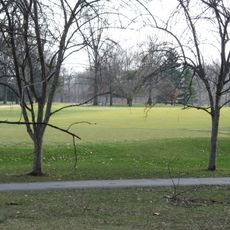
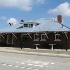
Brendonwood Historic District is a residential neighborhood on the eastern side of Millersville with about 85 protected buildings representing different architectural traditions. The district includes a golf course and is bounded on the west by Fall Creek.

The neighborhood was created between 1917 and 1954 following landscape architect George E. Kessler's designs for a residential vision developed by Charles S. Lewis. The planning established this as a self-managed community that maintained its own standards over time.

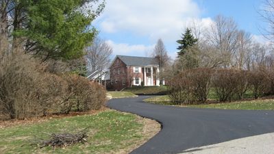
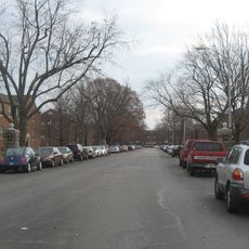
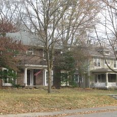
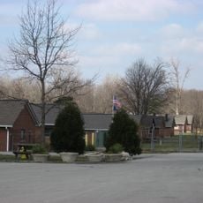
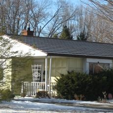
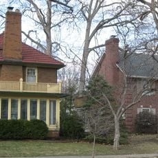
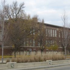
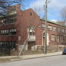
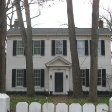
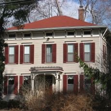
The neighborhood displays Tudor Revival, Colonial Revival, and American Craftsman homes that together create a distinctive residential character. Walking through the streets, you notice how these architectural styles give the area a unified and carefully maintained appearance.

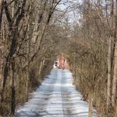
The neighborhood is managed by an active Homeowners Association that maintains building standards and protects the area's appearance. It is best explored on foot to appreciate the architectural details of the homes and the green character of the streets.

Each property plot in this neighborhood was given a distinctive name instead of a street number, such as Two Knolls, Farlook, or Springhead. This naming approach emphasizes the individual character of the community and sets it apart from standard numbered street patterns.

Location: Indianapolis

GPS coordinates: 39.86111,-86.06611

Latest update: December 14, 2025 11:41

Photos
Around this place
Fort Benjamin Harrison
United States of America

Fort Benjamin Harrison

4.8 km
Fort Harrison State Park
United States of America

Fort Harrison State Park

4.3 km
United States of America

Indianapolis Art Center

6.9 km
Skiles Test Nature Park
United States of America

Skiles Test Nature Park

1.7 km
Jazz Kitchen
United States of America

Jazz Kitchen

6.9 km
Marcy Village Apartments
United States of America

Marcy Village Apartments

6.4 km
Oliver Johnson's Woods Historic District
United States of America

Oliver Johnson's Woods Historic District

7.4 km
Tee Pee Restaurant
United States of America

Tee Pee Restaurant

6.8 km
Foster Hall
United States of America

Foster Hall

7.6 km
Hillcrest Country Club
United States of America

Hillcrest Country Club

1.5 km
Camp Edwin F. Glenn
United States of America

Camp Edwin F. Glenn

3.9 km
Roy and Iris Corbin Lustron House
United States of America

Roy and Iris Corbin Lustron House

8 km
Forest Hills Historic District
United States of America

Forest Hills Historic District

6.6 km
Fort Harrison Terminal Station
United States of America

Fort Harrison Terminal Station

4.5 km
Henry P. Coburn Public School No. 66
United States of America

Henry P. Coburn Public School No. 66

7.9 km
Thomas Askren House
United States of America

Thomas Askren House

7.6 km
Meridian Street United Methodist Church
United States of America

Meridian Street United Methodist Church

7.9 km
Broad Ripple Firehouse-Indianapolis Fire Department Station 32
United States of America

Broad Ripple Firehouse-Indianapolis Fire Department Station 32

6.7 km
Marion County Bridge 0501F
United States of America

Marion County Bridge 0501F

6.6 km
Immaculate Heart of Mary
United States of America

Immaculate Heart of Mary

1.2 km
Joseph J. Bingham Indianapolis Public School No. 84
United States of America

Joseph J. Bingham Indianapolis Public School No. 84

7.3 km
Johnson-Denny House
United States of America

Johnson-Denny House

7.5 km
Hiram A. Haverstick Farmstead
United States of America

Hiram A. Haverstick Farmstead

7.2 km
Christus
United States of America

Christus

7.7 km
Monon Trail
United States of America

Monon Trail

6.7 km
Vogue Theatre
United States of America

Vogue Theatre

6.9 km
8888 Keystone Crossing
United States of America

8888 Keystone Crossing

7.2 km
Vogue Theater
United States of America

Vogue Theater

6.9 km
Show the full map
Reviews

Visited this place? Tap the stars to rate it and share your experience / photos with the community! Try now! You can cancel it anytime.

« Brendonwood Historic District - Historic residential district in Indianapolis, United States » is provided by Around Us (aroundus.com). Images and texts are derived from Wikimedia project under a Creative Commons license. You are allowed to copy, distribute, and modify copies of this page, under the conditions set by the license, as long as this note is clearly visible.

Discover hidden gems everywhere you go!

From secret cafés to breathtaking viewpoints, skip the crowded tourist spots and find places that match your style. Our app makes it easy with voice search, smart filtering, route optimization, and insider tips from travelers worldwide. Download now for the complete mobile experience.

Around Us App Screenshot

A unique approach to discovering new places

Le Figaro

All the places worth exploring

France Info

A tailor-made excursion in just a few clicks

20 Minutes