Fort Benjamin Harrison

Log in to your account

AroundUs is a community-driven map of interesting places, built by curious explorers like you. It grows with every review, story, and photo you share.
Connect to save your favorite spots, contribute locations, and create personalized routes.
Continue with Google
Continue with Apple
Continue with X
Continue with Facebook
Continue with email
By continuing, you accept our Terms and Conditions and our Privacy Policy
Create an account
Add to collection
Map
Suggest a change
Share

Fort Benjamin Harrison, Historic military district in Lawrence Township, Indiana.

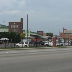
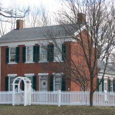
Fort Benjamin Harrison is a military district in Lawrence Township northeast of Indianapolis, covering 1,700 acres of preserved barracks, training grounds, and wooded areas. The installation spreads across rolling terrain with brick buildings from the turn of the century, open drill fields, and paved roads that run between former command structures.

The Army established the installation in 1904 as a training facility and named it after President Benjamin Harrison from Indianapolis. During World War II, the fort served as a major center for training supply troops and prepared more than 200,000 soldiers.

The Museum of 20th Century Warfare displays artifacts and documents from soldiers who served at the installation. Visitors can walk through rooms filled with personal items and equipment from different military periods.

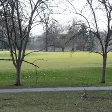
Multiple hiking trails run through the grounds, including the 3.2-mile (5.1-kilometer) Harrison Trace Trail and the 4.2-mile (6.8-kilometer) Lawrence Creek Trail. The paved and gravel paths lead past abandoned buildings and through wooded sections that work for walks in all seasons.

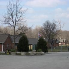
Camp Glenn within the installation housed Civilian Conservation Corps workers in the 1930s and later held German prisoners from 1943 to 1945. The barracks served both groups in succession and still stand on the grounds today.

Location: Indiana

GPS coordinates: 39.86389,-86.01056

Latest update: December 5, 2025 22:25

Photos
Around this place
Geist Reservoir
United States of America

Geist Reservoir

8.2 km
Fort Harrison State Park
United States of America

Fort Harrison State Park

611 m
Indiana School for the Deaf
United States of America

Indiana School for the Deaf

11.3 km
Skiles Test Nature Park
United States of America

Skiles Test Nature Park

3.4 km
Hindu Temple of Central Indiana
United States of America

Hindu Temple of Central Indiana

6 km
Marcy Village Apartments
United States of America

Marcy Village Apartments

11 km
Brendonwood Historic District
United States of America

Brendonwood Historic District

4.8 km
Irvington Terrace Historic District
United States of America

Irvington Terrace Historic District

11.1 km
Tee Pee Restaurant
United States of America

Tee Pee Restaurant

11.2 km
West-Harris House
United States of America

West-Harris House

9.8 km
Hillcrest Country Club
United States of America

Hillcrest Country Club

4.5 km
Camp Edwin F. Glenn
United States of America

Camp Edwin F. Glenn

1 km
Roy and Iris Corbin Lustron House
United States of America

Roy and Iris Corbin Lustron House

10.2 km
Forest Hills Historic District
United States of America

Forest Hills Historic District

11.3 km
Oaklandon Historic District
United States of America

Oaklandon Historic District

4.7 km
Christopher Apple House
United States of America

Christopher Apple House

4.4 km
Emerson Avenue Addition Historic District
United States of America

Emerson Avenue Addition Historic District

11.4 km
Fort Harrison Terminal Station
United States of America

Fort Harrison Terminal Station

928 m
Carlos and Anne Recker House
United States of America

Carlos and Anne Recker House

11.3 km
Thomas Askren House
United States of America

Thomas Askren House

8.7 km
Broad Ripple Firehouse-Indianapolis Fire Department Station 32
United States of America

Broad Ripple Firehouse-Indianapolis Fire Department Station 32

11.3 km
Marion County Bridge 0501F
United States of America

Marion County Bridge 0501F

9.7 km
Cumberland Historic District
United States of America

Cumberland Historic District

10.8 km
Immaculate Heart of Mary
United States of America

Immaculate Heart of Mary

5.8 km
Hiram A. Haverstick Farmstead
United States of America

Hiram A. Haverstick Farmstead

11.3 km
Frank Littleton Round Barn
United States of America

Frank Littleton Round Barn

10.3 km
Christus
United States of America

Christus

8.6 km
Monon Trail
United States of America

Monon Trail

11.3 km
Show the full map
Reviews

Visited this place? Tap the stars to rate it and share your experience / photos with the community! Try now! You can cancel it anytime.

« Fort Benjamin Harrison - Historic military district in Lawrence Township, Indiana » is provided by Around Us (aroundus.com). Images and texts are derived from Wikimedia project under a Creative Commons license. You are allowed to copy, distribute, and modify copies of this page, under the conditions set by the license, as long as this note is clearly visible.

Discover hidden gems everywhere you go!

From secret cafés to breathtaking viewpoints, skip the crowded tourist spots and find places that match your style. Our app makes it easy with voice search, smart filtering, route optimization, and insider tips from travelers worldwide. Download now for the complete mobile experience.

Around Us App Screenshot

A unique approach to discovering new places

Le Figaro

All the places worth exploring

France Info

A tailor-made excursion in just a few clicks

20 Minutes