Irvington Terrace Historic District

Log in to your account

AroundUs is a community-driven map of interesting places, built by curious explorers like you. It grows with every review, story, and photo you share.
Connect to save your favorite spots, contribute locations, and create personalized routes.
Continue with Google
Continue with Apple
Continue with X
Continue with Facebook
Continue with email
By continuing, you accept our Terms and Conditions and our Privacy Policy
Create an account
Add to collection
Map
Suggest a change
Share

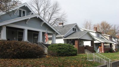
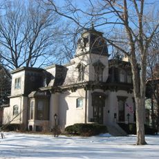
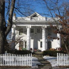
Irvington Terrace Historic District, Historic residential district in Indianapolis, United States.

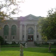
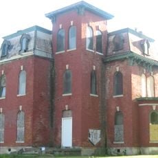
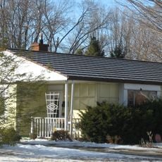
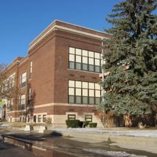
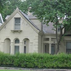
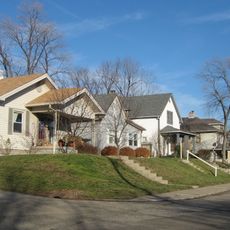
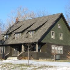
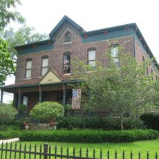
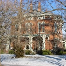
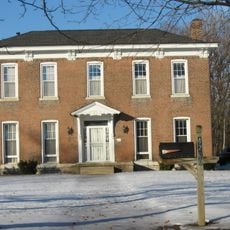
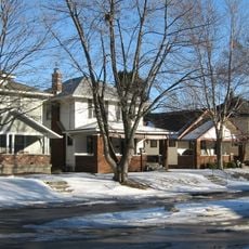
Irvington Terrace Historic District is a residential area in Indianapolis containing 578 buildings across 98 acres with homes in Tudor Revival, Colonial Revival, and American Craftsman styles. The architecture spans these different design approaches, giving the neighborhood visual variety and character throughout its streets.

The district grew between 1895 and 1959 during Indianapolis's early 20th century expansion as the city spread outward. This growth period reflects when American cities began building residential suburbs to house their growing populations.

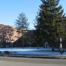
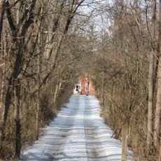
The neighborhood was designed with planned streets that organize homes in a deliberate pattern, creating a strong sense of community layout. Residents and visitors can see how this structure still shapes how people move through and experience the area today.

The district is located between East Washington Street, Pleasant Run Parkway, North Arlington Avenue, and the eastern side of North Irwin Street. Walking through the neighborhood at a slow pace lets you appreciate the different houses and street layouts without rushing.

The district received recognition through the Multiple Property Submission program for Historic Residential Suburbs in 2011, a special designation for well-preserved neighborhoods. This recognition highlighted its importance as an example of how American suburbs developed during that era.

Location: Indianapolis

GPS coordinates: 39.77250,-86.06278

Latest update: December 14, 2025 12:25

Photos
Around this place
Benton House
United States of America

Benton House

1.4 km
General German Protestant Orphans Home
United States of America

General German Protestant Orphans Home

6.5 km
Rivoli Theater
United States of America

Rivoli Theater

4.3 km
William H. H. Graham House
United States of America

William H. H. Graham House

1.3 km
Bona Thompson Memorial Center
United States of America

Bona Thompson Memorial Center

1.4 km
Linwood Colonial Apartments
United States of America

Linwood Colonial Apartments

2.6 km
Horner–Terrill House
United States of America

Horner–Terrill House

2.1 km
Roy and Iris Corbin Lustron House
United States of America

Roy and Iris Corbin Lustron House

2.6 km
Spades Park Branch
United States of America

Spades Park Branch

5.8 km
Christian Park School No. 82
United States of America

Christian Park School No. 82

2.6 km
East Washington Branch
United States of America

East Washington Branch

4.6 km
Ralph Waldo Emerson Indianapolis Public School No. 58
United States of America

Ralph Waldo Emerson Indianapolis Public School No. 58

2.5 km
Prosser House
United States of America

Prosser House

6.1 km
Emerson Avenue Addition Historic District
United States of America

Emerson Avenue Addition Historic District

1.6 km
Carlos and Anne Recker House
United States of America

Carlos and Anne Recker House

315 m
John Fitch Hill House
United States of America

John Fitch Hill House

6 km
Thomas Askren House
United States of America

Thomas Askren House

2.4 km
Virginia Avenue District
United States of America

Virginia Avenue District

7 km
Julian-Clark House
United States of America

Julian-Clark House

735 m
State and Prospect District
United States of America

State and Prospect District

6.2 km
Laurel and Prospect District
United States of America

Laurel and Prospect District

6.6 km
John Greenleaf Whittier School, No. 33
United States of America

John Greenleaf Whittier School, No. 33

5.7 km
Gaseteria, Inc.
United States of America

Gaseteria, Inc.

6.6 km
Thomas Moore House
United States of America

Thomas Moore House

2.9 km
Emerson Heights Historic District
United States of America

Emerson Heights Historic District

2.2 km
Fountain Square Theatre
United States of America

Fountain Square Theatre

7 km
Radio Radio
United States of America

Radio Radio

6.9 km
Cole Motor Car Company building
United States of America

Cole Motor Car Company building

7 km
Show the full map
Reviews

Visited this place? Tap the stars to rate it and share your experience / photos with the community! Try now! You can cancel it anytime.

« Irvington Terrace Historic District - Historic residential district in Indianapolis, United States » is provided by Around Us (aroundus.com). Images and texts are derived from Wikimedia project under a Creative Commons license. You are allowed to copy, distribute, and modify copies of this page, under the conditions set by the license, as long as this note is clearly visible.

Discover hidden gems everywhere you go!

From secret cafés to breathtaking viewpoints, skip the crowded tourist spots and find places that match your style. Our app makes it easy with voice search, smart filtering, route optimization, and insider tips from travelers worldwide. Download now for the complete mobile experience.

Around Us App Screenshot

A unique approach to discovering new places

Le Figaro

All the places worth exploring

France Info

A tailor-made excursion in just a few clicks

20 Minutes