Enable Location

We need your location to show you interesting places around you

Discover nearby places

Find interesting locations and hidden gems around you

Precise directions

Get accurate directions and distances to places

Your location is never shared with other users. It's only used when you tap the location button.

Molly Stark State Park

Log in to your account

Start exploring — it's free

Trusted by 61,895 travelers worldwide

Continue with Google
Continue with Apple
or

We will send you a code to connect

By continuing, you accept our Terms and Conditions and our Privacy Policy

Check your inbox

We've sent a pincode in your inbox. Please enter the code below.

Molly Stark State Park

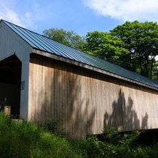
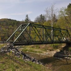
Molly Stark State Park, State park in Wilmington, United States.

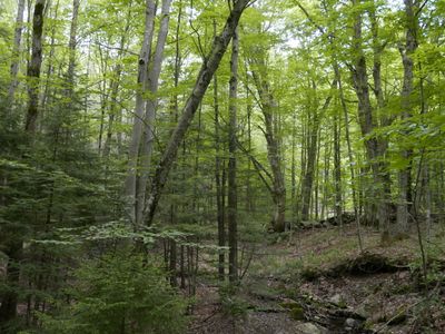
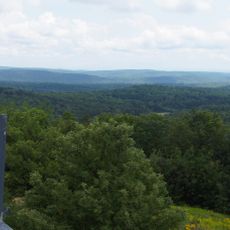
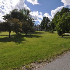
Molly Stark State Park is a 148-acre nature reserve with hiking trails that reach Mount Olga, where an observation tower overlooks the surrounding landscape. The terrain includes woodlands and cleared areas that provide different walking experiences depending on the chosen route.

The park was established in 1960 when the Vermont Department of Forests converted former farmland into a public nature reserve. This transformation reflected growing efforts to protect natural spaces for outdoor recreation and conservation.

The place takes its name from Molly Stark, wife of General John Stark, honoring her link to the American independence struggle in Vermont. This connection is woven into the area's identity and reminds visitors of the region's historical roots.

The site offers 23 tent campsites and 11 lean-to shelters, along with facilities like flush toilets, hot showers, and a pavilion with electrical hookups. Most trails are clearly marked and suitable for different activity levels.

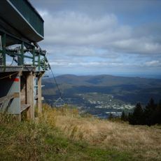
The fire tower atop the mountain is a remnant of early forest protection efforts and still provides sweeping views across the landscape today. From this vantage point, visitors can also see the eastern slope where the original ski area once operated.

The community of curious travelers

AroundUs brings together thousands of curated places, local tips, and hidden gems, enriched daily by 60,000 contributors worldwide.

Start exploring
Location
Inception
1960
GPS coordinates
42.85080,-72.80980
Latest update
December 14, 2025 13:02
Around this place
Mount Snow
United States of America

Mount Snow

15.2 km
Hogback Mountain
United States of America

Hogback Mountain

2.6 km
United States of America

Haystack Mountain

11.4 km
West Dummerston Covered Bridge
United States of America

West Dummerston Covered Bridge

18.6 km
Creamery Covered Bridge
United States of America

Creamery Covered Bridge

18.2 km
Woodford State Park
United States of America

Woodford State Park

19.1 km
Heath Center Historic District
United States of America

Heath Center Historic District

19.8 km
Green River Covered Bridge
United States of America

Green River Covered Bridge

14.3 km
Williamsville Covered Bridge
United States of America

Williamsville Covered Bridge

14.3 km
Deacon John Holbrook House
United States of America

Deacon John Holbrook House

20.2 km
Dover Town Hall
United States of America

Dover Town Hall

10.4 km
Medburyville Bridge
United States of America

Medburyville Bridge

9.3 km
Rice Farm Road Bridge
United States of America

Rice Farm Road Bridge

17.6 km
Southern Vermont Natural History Museum
United States of America

Southern Vermont Natural History Museum

1.4 km
William Harris House
United States of America

William Harris House

18.1 km
Whitingham Village Historic District
United States of America

Whitingham Village Historic District

8.9 km
Wilmington Village Historic District
United States of America

Wilmington Village Historic District

5.7 km
Historical Society of Windham County
United States of America

Historical Society of Windham County

19.5 km
Lewis Grout House
United States of America

Lewis Grout House

17.1 km
Guilford Center Meetinghouse
United States of America

Guilford Center Meetinghouse

16.4 km
Dickinson Estate Historic District
United States of America

Dickinson Estate Historic District

20.3 km
South Newfane Bridge
United States of America

South Newfane Bridge

12.9 km
Tontine Building
United States of America

Tontine Building

19.3 km
West Brattleboro Green Historic District
United States of America

West Brattleboro Green Historic District

17.1 km
Corse-Shippee House
United States of America

Corse-Shippee House

9.9 km
Homestead-Horton Neighborhood Historic District
United States of America

Homestead-Horton Neighborhood Historic District

20.2 km
Municipal Center
United States of America

Municipal Center

20.3 km
Newfane Village Historic District
United States of America

Newfane Village Historic District

19.7 km
Show the full map
« Molly Stark State Park - State park in Wilmington, United States » is provided by Around Us (aroundus.com). Images and texts are derived from Wikimedia project under a Creative Commons license. You are allowed to copy, distribute, and modify copies of this page, under the conditions set by the license, as long as this note is clearly visible.

Discover hidden gems everywhere you go!

From secret cafés to breathtaking viewpoints, skip the crowded tourist spots and find places that match your style. Our app makes it easy with voice search, smart filtering, route optimization, and insider tips from travelers worldwide. Download now for the complete mobile experience.

Around Us App Screenshot

A unique approach to discovering new places

Le Figaro

All the places worth exploring

France Info

A tailor-made excursion in just a few clicks

20 Minutes

Around Us
Travel Guide & Maps
Download

Send to your phone

QR Code
1

Open the camera app on your mobile.

2

Point at the QR code with your camera. A notification will appear.

3

Tap the notification to open the link.