Enable Location

We need your location to show you interesting places around you

Discover nearby places

Find interesting locations and hidden gems around you

Precise directions

Get accurate directions and distances to places

Your location is never shared with other users. It's only used when you tap the location button.

Log in to your account

Start exploring — it's free

Trusted by 63,741 travelers worldwide

Continue with Google
Continue with Apple
or

We will send you a code to connect

By continuing, you accept our Terms and Conditions and our Privacy Policy

Check your inbox

We've sent a pincode in your inbox. Please enter the code below.

Kingsland Bay State Park
Discussion Reviews Photo
1.3k Popularity

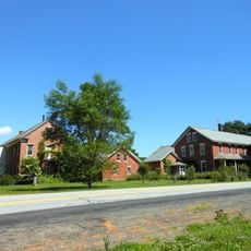
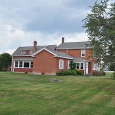
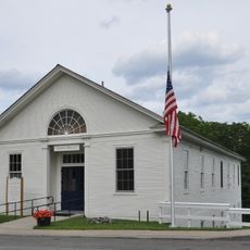
Kingsland Bay State Park, State park in Ferrisburgh, United States.

Kingsland Bay State Park covers around 264 acres along Lake Champlain and features cedar-pine forests, natural shorelines, and two distinct peninsulas that shape the landscape. The park's layout provides visitors with varied sections to explore, from wooded areas to open waterfront.

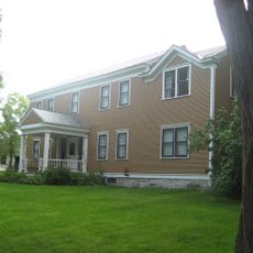
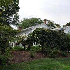
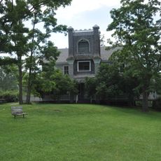
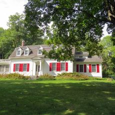
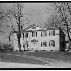
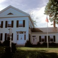
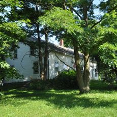
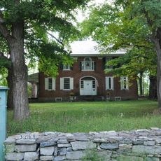
The Hawley House was built in 1790 as a residence for early settlers living along the lake. Later the structure served as a girls' camp before the site eventually became what it is today.

The park protects native plant communities along the shoreline and behind the bluffs, showing how nature thrives in this particular setting. These preserved areas reflect the land's natural character and its importance to the region.

The beach with snack facilities, boat rentals, and picnic areas with grills are set up for day visitors to use easily. Swimming, boating, and wildlife watching are popular activities throughout the year.

The western section contains a cedar-pine forest growing on lake bluff soil, creating specific ecological conditions that support unusual combinations of plants and animals. This forest type is relatively uncommon in the region and gives visitors a different natural experience than typical woodlands.

The community of curious travelers

AroundUs brings together thousands of curated places, local tips, and hidden gems, enriched daily by 60,000 contributors worldwide.

Start exploring
Location
GPS coordinates
44.23600,-73.30400
Latest update
December 14, 2025 18:14
Around this place
Mount Philo State Park
United States of America

Mount Philo State Park

8.4 km
Rokeby
United States of America

Rokeby

5.5 km
Grand Isle State Park
United States of America

Grand Isle State Park

7 km
Spade Farm Covered Bridge
United States of America

Spade Farm Covered Bridge

5.7 km
Barber's Point Light
United States of America

Barber's Point Light

12.1 km
Essex County Fairgrounds
United States of America

Essex County Fairgrounds

12.8 km
Holmes Creek Covered Bridge
United States of America

Holmes Creek Covered Bridge

10.9 km
Champlain II
United States of America

Champlain II

6.8 km
Quinlan's Covered Bridge
United States of America

Quinlan's Covered Bridge

10.5 km
Octagonal Schoolhouse
United States of America

Octagonal Schoolhouse

10.9 km
Foothills Baptist Church
United States of America

Foothills Baptist Church

10.7 km
McNeil Homestead
United States of America

McNeil Homestead

7.5 km
Charlotte Center Historic District
United States of America

Charlotte Center Historic District

10.1 km
Hawley's Ferry House
United States of America

Hawley's Ferry House

710 m
Essex Village Historic District
United States of America

Essex Village Historic District

9.3 km
Tavern on Mutton Hill
United States of America

Tavern on Mutton Hill

11.2 km
Essex County Home and Farm
United States of America

Essex County Home and Farm

8.8 km
Gen. Samuel Strong House
United States of America

Gen. Samuel Strong House

8.8 km
Union Meetinghouse
United States of America

Union Meetinghouse

5.7 km
Camp Dudley Road Historic District
United States of America

Camp Dudley Road Historic District

12.9 km
Lake View Grange No. 970
United States of America

Lake View Grange No. 970

12 km
Bixby Memorial Free Library
United States of America

Bixby Memorial Free Library

8.6 km
Vergennes Residential Historic District
United States of America

Vergennes Residential Historic District

8.8 km
Samuel Paddock Strong House
United States of America

Samuel Paddock Strong House

9 km
Field Farm
United States of America

Field Farm

8.5 km
Abraham Aiken House
United States of America

Abraham Aiken House

12.8 km
Vergennes Historic District
United States of America

Vergennes Historic District

8.5 km
Capts. Louis and Philomene Daniels House
United States of America

Capts. Louis and Philomene Daniels House

8.2 km
Show the full map
Reviews
Share your experience

No review yet

Discussions
Start a discussion...

No discussion yet

« Kingsland Bay State Park - State park in Ferrisburgh, United States » is provided by Around Us (aroundus.com). Images and texts are derived from Wikimedia project under a Creative Commons license. You are allowed to copy, distribute, and modify copies of this page, under the conditions set by the license, as long as this note is clearly visible.

Discover hidden gems everywhere you go!

From secret cafés to breathtaking viewpoints, skip the crowded tourist spots and find places that match your style. Our app makes it easy with voice search, smart filtering, route optimization, and insider tips from travelers worldwide. Download now for the complete mobile experience.

Around Us App Screenshot

A unique approach to discovering new places

Le Figaro

All the places worth exploring

France Info

A tailor-made excursion in just a few clicks

20 Minutes

Around Us
Travel Guide & Maps
Download

Send to your phone

QR Code
1

Open the camera app on your mobile.

2

Point at the QR code with your camera. A notification will appear.

3

Tap the notification to open the link.