Maurepas Swamp Wildlife Management Area

Log in to your account

AroundUs is a community-driven map of interesting places, built by curious explorers like you. It grows with every review, story, and photo you share.
Connect to save your favorite spots, contribute locations, and create personalized routes.
Continue with Google
Continue with Apple
Continue with X
Continue with Facebook
Continue with email
By continuing, you accept our Terms and Conditions and our Privacy Policy
Create an account

Maurepas Swamp Wildlife Management Area

Add to collection
Map
Suggest a change
Share

Maurepas Swamp Wildlife Management Area, Wildlife management area near Lake Maurepas, Louisiana, United States.

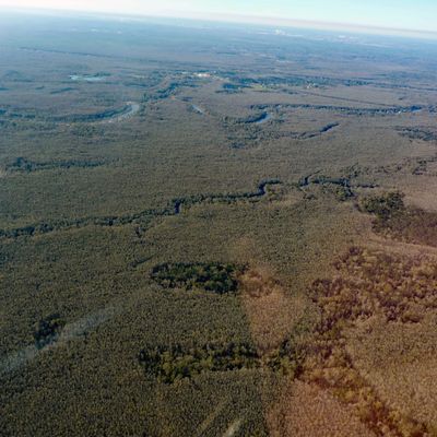
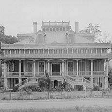
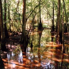
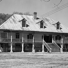
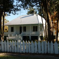
Maurepas Swamp Wildlife Management Area is a large protected zone in Louisiana spanning multiple parishes with a landscape dominated by swamp forest. The terrain features cypress trees, tupelo gums, and oak species interspersed with waterways and open water.

The protected area gained significant expansion in 2001 through a major land donation that brought much of the swamp under formal state management. This marked a turning point in formally preserving this landscape.

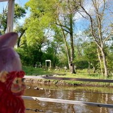
The swamp has been home to hunting and fishing traditions for generations, shaping how local people relate to the land and water. Visitors can witness these daily practices and see how central this place remains to the community.

Visitors should check ahead on which areas are open, as certain zones close during nesting and hunting seasons. Boat or kayak access works best, requiring awareness of changing water levels and narrow channels.

Water levels shift constantly with rainfall, wind, and tidal currents, meaning boaters must adjust their routes with each visit. This ongoing change makes each exploration feel different.

Location: Louisiana

GPS coordinates: 30.14639,-90.51639

Latest update: December 6, 2025 17:46

Photos
Louisiana museums: historic plantations, archaeological sites, and botanical gardens

Louisiana preserves a diverse heritage through its plantations, museums, and natural areas. This collection includes sites where French colonial architecture can be seen along the Cane River, plantation buildings like Melrose and Frogmore that reflect cotton farming and African-American history, and...

Around this place
Oak Alley Plantation
United States of America

Oak Alley Plantation

29.6 km
Whitney Plantation Historic District
United States of America

Whitney Plantation Historic District

17.6 km
Evergreen Plantation
United States of America

Evergreen Plantation

17.9 km
Manchac Swamp Bridge
United States of America

Manchac Swamp Bridge

20.4 km
Destrehan Plantation
United States of America

Destrehan Plantation

26.7 km
Hale Boggs Memorial Bridge
United States of America

Hale Boggs Memorial Bridge

26.5 km
Gramercy Bridge
United States of America

Gramercy Bridge

18.7 km
San Francisco Plantation House
United States of America

San Francisco Plantation House

13.8 km
Carter Plantation
United States of America

Carter Plantation

30 km
Tickfaw State Park
United States of America

Tickfaw State Park

28.5 km
Homeplace Plantation House
United States of America

Homeplace Plantation House

22.2 km
Laura Plantation
United States of America

Laura Plantation

25.3 km
Pass Manchac Light
United States of America

Pass Manchac Light

26.8 km
Godchaux–Reserve Plantation
United States of America

Godchaux–Reserve Plantation

11.1 km
Desire Plantation House
United States of America

Desire Plantation House

28.2 km
Wildcat Stadium
United States of America

Wildcat Stadium

23.8 km
Olive Jeanette
United States of America

Olive Jeanette

20.9 km
Emilie Plantation
United States of America

Emilie Plantation

14.3 km
Old Livingston Parish Courthouse
United States of America

Old Livingston Parish Courthouse

31.5 km
Raziano House
United States of America

Raziano House

31.9 km
Our Lady of Grace Church
United States of America

Our Lady of Grace Church

9 km
Deslattes House
United States of America

Deslattes House

31.4 km
Dorvin House
United States of America

Dorvin House

19.9 km
Adam Lobell House
United States of America

Adam Lobell House

31.5 km
San Francisco Plantation
United States of America

San Francisco Plantation

13.6 km
Hope Plantation (Louisiana)
United States of America

Hope Plantation (Louisiana)

15.4 km
Montegut Plantation
United States of America

Montegut Plantation

10.3 km
Frenier Cemetery
United States of America

Frenier Cemetery

10.1 km
Show the full map
Reviews

Visited this place? Tap the stars to rate it and share your experience / photos with the community! Try now! You can cancel it anytime.

« Maurepas Swamp Wildlife Management Area - Wildlife management area near Lake Maurepas, Louisiana, United States » is provided by Around Us (aroundus.com). Images and texts are derived from Wikimedia project under a Creative Commons license. You are allowed to copy, distribute, and modify copies of this page, under the conditions set by the license, as long as this note is clearly visible.

Discover hidden gems everywhere you go!

From secret cafés to breathtaking viewpoints, skip the crowded tourist spots and find places that match your style. Our app makes it easy with voice search, smart filtering, route optimization, and insider tips from travelers worldwide. Download now for the complete mobile experience.

Around Us App Screenshot

A unique approach to discovering new places

Le Figaro

All the places worth exploring

France Info

A tailor-made excursion in just a few clicks

20 Minutes