Potato Chip Rock

Log in to your account

AroundUs is a community-driven map of interesting places, built by curious explorers like you. It grows with every review, story, and photo you share.
Connect to save your favorite spots, contribute locations, and create personalized routes.
Continue with Google
Continue with Apple
Continue with X
Continue with Facebook
Continue with email
By continuing, you accept our Terms and Conditions and our Privacy Policy
Create an account
Add to collection
Map
Suggest a change
Share

Potato Chip Rock, Rock formation in San Diego County, United States

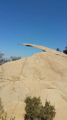
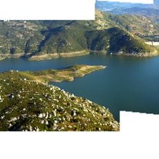
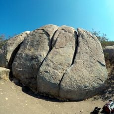
Potato Chip Rock is a granite formation that juts outward from Mount Woodson at an elevation of 2,846 feet, creating a thin, flat ledge. The natural structure resembles a potato chip extended horizontally from the mountainside.

Mount Woodson, where this formation sits, was named in 1895 after a settler, replacing the Native American name Mountain of Moonlit Rocks. The granite itself formed over millions of years through natural geological processes.

The rock has become a destination for photographers and hikers seeking to stand on its narrow ridge. Visitors come here to capture images and share their experience with others.

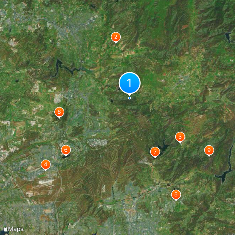
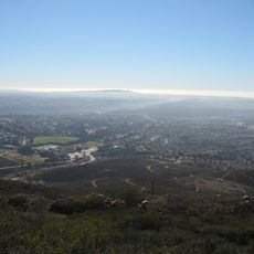
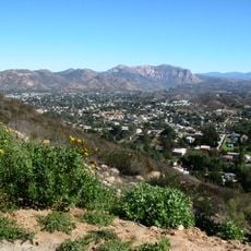
The hike to reach this rock is demanding and requires several hours, with minimal shade coverage and significant elevation gain throughout. Bring plenty of water and assess your fitness level carefully, as the trek can be exhausting.

This spot has become so popular that crowds form during peak times, with people lining up to take photos on the narrow ledge. The congestion is why many hikers prefer arriving early in the morning or on less busy days.

Location: San Diego County

GPS coordinates: 33.00922,-116.97422

Latest update: December 20, 2025 13:24

Photos
Around this place
San Diego Wild Animal Park
United States of America

San Diego Wild Animal Park

10.4 km
Blackjack Hall of Fame
United States of America

Blackjack Hall of Fame

12.2 km
Flying Leatherneck Aviation Museum
United States of America

Flying Leatherneck Aviation Museum

20.2 km
Marshal Scotty's Playland Park
United States of America

Marshal Scotty's Playland Park

20.4 km
Miramar Reservoir
United States of America

Miramar Reservoir

15.6 km
San Vicente Reservoir
United States of America

San Vicente Reservoir

11.7 km
Black Mountain Open Space Park
United States of America

Black Mountain Open Space Park

13.3 km
El Cajon Mountain
United States of America

El Cajon Mountain

17.8 km
Museum of Creation and Earth History
United States of America

Museum of Creation and Earth History

18.3 km
Old Mission Dam
United States of America

Old Mission Dam

19.9 km
San Vicente Dam
United States of America

San Vicente Dam

11.8 km
Olivenhain Dam
United States of America

Olivenhain Dam

16.7 km
Classic Rotors Museum
United States of America

Classic Rotors Museum

6.5 km
Lake Hodges Bridge
United States of America

Lake Hodges Bridge

10.5 km
Rancho Santa Maria de Los Peñasquitos
United States of America

Rancho Santa Maria de Los Peñasquitos

16.3 km
A.H. Beach House
United States of America

A.H. Beach House

15.2 km
Edgemoor Farm Dairy Barn
United States of America

Edgemoor Farm Dairy Barn

18.5 km
Santee Boulders
United States of America

Santee Boulders

18.2 km
Thomas House
United States of America

Thomas House

15.6 km
Creation & Earth History Museum & Bookstore
United States of America

Creation & Earth History Museum & Bookstore

18.3 km
San Vicente Golf Club
United States of America

San Vicente Golf Club

15.6 km
Casa Norman and Florence B. Carmichael
United States of America

Casa Norman and Florence B. Carmichael

19.7 km
Casa Samuel Bingham
United States of America

Casa Samuel Bingham

20.1 km
Johnson-Taylor Ranch Headquarters
United States of America

Johnson-Taylor Ranch Headquarters

17.2 km
MCAS Miramar Commissioned Officer's Club
United States of America

MCAS Miramar Commissioned Officer's Club

20.3 km
Heritage Park
United States of America

Heritage Park

13.3 km
Patriot Park
United States of America

Patriot Park

12.7 km
Ramona Grasslands Preserve
United States of America

Ramona Grasslands Preserve

4.3 km
Show the full map
Reviews

Visited this place? Tap the stars to rate it and share your experience / photos with the community! Try now! You can cancel it anytime.

« Potato Chip Rock - Rock formation in San Diego County, United States » is provided by Around Us (aroundus.com). Images and texts are derived from Wikimedia project under a Creative Commons license. You are allowed to copy, distribute, and modify copies of this page, under the conditions set by the license, as long as this note is clearly visible.

Discover hidden gems everywhere you go!

From secret cafés to breathtaking viewpoints, skip the crowded tourist spots and find places that match your style. Our app makes it easy with voice search, smart filtering, route optimization, and insider tips from travelers worldwide. Download now for the complete mobile experience.

Around Us App Screenshot

A unique approach to discovering new places

Le Figaro

All the places worth exploring

France Info

A tailor-made excursion in just a few clicks

20 Minutes