Enable Location

We need your location to show you interesting places around you

Discover nearby places

Find interesting locations and hidden gems around you

Precise directions

Get accurate directions and distances to places

Your location is never shared with other users. It's only used when you tap the location button.

Miramar Reservoir

Log in to your account

Start exploring — it's free

Trusted by 62,172 travelers worldwide

Continue with Google
Continue with Apple
or

We will send you a code to connect

By continuing, you accept our Terms and Conditions and our Privacy Policy

Check your inbox

We've sent a pincode in your inbox. Please enter the code below.

Miramar Reservoir

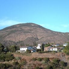
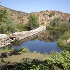
Miramar Reservoir, water reservoir in San Diego, California

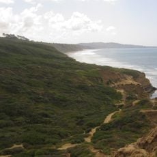
Miramar Reservoir is a lake in San Diego, California, accessible through two trails: a dirt path close to the water and an asphalt road for walkers and cyclists. The water comes from two major aqueducts - the Colorado River Aqueduct and the California Aqueduct - supplying the city's water needs.

The reservoir was completed in 1960 as part of a water management project and has since served as a vital part of San Diego's water supply system. Over the decades, it grew from pure infrastructure into a cherished community gathering place for outdoor recreation.

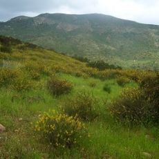
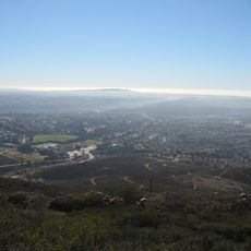
The name Miramar means "sea view" in Spanish, reflecting the reservoir's location in San Diego. People visit to escape city noise and enjoy quiet time with family, friends, or pets in this peaceful outdoor space.

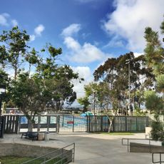
The reservoir is open from sunrise to sunset and offers ample parking, restrooms, and picnic areas with grilling options. Bring water and sunscreen since summers get warm, and wear comfortable shoes for the trails.

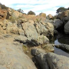
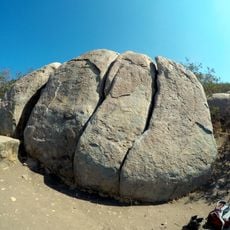
A large rock jutting into the water is a popular photo spot, especially for visitors with pets. During rainy seasons, this rock can disappear underwater, revealing the natural changes in water level throughout the year.

The community of curious travelers

AroundUs brings together thousands of curated places, local tips, and hidden gems, enriched daily by 60,000 contributors worldwide.

Start exploring
Location
Location
Inception
1960
GPS coordinates
32.91540,-117.09880
Latest update
February 7, 2026 11:01
Around this place
Torrey Pines Golf Course
United States of America

Torrey Pines Golf Course

13.7 km
Snapdragon Stadium
United States of America

Snapdragon Stadium

14.8 km
Cowles Mountain
United States of America

Cowles Mountain

13 km
Torrey Pines State Natural Reserve
United States of America

Torrey Pines State Natural Reserve

14.4 km
San Diego Supercomputer Center
United States of America

San Diego Supercomputer Center

13.6 km
Mission Trails Regional Park
United States of America

Mission Trails Regional Park

10.6 km
Flying Leatherneck Aviation Museum
United States of America

Flying Leatherneck Aviation Museum

4.5 km
Torrey Pines Gliderport
United States of America

Torrey Pines Gliderport

14.1 km
Ché Café
United States of America

Ché Café

13.9 km
Price Center
United States of America

Price Center

13.5 km
Audrey Geisel University House
United States of America

Audrey Geisel University House

14.6 km
Black Mountain Open Space Park
United States of America

Black Mountain Open Space Park

7 km
Los Peñasquitos Canyon Preserve
United States of America

Los Peñasquitos Canyon Preserve

7.9 km
Conrad Prebys Music Center
United States of America

Conrad Prebys Music Center

13.4 km
Old Mission Dam
United States of America

Old Mission Dam

9.9 km
Congregation Beth Israel
United States of America

Congregation Beth Israel

11.2 km
UCSD Moores Cancer Center
United States of America

UCSD Moores Cancer Center

12.3 km
Canyonview Aquatic Center
United States of America

Canyonview Aquatic Center

13 km
Rancho Santa Maria de Los Peñasquitos
United States of America

Rancho Santa Maria de Los Peñasquitos

3.6 km
San Clemente Canyon
United States of America

San Clemente Canyon

12.6 km
Edgemoor Farm Dairy Barn
United States of America

Edgemoor Farm Dairy Barn

14.5 km
Santee Boulders
United States of America

Santee Boulders

10.3 km
Torrey Pines Lodge
United States of America

Torrey Pines Lodge

14.4 km
Casa Norman and Florence B. Carmichael
United States of America

Casa Norman and Florence B. Carmichael

14.6 km
Torrey Pines Park Road
United States of America

Torrey Pines Park Road

14.2 km
Johnson-Taylor Ranch Headquarters
United States of America

Johnson-Taylor Ranch Headquarters

4.5 km
MCAS Miramar Commissioned Officer's Club
United States of America

MCAS Miramar Commissioned Officer's Club

4.6 km
Heritage Park
United States of America

Heritage Park

11.3 km
Show the full map
« Miramar Reservoir - water reservoir in San Diego, California » is provided by Around Us (aroundus.com). Images and texts are derived from Wikimedia project under a Creative Commons license. You are allowed to copy, distribute, and modify copies of this page, under the conditions set by the license, as long as this note is clearly visible.

Discover hidden gems everywhere you go!

From secret cafés to breathtaking viewpoints, skip the crowded tourist spots and find places that match your style. Our app makes it easy with voice search, smart filtering, route optimization, and insider tips from travelers worldwide. Download now for the complete mobile experience.

Around Us App Screenshot

A unique approach to discovering new places

Le Figaro

All the places worth exploring

France Info

A tailor-made excursion in just a few clicks

20 Minutes

Around Us
Travel Guide & Maps
Download

Send to your phone

QR Code
1

Open the camera app on your mobile.

2

Point at the QR code with your camera. A notification will appear.

3

Tap the notification to open the link.