El Cajon Mountain

Log in to your account

AroundUs is a community-driven map of interesting places, built by curious explorers like you. It grows with every review, story, and photo you share.
Connect to save your favorite spots, contribute locations, and create personalized routes.
Continue with Google
Continue with Apple
Continue with X
Continue with Facebook
Continue with email
By continuing, you accept our Terms and Conditions and our Privacy Policy
Create an account
Add to collection
Map
Suggest a change
Share

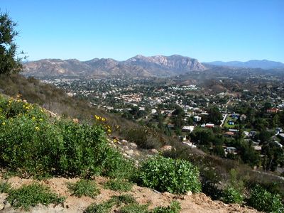
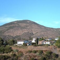
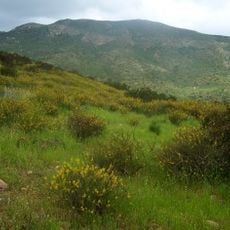
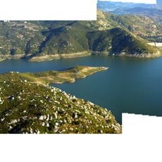
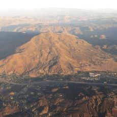
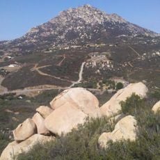
El Cajon Mountain, Granite summit in San Diego County, United States.

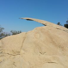
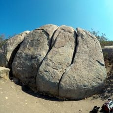
El Cajon Mountain is a granite summit in San Diego County with steep cliffs on its south face and multiple challenging slopes. The peak features prominent rock formations that define its rugged appearance and make it visually distinctive in the local landscape.

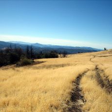
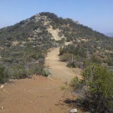
The trails on the mountain follow former mining roads that pass through dense chaparral vegetation and extensive boulder formations. These routes were originally created for resource extraction before later being adapted as hiking paths.

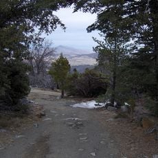
The peak is known locally by the nickname El Cap and serves many hikers as a training ground before attempting more difficult climbs elsewhere. The climbing community in the area frequently uses it to build skills and test their abilities on varied terrain.

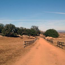
The climb requires thorough preparation and sufficient water for a full day of hiking. Visitors should expect long periods on the trail and account for warm conditions, especially during sunnier months.

An abandoned rusty vehicle sits on the slopes and serves as a distinctive landmark that hikers use to navigate the final approach to the summit. This unexpected discovery adds a curious element to the climb and is often mentioned in local hiker conversations about route navigation.

Location: San Diego County

GPS coordinates: 32.91489,-116.82007

Latest update: December 11, 2025 18:01

Photos
Around this place
Potato Chip Rock
United States of America

Potato Chip Rock

17.8 km
Cowles Mountain
United States of America

Cowles Mountain

22.8 km
Cuyamaca Rancho State Park
United States of America

Cuyamaca Rancho State Park

23.3 km
Mission Trails Regional Park
United States of America

Mission Trails Regional Park

23.7 km
Blackjack Hall of Fame
United States of America

Blackjack Hall of Fame

5.8 km
Barona Casino
United States of America

Barona Casino

5.8 km
Viejas Casino
United States of America

Viejas Casino

13.5 km
Skyline Church
United States of America

Skyline Church

22.9 km
Cuyamaca Peak
United States of America

Cuyamaca Peak

20.3 km
San Vicente Reservoir
United States of America

San Vicente Reservoir

9.8 km
El Capitan Reservoir
United States of America

El Capitan Reservoir

3.4 km
Museum of Creation and Earth History
United States of America

Museum of Creation and Earth History

15.2 km
Old Mission Dam
United States of America

Old Mission Dam

22.5 km
San Vicente Dam
United States of America

San Vicente Dam

9.7 km
Classic Rotors Museum
United States of America

Classic Rotors Museum

16.4 km
Viejas Mountain
United States of America

Viejas Mountain

10.6 km
Loveland Dam
United States of America

Loveland Dam

15 km
Edgemoor Farm Dairy Barn
United States of America

Edgemoor Farm Dairy Barn

16.1 km
Lyons Peak
United States of America

Lyons Peak

24.3 km
Santee Boulders
United States of America

Santee Boulders

20.1 km
McGinty Mountain
United States of America

McGinty Mountain

18.5 km
Creation & Earth History Museum & Bookstore
United States of America

Creation & Earth History Museum & Bookstore

15.2 km
Jardín Ahorrador de Agua en el Cuyamaca College
United States of America

Jardín Ahorrador de Agua en el Cuyamaca College

22 km
San Vicente Golf Club
United States of America

San Vicente Golf Club

9.7 km
Museum
United States of America

Museum

22.2 km
La Mesa Library
United States of America

La Mesa Library

25.2 km
Ramona Grasslands Preserve
United States of America

Ramona Grasslands Preserve

18.8 km
Black Canyon Road Bridge
United States of America

Black Canyon Road Bridge

23.3 km
Show the full map
Reviews

Visited this place? Tap the stars to rate it and share your experience / photos with the community! Try now! You can cancel it anytime.

« El Cajon Mountain - Granite summit in San Diego County, United States » is provided by Around Us (aroundus.com). Images and texts are derived from Wikimedia project under a Creative Commons license. You are allowed to copy, distribute, and modify copies of this page, under the conditions set by the license, as long as this note is clearly visible.

Discover hidden gems everywhere you go!

From secret cafés to breathtaking viewpoints, skip the crowded tourist spots and find places that match your style. Our app makes it easy with voice search, smart filtering, route optimization, and insider tips from travelers worldwide. Download now for the complete mobile experience.

Around Us App Screenshot

A unique approach to discovering new places

Le Figaro

All the places worth exploring

France Info

A tailor-made excursion in just a few clicks

20 Minutes