Enable Location

We need your location to show you interesting places around you

Discover nearby places

Find interesting locations and hidden gems around you

Precise directions

Get accurate directions and distances to places

Your location is never shared with other users. It's only used when you tap the location button.

Cuyamaca Rancho State Park

Log in to your account

Start exploring — it's free

Trusted by 62,031 travelers worldwide

Continue with Google
Continue with Apple
or

We will send you a code to connect

By continuing, you accept our Terms and Conditions and our Privacy Policy

Check your inbox

We've sent a pincode in your inbox. Please enter the code below.

Cuyamaca Rancho State Park

Cuyamaca Rancho State Park, Nature reserve in San Diego County, United States

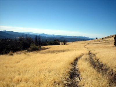
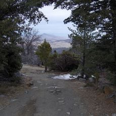
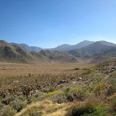
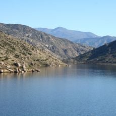
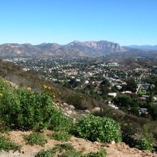
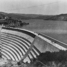
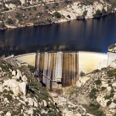
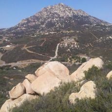
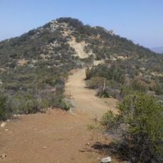
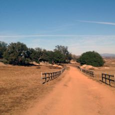
Cuyamaca Rancho State Park is a nature reserve in San Diego County featuring meadows, forests, and streams across multiple elevation zones. The landscape supports different ecosystems, with the highest point at Cuyamaca Peak.

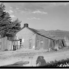
The property became a state park in 1933 when Ralph Dyar sold his land to California, opening his former summer residence to the public. This transition converted the area into a protected recreation space.

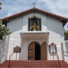
The territory holds evidence of Kumeyaay settlements dating back 7,000 years, followed by Spanish colonists and American settlers during the Southern California Gold Rush.

The park offers camping sites, hiking trails suited to different abilities, riding paths, and mountain biking routes throughout its grounds. A visitor center provides information and educational resources about the natural features and activities available.

The reserve supports a variety of wildlife including mammals, birds, reptiles, and arthropods across its different habitats. This biodiversity thrives because of the varying elevation zones and the park's protected conditions.

The community of curious travelers

AroundUs brings together thousands of curated places, local tips, and hidden gems, enriched daily by 60,000 contributors worldwide.

Start exploring
Location
Operator
California Department of Parks and Recreation
GPS coordinates
32.94065,-116.57213
Latest update
December 7, 2025 20:20
Around this place
Anza-Borrego Desert State Park
United States of America

Anza-Borrego Desert State Park

39 km
Blackjack Hall of Fame
United States of America

Blackjack Hall of Fame

28.4 km
Barona Casino
United States of America

Barona Casino

28.2 km
Viejas Casino
United States of America

Viejas Casino

16.6 km
Cuyamaca Peak
United States of America

Cuyamaca Peak

3.3 km
Warner's Ranch
United States of America

Warner's Ranch

34 km
San Vicente Reservoir
United States of America

San Vicente Reservoir

33.1 km
Mount Laguna Observatory
United States of America

Mount Laguna Observatory

17.4 km
Mud Caves
United States of America

Mud Caves

35.8 km
Pine Valley Creek Bridge
United States of America

Pine Valley Creek Bridge

13.1 km
Sawtooth Mountains Wilderness
United States of America

Sawtooth Mountains Wilderness

20.8 km
Santa Ysabel Asistencia
United States of America

Santa Ysabel Asistencia

23.3 km
El Capitan Reservoir
United States of America

El Capitan Reservoir

23 km
El Cajon Mountain
United States of America

El Cajon Mountain

23.3 km
San Vicente Dam
United States of America

San Vicente Dam

33 km
Classic Rotors Museum
United States of America

Classic Rotors Museum

33.8 km
Viejas Mountain
United States of America

Viejas Mountain

16.9 km
Barrett Dam
United States of America

Barrett Dam

30.6 km
Loveland Dam
United States of America

Loveland Dam

27.3 km
La Posta Astro-Geophysical Observatory
United States of America

La Posta Astro-Geophysical Observatory

31.9 km
Lyons Peak
United States of America

Lyons Peak

32 km
McGinty Mountain
United States of America

McGinty Mountain

34.2 km
Morena Reservoir
United States of America

Morena Reservoir

28.5 km
Pacific Southwest Railway Museum Association
United States of America

Pacific Southwest Railway Museum Association

37.6 km
Creation & Earth History Museum & Bookstore
United States of America

Creation & Earth History Museum & Bookstore

37.7 km
San Vicente Golf Club
United States of America

San Vicente Golf Club

23 km
Ramona Grasslands Preserve
United States of America

Ramona Grasslands Preserve

37.2 km
Black Canyon Road Bridge
United States of America

Black Canyon Road Bridge

29.4 km
Show the full map
« Cuyamaca Rancho State Park - Nature reserve in San Diego County, United States » is provided by Around Us (aroundus.com). Images and texts are derived from Wikimedia project under a Creative Commons license. You are allowed to copy, distribute, and modify copies of this page, under the conditions set by the license, as long as this note is clearly visible.

Discover hidden gems everywhere you go!

From secret cafés to breathtaking viewpoints, skip the crowded tourist spots and find places that match your style. Our app makes it easy with voice search, smart filtering, route optimization, and insider tips from travelers worldwide. Download now for the complete mobile experience.

Around Us App Screenshot

A unique approach to discovering new places

Le Figaro

All the places worth exploring

France Info

A tailor-made excursion in just a few clicks

20 Minutes

Around Us
Travel Guide & Maps
Download

Send to your phone

QR Code
1

Open the camera app on your mobile.

2

Point at the QR code with your camera. A notification will appear.

3

Tap the notification to open the link.