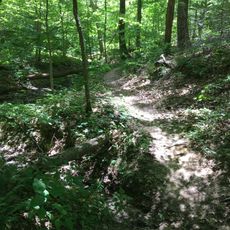
Tecumseh Trail, Forest hiking trail in Morgan-Monroe State Forest, Indiana.
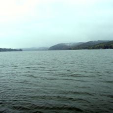
The Tecumseh Trail is a hiking path that runs through dense woodlands in southern Indiana, crossing streams and moving through varied forest terrain with gentle elevation changes. The route connects Morgan-Monroe State Forest to Monroe Reservoir and passes through multiple different landscapes along its length.
The path was built by the Hoosier Hikers Council between 1998 and 2002, creating a modern recreational route through Indiana's state forests. Its construction opened the region for hikers and permanently linked two important natural areas.
The trail is named after the Shawnee leader Tecumseh and reflects the region's connections to Native American peoples who once moved through these forest lands. As you walk, you move through terrain that holds deep historical meaning for indigenous communities.
Bring detailed maps since trail markings can be unclear over longer sections, and you can also get maps from Forest Headquarters before your hike. Any water from streams along the route needs to be filtered or treated before drinking.
The route links two very different natural zones and includes viewing points for wildlife that might otherwise go unnoticed along the way. These transition areas between forest and water are especially active during migration seasons.
The community of curious travelers
AroundUs brings together thousands of curated places, local tips, and hidden gems, enriched daily by 60,000 contributors worldwide.