
Lahrach, commune and village in Mauritania
Location: M'Bout Department
Location: Gorgol Region
GPS coordinates: 16.37784,-12.45035
Latest update: April 20, 2025 07:55

Great Mosque of Touba
403 km
Niokolo-Koba National Park
381.1 km
Djoudj National Bird Sanctuary
405.8 km
Aoukar Depression
362 km
River Gambia National Park
407.1 km
MacCarthy Island
402.8 km
Gouina Falls
300.2 km
National Museum of Mauritania
420.2 km
National Library of Mauritania
420.2 km
Félou Falls
254.4 km
Talari Gorges
329.9 km
Cercles de pierres de Wassu
395.6 km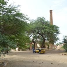
Usine des eaux de Mbakhana
419.9 km
Mosque Marocaine
420.4 km
Deer Island (Gambia)
407.3 km
Isla Sepu
408.3 km
Tata of Koniakary
260.2 km
Ibn Abbas Mosque
420.5 km
Isla Brikama
412.4 km
Bird Island
398.8 km
Eisenbahnbrücke von Kidira
215.1 km
Cercles de pierres de Kerbatch
408.3 km
Sankulay Kunda Bridge
403.5 km
Straßenbrücke von Kidira
215.6 km
Isla Pangon
401.8 km
Isla Pasari
345.6 km
Mimang Island
409.7 km
Fort de Médine
251.2 kmReviews
Visited this place? Tap the stars to rate it and share your experience / photos with the community! Try now! You can cancel it anytime.
Discover hidden gems everywhere you go!
From secret cafés to breathtaking viewpoints, skip the crowded tourist spots and find places that match your style. Our app makes it easy with voice search, smart filtering, route optimization, and insider tips from travelers worldwide. Download now for the complete mobile experience.

A unique approach to discovering new places❞
— Le Figaro
All the places worth exploring❞
— France Info
A tailor-made excursion in just a few clicks❞
— 20 Minutes