Cheekha Dar, Mountain summit in Choman District, Iraq
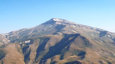
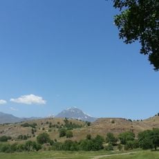
Cheekha Dar is a mountain summit reaching 3,611 meters (11,847 ft) at the Iraq-Iran border within the Zagros mountain range, making it Iraq's highest point. The peak rises through alpine terrain with rocky faces and seasonal snow coverage typical of high-altitude Kurdish mountains.
The summit was first documented as climbed in 2004, with records showing a GPS elevation reading of 3,628 meters at that time. Before this expedition, the peak remained largely unknown and unrecorded in climbing history.
The name Cheekha Dar comes from Kurdish and means Black Tent, a reference to the way mountain peaks were traditionally named in this region.
Climbers must arrange military escorts from Choman town due to landmines along the approach routes, with red triangular warning signs marking hazardous areas. The ascent requires mountain experience and proper gear for snow and ice conditions.
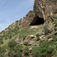
An old Kurdish hut sits on the mountain and serves as a base camp where climbers can rest during their final push to the summit. Built by local mountaineers, this simple shelter offers refuge when snow and cold make the climb challenging.
The community of curious travelers
AroundUs brings together thousands of curated places, local tips, and hidden gems, enriched daily by 60,000 contributors worldwide.