Geography of Iraq, Geographic region in Western Asia.
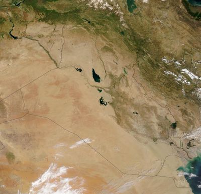
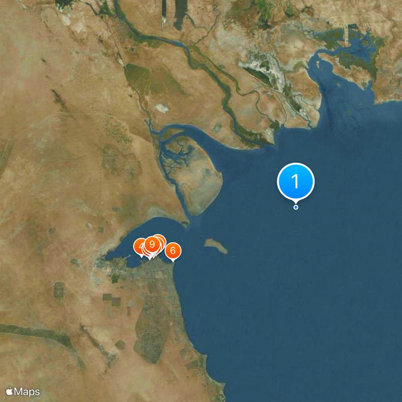
This territory stretches across western desert plains, rolling highlands between two major rivers, northern mountain ranges, and southern floodplains fed by seasonal flows. The twin waterways run northwest to southeast through the land, merging near the Persian Gulf into a shared delta.
The river plains gave birth to early cities and writing systems more than five millennia ago, when settled farming first took root. Persian, Arab, and Ottoman rule followed over the centuries, reshaping the region until modern borders emerged in the 20th century.
Rice cultivation dominates the southern floodplains with seasonal water cycles, while northern slopes rely on rain-fed barley and wheat farming. These agricultural rhythms shape daily life and local diets across different zones of the territory.
Western zones experience harsh desert heat during summer months, while northern highlands receive cooler winters with snow on higher ground. Visitors should plan trips for spring or autumn when temperatures moderate and rural roads remain more passable.
Southeastern marshlands form temporary lakes when rivers swell, creating floating reed mats that sometimes serve as pasture before disappearing when water levels drop. These shifting wetlands support migratory birds and fish species found nowhere else in the region.
The community of curious travelers
AroundUs brings together thousands of curated places, local tips, and hidden gems, enriched daily by 60,000 contributors worldwide.