Kinabatangan River

Log in to your account

AroundUs is a community-driven map of interesting places, built by curious explorers like you. It grows with every review, story, and photo you share.
Connect to save your favorite spots, contribute locations, and create personalized routes.
Continue with Google
Continue with Apple
Continue with X
Continue with Facebook
Continue with email
By continuing, you accept our Terms and Conditions and our Privacy Policy
Create an account

Kinabatangan River

Add to collection
Map
Suggest a change
Share

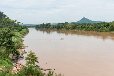
Kinabatangan River, Wildlife watching river corridor in Sabah, Malaysia

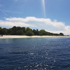
The Kinabatangan is a major river system in Sabah that flows from the Crocker Range mountains down to the Sulu Sea, passing through different forest types and wetland areas. The water moves through a network of mangrove forests, primary rainforest, and open zones, creating a varied landscape that shifts as you travel downstream.

Chinese traders settled along the river starting in the 7th century and exchanged goods like beeswax, rattan, and bird nests. These trading activities connected the region to wider commercial networks and shaped how communities developed along the waterway for centuries.

The name comes from the Dusun language and means "river of Chinese traders," reflecting the settlers who established communities near the river mouth centuries ago. This connection to the past shapes local identity today and appears in the stories that people along the water share.

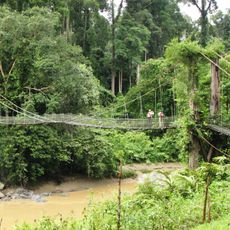
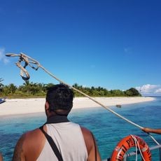
The lower section between the towns of Sukau and Abai has eco-lodges and tour operators offering boat trips for wildlife watching. The drier months are the best time to visit, when animals are easier to spot and the waterways are more accessible.

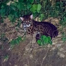
The river system is home to populations of ten primate species, including orangutans, proboscis monkeys, and various types of langurs and macaques. This remarkable concentration of primate species makes it one of the few places on Earth where you can see so many different types in one location.

Location: Sabah

GPS coordinates: 5.70000,118.38333

Latest update: December 6, 2025 16:02

Photos
Photography locations in Malaysia: temples, beaches, rainforests

Malaysia offers diverse photographic subjects from the Cameron Highlands with their tea plantations to the Petronas Towers in Kuala Lumpur. The landscape includes tropical rainforests in Borneo, limestone formations at Batu Caves, and coral reefs off the Perhentian Islands. Chinese temples in...

Reviews

Visited this place? Tap the stars to rate it and share your experience / photos with the community! Try now! You can cancel it anytime.

« Kinabatangan River - Wildlife watching river corridor in Sabah, Malaysia » is provided by Around Us (aroundus.com). Images and texts are derived from Wikimedia project under a Creative Commons license. You are allowed to copy, distribute, and modify copies of this page, under the conditions set by the license, as long as this note is clearly visible.

Discover hidden gems everywhere you go!

From secret cafés to breathtaking viewpoints, skip the crowded tourist spots and find places that match your style. Our app makes it easy with voice search, smart filtering, route optimization, and insider tips from travelers worldwide. Download now for the complete mobile experience.

Around Us App Screenshot

A unique approach to discovering new places

Le Figaro

All the places worth exploring

France Info

A tailor-made excursion in just a few clicks

20 Minutes