Rub' al Khali

Log in to your account

AroundUs is a community-driven map of interesting places, built by curious explorers like you. It grows with every review, story, and photo you share.
Connect to save your favorite spots, contribute locations, and create personalized routes.
By continuing, you accept our Terms and Conditions and our Privacy Policy

Rub' al Khali

Add to collection
Map
Suggest a change
Share

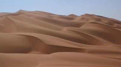
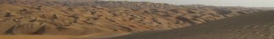
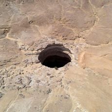
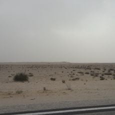
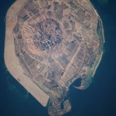
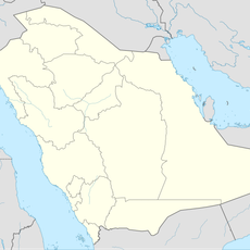
Rub' al Khali, Sand desert in southern Arabian Peninsula, Saudi Arabia

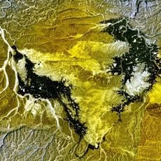
Sand dunes extend across vast plains with steep ridges and rounded slopes marked by brownish and ochre tones, occasionally interrupted by flat salt flats between the formations.

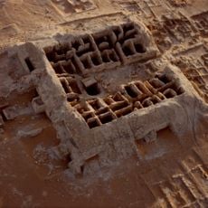
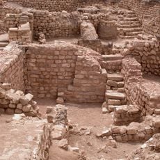
European explorers attempted to chart the southern sections beginning in the 16th century, but complete surveys only took place during the 20th century through government expeditions and geological studies for oil exploration.

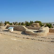
Bedouin tribes conducted nomadic migrations across the region until the 20th century, using wells at hidden oases as meeting points and trading hubs for seasonal gatherings.

Visits require permits from local authorities, experienced desert guides and vehicles equipped with navigation systems, as summer temperatures exceed 122 Fahrenheit (50 Celsius) while October through April offers milder conditions.

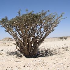
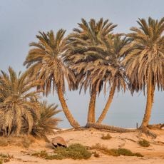
Scientists have documented meteorological anomalies where rare rainfall events every few years trigger ephemeral plants that germinate, bloom and die within a matter of weeks.

Part of: Middle East

GPS coordinates: 20.00000,50.00000

Latest update: December 2, 2025 10:19

Satellite images showing incredible locations seen from the sky

Satellite imagery has transformed how we view remote locations on Earth, offering perspectives on places that are often invisible or difficult to reach from ground level. This collection presents natural formations, artificial structures and historical sites from an aerial vantage point. From geological features like the circular Richat Structure in Mauritania's desert to ancient geoglyphs and modern engineering achievements, these images provide a distinct view of our planet's diversity. Locations documented include the geometric Nazca Lines in Peru, the pyramid structure of El Castillo in Mexico's Yucatán Peninsula and the Badlands Guardian in Alberta, a natural rock formation that resembles a head wearing headphones when seen from above. The collection also features Palm Jumeirah in Dubai, an artificial archipelago shaped like a palm tree, the vivid blue potash evaporation ponds in Utah, the pink waters of Lake Hillier in Western Australia and the volcanic island of Surtsey off Iceland. Additional examples include the Atacama Giant in Chile, a prehistoric geoglyph, the heart shaped Galesnjak island off Croatia's coast and the ship graveyard of the former Aral Sea in Uzbekistan, which documents the ecological consequences of human intervention.

Reviews

Visited this place? Tap the stars to rate it and share your experience / photos with the community! Try now! You can cancel it anytime.

« Rub' al Khali - Sand desert in southern Arabian Peninsula, Saudi Arabia » is provided by Around Us (aroundus.com). Images and texts are derived from Wikimedia project under a Creative Commons license. You are allowed to copy, distribute, and modify copies of this page, under the conditions set by the license, as long as this note is clearly visible.

Discover hidden gems everywhere you go!

From secret cafés to breathtaking viewpoints, skip the crowded tourist spots and find places that match your style. Our app makes it easy with voice search, smart filtering, route optimization, and insider tips from travelers worldwide. Download now for the complete mobile experience.

Around Us App Screenshot

A unique approach to discovering new places

Le Figaro

All the places worth exploring

France Info

A tailor-made excursion in just a few clicks

20 Minutes