Fanuatapu, Uninhabited volcanic island in Samoa
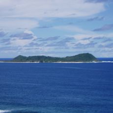
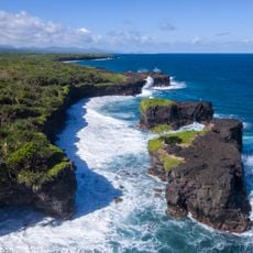
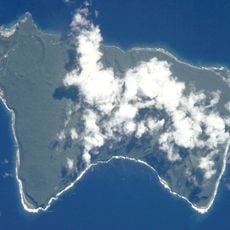
Fanuatapu is the smallest and easternmost of the four Aleipata Islands, a 15-hectare volcanic tuff ring rising in a crescent shape from the sea off the eastern tip of Upolu. The ring juts into the coral reef that encloses Upolu and Namua, and an automated lighthouse stands on the island. It is administratively part of the Atua district.
The island forms part of the Aleipata Islands, which French explorer Bougainville named as part of the Navigator Islands in the late 1700s. This island group was historically known by this European name before later becoming incorporated into the modern Samoan archipelago designations.
Fanuatapu lies in the Atua district and belongs to the Aleipata group, whose name refers to the four islands off Upolu's eastern tip. No village or resident community exists on it, so it carries no fa'a Samoa traditions of its own; its role today is as a protected breeding site for seabirds, watched from boats or the Upolu shore.
Fanuatapu is the easternmost of the Aleipata Islands, lying off Upolu's eastern tip; there is no wharf, so any landing is by small boat on the reef edge. The island is uninhabited and has no facilities or shelter, and Samoa's cyclone season runs roughly from November to April.
Fanuatapu is the easternmost of the four Aleipata Islands, lying off the eastern tip of Upolu, and at 15 hectares it is also the smallest of the group. Its tuff ring rises in a crescent shape from the sea, pushing into the coral reef that encloses Upolu and Namua.
The community of curious travelers
AroundUs brings together thousands of curated places, local tips, and hidden gems, enriched daily by 93,557 contributors worldwide.