Enable Location

We need your location to show you interesting places around you

Discover nearby places

Find interesting locations and hidden gems around you

Precise directions

Get accurate directions and distances to places

Your location is never shared with other users. It's only used when you tap the location button.

Tikehau

Log in to your account

Start exploring — it's free

Trusted by 62,835 travelers worldwide

Continue with Google
Continue with Apple
or

We will send you a code to connect

By continuing, you accept our Terms and Conditions and our Privacy Policy

Check your inbox

We've sent a pincode in your inbox. Please enter the code below.

Tikehau

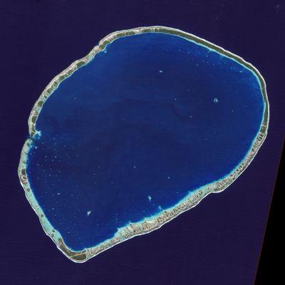
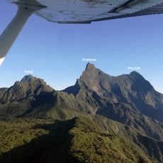
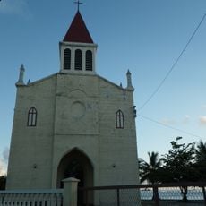
Tikehau, Maritime boundary in Tuamotu-Gambier, French Polynesia

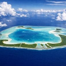
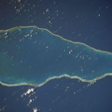
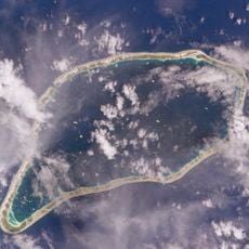
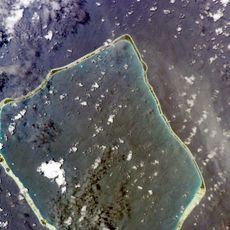
Tikehau is a ring-shaped atoll with a large central lagoon in the South Pacific, marked by a maritime boundary that defines its territory. Several boat passages cut through the reef formation, providing access to the island.

Russian explorer Otto von Kotzebue documented this atoll in the early 1800s and named it after a fellow navigator. This early contact connected the island to the wider world and brought it into European records.

The name Tikehau comes from the Tuamotuan language and means "Peaceful Landing," a term reflecting how local Polynésians viewed their connection to these waters. This name shows the deep relationship between the community and the sea.

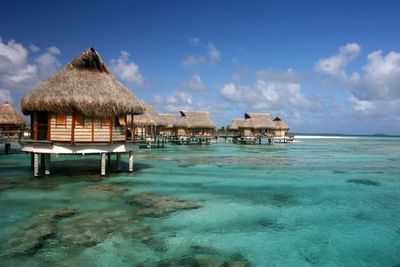
The atoll is accessible by boat, with Tuheiava serving as the main entrance to the lagoon. Visitors should prepare for sea conditions and pay attention to tidal patterns that affect access to different areas.

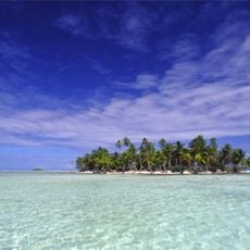
Marine researchers identified an exceptionally high concentration of fish species in these waters, making the lagoon a remarkable habitat. This abundance of marine life attracts divers and nature enthusiasts who come to explore the biodiversity.

The community of curious travelers

AroundUs brings together thousands of curated places, local tips, and hidden gems, enriched daily by 60,000 contributors worldwide.

Start exploring
Location
Part of
Palliser Islands
GPS coordinates
-14.98333,-148.15000
Latest update
December 7, 2025 20:44
« Tikehau - Maritime boundary in Tuamotu-Gambier, French Polynesia » is provided by Around Us (aroundus.com). Images and texts are derived from Wikimedia project under a Creative Commons license. You are allowed to copy, distribute, and modify copies of this page, under the conditions set by the license, as long as this note is clearly visible.

Discover hidden gems everywhere you go!

From secret cafés to breathtaking viewpoints, skip the crowded tourist spots and find places that match your style. Our app makes it easy with voice search, smart filtering, route optimization, and insider tips from travelers worldwide. Download now for the complete mobile experience.

Around Us App Screenshot

A unique approach to discovering new places

Le Figaro

All the places worth exploring

France Info

A tailor-made excursion in just a few clicks

20 Minutes

Around Us
Travel Guide & Maps
Download

Send to your phone

QR Code
1

Open the camera app on your mobile.

2

Point at the QR code with your camera. A notification will appear.

3

Tap the notification to open the link.