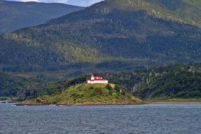
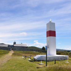
San Isidro lighthouse, Historical maritime lighthouse in Magallanes Province, Chile
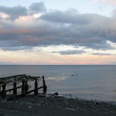
San Isidro lighthouse is a modest structure standing about 8 meters tall on the Brunswick Peninsula and serves as a navigation aid for ships in the Strait of Magellan. Its white flashing light pattern warns captains of the treacherous coastal waters along this southern route.
This beacon was built in 1904 and forms part of a chain of eight lighthouses along the Strait of Magellan, which helped make navigation safer in this difficult region. It witnessed the growth of southern shipping activity during the era of intensive maritime exploration.
The lighthouse carries the name of Saint Isidore, patron of farmers, reflecting the deep connection between land and sea in this region. This religious naming choice links maritime history with the spiritual traditions of southern Patagonia.
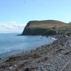
Reaching the lighthouse involves a roughly two-hour hike from the parking area marked 'Fin de Camino'. The trail is suitable for anyone who can walk steadily but requires good footwear and proper clothing for the southern climate conditions.
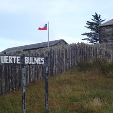
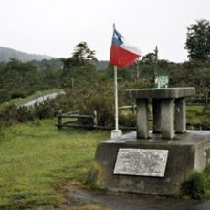
On this spot once stood the Spanish settlements of Nombre de Jesús and Rey Don Felipe, which became known as Port of Hunger due to harsh conditions. This tragic early colonial history lies beneath one of the remote places travelers hike to today.
The community of curious travelers
AroundUs brings together thousands of curated places, local tips, and hidden gems, enriched daily by 60,000 contributors worldwide.