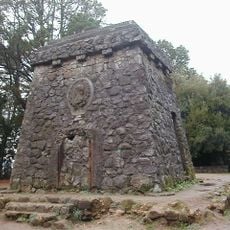
Fort Colcura, Spanish colonial fort in Lota, Chile
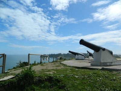
Fort Colcura is a fortification on a hilltop overlooking Arauco Bay in the Lota region and provides strategic command over the Colcura valley below. The structure incorporates natural cliff defenses and displays a curved outer wall on the accessible side facing the main approach.
Governor Alonso de Ribiera ordered the fort built in 1602 following the Mapuche Uprising of 1598 and established the first Spanish settlement in the Lota region. The structure underwent several reconstructions afterwards due to repeated indigenous attacks.
The fort displays Spanish colonial military design with its triangular layout and bastions positioned at two protruding angles. The structure shows how settlers built defenses to command the surrounding landscape and valley below.
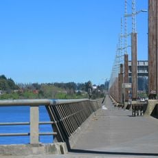
The fort is accessible via Bajada de N de Cuesta Villagrán and still displays original cannons from the colonial period. Visitors should expect steep pathways and exposed areas, especially when wind or wet conditions are present.
The builders ingeniously merged the fort with natural cliff formations, making portions of the structure appear to blend into the rock face. This design approach reduced the fort's visibility to attackers approaching from offshore or open waters.
The community of curious travelers
AroundUs brings together thousands of curated places, local tips, and hidden gems, enriched daily by 60,000 contributors worldwide.