Enable Location

We need your location to show you interesting places around you

Discover nearby places

Find interesting locations and hidden gems around you

Precise directions

Get accurate directions and distances to places

Your location is never shared with other users. It's only used when you tap the location button.

Lurín District

Log in to your account

Start exploring — it's free

Trusted by 61,509 travelers worldwide

Continue with Google
Continue with Apple
or

We will send you a code to connect

By continuing, you accept our Terms and Conditions and our Privacy Policy

Check your inbox

We've sent a pincode in your inbox. Please enter the code below.

Lurín District

Lurín District, Archaeological district with pre-Hispanic pyramids in Lima, Peru

Description

Lurín District stretches along Lima's southern coast between the Pacific Ocean and the river valley, connecting coastal areas with inland farmland. The area includes residential neighborhoods, croplands, beaches, and several archaeological sites from pre-Hispanic times.

History

The area was an important religious and economic center during Inca times and before. It was established as an administrative district in 1857 and has since developed into a mix of urban, agricultural, and archaeological zones.

Culture

The name Lurín comes from Quechua and refers to the river valley that defines the area. People use the land today for farming and small craft businesses that keep local traditions alive.

Practical

The district is easily reached from central Lima via the Panamericana Highway, which connects the north to the southern areas. Visitors should know that the best time for exploration follows the dry season, when weather is clear and roads are most accessible.

Did you know?

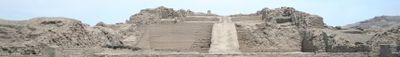
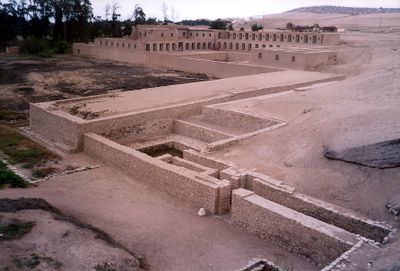
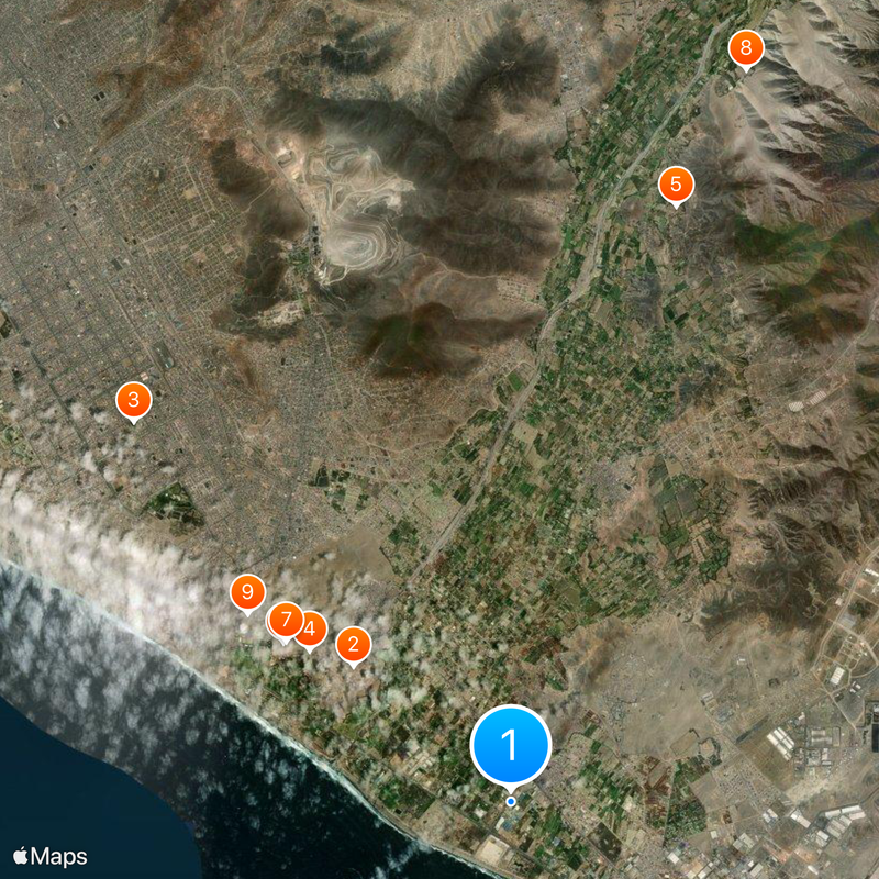
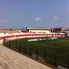
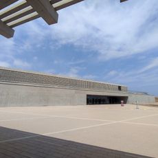
The Pachacámac complex within the district was not just a religious site but also a trading hub that drew people from across the region. Archaeologists have found traces of at least five different cultures there, layered over more than a thousand years.

Location
Elevation above the sea
9 m
Shares border with
Villa El Salvador District, Villa María del Triunfo, Pachacamac, Punta Hermosa
GPS coordinates
-12.27917,-76.87500
Latest update
December 17, 2025 08:43

AroundUs brings together thousands of curated places, local tips, and hidden gems, enriched daily by 60,000 contributors worldwide. Discover all places nearby (Lima province).

« Lurín District - Archaeological district with pre-Hispanic pyramids in Lima, Peru » is provided by Around Us (aroundus.com). Images and texts are derived from Wikimedia project under a Creative Commons license. You are allowed to copy, distribute, and modify copies of this page, under the conditions set by the license, as long as this note is clearly visible.

Discover hidden gems everywhere you go!

From secret cafés to breathtaking viewpoints, skip the crowded tourist spots and find places that match your style. Our app makes it easy with voice search, smart filtering, route optimization, and insider tips from travelers worldwide. Download now for the complete mobile experience.

Around Us App Screenshot

A unique approach to discovering new places

Le Figaro

All the places worth exploring

France Info

A tailor-made excursion in just a few clicks

20 Minutes

Around Us
Travel Guide & Maps
Download

Send to your phone

QR Code
1

Open the camera app on your mobile.

2

Point at the QR code with your camera. A notification will appear.

3

Tap the notification to open the link.