
Sierra de las Quijadas National Park
Sierra de las Quijadas National Park, National park in San Luis Province, Argentina.
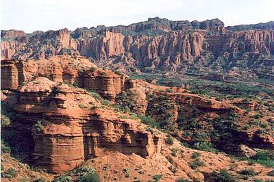
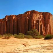
The park spans 73,534 hectares of red cliffs, natural terraces, and deep canyons shaped by millions of years of geological processes.
The area contains archaeological remains of indigenous Huarpe settlements, including twenty ceramic production furnaces dating back several centuries.
Local indigenous communities maintained connections to this land through hunting, gathering, and pottery making, leaving traces of their activities across the region.
Visitors can access the park through guided tours, with free entry and administrative offices located at Junin 1460 in San Luis Capital.
The park preserves fossils of two pterosaur species, including one with specialized teeth forming a basket-like structure for filtering microorganisms.
Location: San Luis Province
Inception: 1991
Elevation above the sea: 595 m
Operator: Administración Parques Nacionales
Website: http://parquesnacionales.gov.ar/03_ap/35_squijadas_PN/35_squijadas_PN.htm
GPS coordinates: -32.55083,-67.06417
Latest update: May 27, 2025 09:50
Argentina extends across multiple climate zones and contains numerous geological formations. The country encompasses high mountain ranges in the Andes, salt flats in the northwest, rock formations in Patagonia, and extensive grasslands. These areas display the region's geological history and the adaptation of human settlements to different environments. The sites include volcanic craters, thermal springs, canyons, and historic villages. Many of these locations lie away from main routes and require several hours of travel. The regions document pre-Columbian cultures, colonial history, and traditional ways of life that continue today.
Nuevo Cuyo contains national parks, geological formations, and historical sites. The region includes red sandstone cliffs in Talampaya Park, the astronomical observatory in El Leoncito, and the natural bridge Puente del Inca. This Argentine region features salt flats, volcanoes, caves, and canyons. The areas house various wildlife species and prehistoric sites.
Plaza Independencia
170.9 km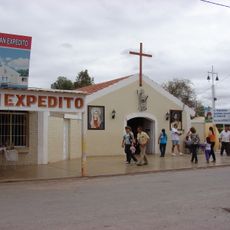
Santuario de San Expedito
120.9 km
Potrero de los Funes Circuit
108.5 km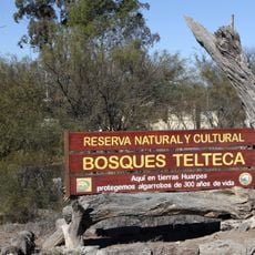
Reserva provincial Telteca
92 km
Oratorio de la Difunta Correa
125.4 km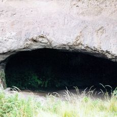
Inti Huasi
107.9 km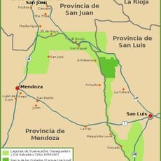
Lagunas de Guanacache, Desaguadero y del Bebedero
11.3 km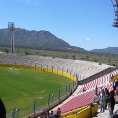
Estadio Juan Gilberto Funes
100.2 km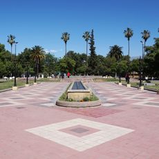
Museo del Área Fundacional
169.2 km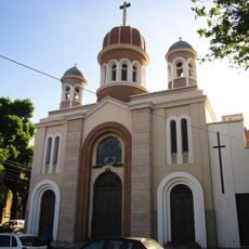
Our Lady of Loreto Cathedral, Mendoza
171.1 km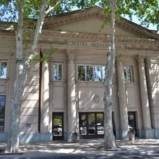
Teatro Independencia
171 km
Historical Museum Vaults
144.1 km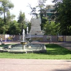
Plaza España
170.8 km
Gómez Building
170.5 km
Plaza Pedro del Castillo
169.3 km
Estadio Omar Higinio Sperdutti
168.8 km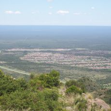
Mirador del Potrero
103.1 km
Ruinas de San Francisco
169.4 km
General San Martin Historical Museum
170.1 km
Area Fundacional
169.3 km
Contemporary Art gallery Eliana Molinelli
170.5 km
Catedral de San Luis
107.8 km
Castillo De La Toma Vieja
142.8 km
Molino Orfila Solar Histórico
149 km
Colegio Nacional Agustín Alvarez
171.1 km
Chalets Giol y Gargantini
168.1 km
Biblioteca del Agua
170.4 km
Municipal Museum of Modern Art of Mendoza
171 kmReviews
Visited this place? Tap the stars to rate it and share your experience / photos with the community! Try now! You can cancel it anytime.
Discover hidden gems everywhere you go!
From secret cafés to breathtaking viewpoints, skip the crowded tourist spots and find places that match your style. Our app makes it easy with voice search, smart filtering, route optimization, and insider tips from travelers worldwide. Download now for the complete mobile experience.

A unique approach to discovering new places❞
— Le Figaro
All the places worth exploring❞
— France Info
A tailor-made excursion in just a few clicks❞
— 20 Minutes