La Cangayé, National Historic Site in Chaco Province, Argentina
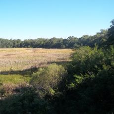
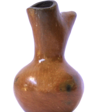
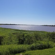
La Cangayé is an archaeological site holding remains of colonial buildings situated along the right bank of the Bermejo River. The exposed foundations and recovered artifacts provide a picture of how this former settlement was laid out and constructed.
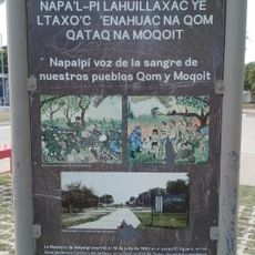
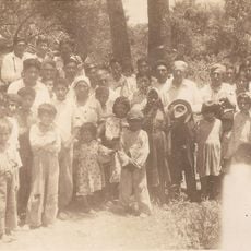
Following a peace agreement in 1774 between Spanish explorer Gerónimo Luis de Matorras and Cacique Paykín, this settlement was established as a reduction beginning in 1780. It functioned for roughly 13 years before being abandoned in the early 1790s.
The site marks where Spanish missionaries and Mocoví people came together, with their religious and indigenous practices existing side by side. You can sense this meeting of worlds in how the ruins are arranged on the landscape.
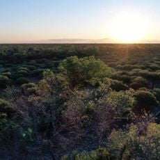
You can walk through the archaeological remains and examine the exposed foundations and scattered artifacts on the ground. Wear sturdy shoes as the terrain is uneven and some areas are overgrown with vegetation.
Archaeological excavations in the 1940s uncovered the precise layout of this settlement and revealed it once housed around 900 people. These investigations made this site valuable for understanding how such reduction settlements actually functioned and were organized.
Location: Chaco Province
Address: Situada en la margen derecha del Río Bermejo a unos 2 km de la Costa; distante unos 61 km. de la confluencia del Teuco con el Bermejo aguas arriba, próxima al Fortín del mismo nombre.
GPS coordinates: -25.59961,-60.31681
Latest update: December 14, 2025 11:04
Chaco National Park
151.9 km
Mburucuyá National Park
351.9 km
Copo National Park
162.3 km
Zoológico de Sáenz Peña
136 km
Our Lady of Carmel Cathedral, Formosa
224.8 km
Parque provincial Pampa del Indio
83.1 km
Puente Libertad
125.8 km
Quitilipi train station
146.4 km
Vasija moqoit
191.9 km
"Juan Pablo Duffard" Regional Historical Museum
225.1 km
Popular and Public Library Juan Martín de Pueyrredón
200 km
Museo de la Fundación
133.7 km
Entrada a Colonia Aborígen
151.4 km
Instituto de Educación Superior Villa Ángela
222.6 km
Municipalidad de Villa Ángela
223.5 km
Florentino Ameghino
191.6 km
Plazoleta Héroes de Malvinas
191.7 km
Casa Cruz
127.8 km
Centro Cultural "Mario Nestoroff"
191.6 km
E.E.P N° 1087 "Florencio Ruiz"
191.3 km
Acceso central San Bernardo
191.4 km
Colección de fotografías de Esteban Zugasti
107.7 km
Entrada San Bernardo "Ciudad de la Primavera"
191.5 km
Instituto del Aborigen chaqueño - Colonia Aborigen
151.2 km
Nuevo Banco del Chaco
151.4 km
Banco de la Nacion Argentina
223.5 km
Centro de Educación Fisica Nº15 San Bernardo
191.7 km
Construcciones de la ex misión San Francisco de Asis del Laishi
183.5 kmVisited this place? Tap the stars to rate it and share your experience / photos with the community! Try now! You can cancel it anytime.
Discover hidden gems everywhere you go!
From secret cafés to breathtaking viewpoints, skip the crowded tourist spots and find places that match your style. Our app makes it easy with voice search, smart filtering, route optimization, and insider tips from travelers worldwide. Download now for the complete mobile experience.
A unique approach to discovering new places❞
— Le Figaro
All the places worth exploring❞
— France Info
A tailor-made excursion in just a few clicks❞
— 20 Minutes